Fort Stevens to Tillamook Head, August 6th 2007.
Click on the small image to see the full-sized one.
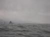
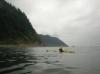 The intrepid kayaker approaching Tillamook Head, Oregon
Links to related images: Nearby. Proofs. Map.
Approximate location: 45.9722708320779N / 123.96800994873W.
 The intrepid kayaker on Tillamook Head, Oregon
Links to related images: Nearby. Proofs. Map.
Approximate location: 45.9346170734666N / 123.98551940918W.
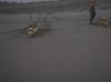
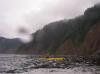
 Dick Ryon loading kayaks in the morning at Fort Stevens State Park
Links to related images: Nearby. Proofs. Map.
Approximate location: 46.22077N / 124.0117W.
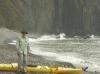
 Dick Ryon launching in the morning at Fort Stevens State Park
Links to related images: Nearby. Proofs. Map.
Approximate location: 46.22068N / 124.01232W.
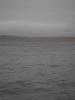
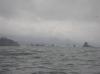
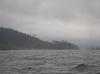
 Approaching Tillamook Head
Links to related images: Nearby. Proofs. Map.
Approximate location: 45.99366N / 123.9696W.
 Dick Ryon approaching Tillamook Head
Links to related images: Nearby. Proofs. Map.
Approximate location: 45.99366N / 123.9696W.
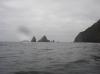
 Approaching Tillamook Head
Links to related images: Nearby. Proofs. Map.
Approximate location: 45.9483N / 123.99378W.
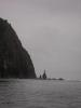
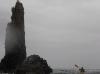
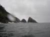
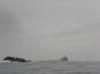 The Tillamook Rock Lighthouse off Tillamook Head
Links to related images: Nearby. Proofs. Map.
Approximate location: 45.9483N / 123.99378W.
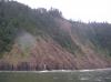
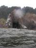
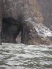
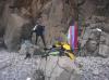
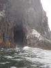 A rough cave in Tillamook Head
Links to related images: Nearby. Proofs. Map.
Approximate location: 45.9483N / 123.99378W.
 Dick Ryon approaching Tillamook Head
Links to related images: Nearby. Proofs. Map.
Approximate location: 45.94736N / 123.99578W.
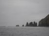
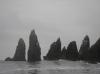
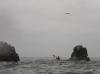
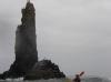
 Bird Point on Tillamook Head
Links to related images: Nearby. Proofs. Map.
Approximate location: 45.94596N / 123.99472W.
 Dick Ryon takin the shortcut through Tillamook Head
Links to related images: Nearby. Proofs. Map.
Approximate location: 45.94588N / 123.9947W.
 Looking back at the point of Tillamook Head
Links to related images: Nearby. Proofs. Map.
Approximate location: 45.94588N / 123.9947W.
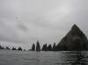
 Bird Point on Tillamook Head
Links to related images: Nearby. Proofs. Map.
Approximate location: 45.94588N / 123.9947W.
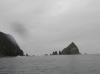
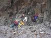
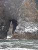 A cave/arch in Tillamook Head
Links to related images: Nearby. Proofs. Map.
Approximate location: 45.94588N / 123.9947W.
 Looking ahead past Tillamook Head
Links to related images: Nearby. Proofs. Map.
Approximate location: 45.94588N / 123.9947W.

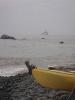
 Landed on a gravel beach on Tillamook Head
Links to related images: Nearby. Proofs. Map.
Approximate location: 45.93482N / 123.98485W.
 Dick Ryon landed on a gravel beach on Tillamook Head
Links to related images: Nearby. Proofs. Map.
Approximate location: 45.93482N / 123.98485W.
 Tillamook Rock Lighthouse viewed from our gravel beach on Tillamook Head
Links to related images: Nearby. Proofs. Map.
Approximate location: 45.93482N / 123.98485W.
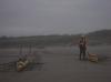
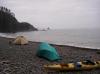
 Dick Ryon in camp on our gravel beach on Tillamook Head
Links to related images: Nearby. Proofs. Map.
Approximate location: 45.93472N / 123.98464W.
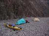
 Camp on our gravel beach on Tillamook Head
Links to related images: Nearby. Proofs. Map.
Approximate location: 45.93472N / 123.98464W.
 Dick Ryon in camp on our gravel beach on Tillamook Head
Links to related images: Nearby. Proofs. Map.
Approximate location: 45.93472N / 123.98464W.
All text and images Copyright © 2007 by Mike Higgins / contact