Isla San Martin to the Old Mill, October 18th 2007.
Click on the small image to see the full-sized one.
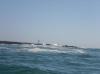
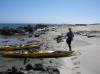
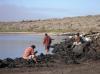 Panga fishermen from the fish camp in the cove
Links to related images: Nearby. Proofs. Map.
Approximate location: 30.48337N / 116.10564W.
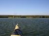
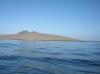 View back at Isla San Martin as we leave
Links to related images: Nearby. Proofs. Map.
Approximate location: 30.47796N / 116.09978W.
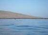 Gregg Berman leaving Isla San Martin
Links to related images: Nearby. Proofs. Map.
Approximate location: 30.47777N / 116.09955W.
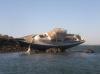
 Shipwreck, or is it yacht-wreck, near San Quintin Bay
Links to related images: Nearby. Proofs. Map.
Approximate location: 30.36151N / 116.0052W.
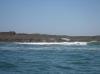
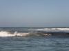
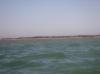
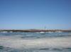 Rough water around Cabo San Quintin
Links to related images: Nearby. Proofs. Map.
Approximate location: 30.35857N / 115.99977W.
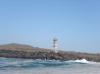 The light on Cabo San Quintin
Links to related images: Nearby. Proofs. Map.
Approximate location: 30.35857N / 115.99977W.

 Rough water around Cabo San Quintin
Links to related images: Nearby. Proofs. Map.
Approximate location: 30.35591N / 115.98951W.
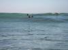 Sea lions surfing around Cabo San Quintin
Links to related images: Nearby. Proofs. Map.
Approximate location: 30.35542N / 115.98754W.


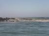
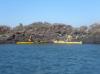
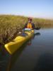
 Finally we turn into the protection of San Quintin Bay
Links to related images: Nearby. Proofs. Map.
Approximate location: 30.36773N / 115.9808W.
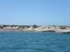 I camped on this beach in 2001
Links to related images: Nearby. Proofs. Map.
Approximate location: 30.36902N / 115.98166W.

 Charles Harris and I land at Punta Entrada for a break
Links to related images: Nearby. Proofs. Map.
Approximate location: 30.36943N / 115.9826W.
 I camped on this beach in 2001
Links to related images: Nearby. Proofs. Map.
Approximate location: 30.40168N / 115.98112W.
 Gregg Berman and Charles Harris hiding behind a point from the wind
Links to related images: Nearby. Proofs. Map.
Approximate location: 30.4382N / 115.95737W.
 Shipwreck, or is it yacht-wreck, in San Quintin Bay
Links to related images: Nearby. Proofs. Map.
Approximate location: 30.4682N / 115.96795W.
 Charles Harris and Gregg Berman hiding behind a point from the wind
Links to related images: Nearby. Proofs. Map.
Approximate location: 30.47605N / 115.9744W.
 A boat from Florence Oregon in San Quintin Bay, Baja
Links to related images: Nearby. Proofs. Map.
Approximate location: 30.48326N / 115.9761W.
 Approaching our goal: The Old Mill Hotel
Links to related images: Nearby. Proofs. Map.
Approximate location: 30.48326N / 115.9761W.
 Gregg Berman and Charles Harris landed at the Old Mill
Links to related images: Nearby. Proofs. Map.
Approximate location: 30.48427N / 115.97687W.
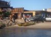
 Charles Harris checking into the Old Mill Hotel
Links to related images: Nearby. Proofs. Map.
Approximate location: 30.48506N / 115.97724W.
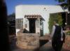
 We stayed in room Zero at the Old Mill Hotel
Links to related images: Nearby. Proofs. Map.
Approximate location: 30.48511N / 115.97724W.
All text and images Copyright © 2007 by Mike Higgins / contact