Russian Gulch, September 12th 2008.
Click on the small image to see the full-sized one.
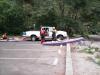 BASKers getting ready to launch at Russian Gulch State Park
Links to related images: Nearby. Proofs. Map.
Approximate location: 39.3292352619162N / 123.8039124012W.
 Jonathan Purcell getting ready to launch at Russian Gulch State Park
Links to related images: Nearby. Proofs. Map.
Approximate location: 39.3292684576535N / 123.80405187607W.
 The first arch at Russian Gulch State Park
Links to related images: Nearby. Proofs. Map.
Approximate location: 39.3272683863574N / 123.81129384041W.
 Jonathin Purcell at Russian Gulch State Park
Links to related images: Nearby. Proofs. Map.
Approximate location: 39.3276833436112N / 123.81130456924W.
 Mary Ann Furda entering an arch near Russian Gulch State Park
Links to related images: Nearby. Proofs. Map.
Approximate location: 39.3276916427312N / 123.81130456924W.
 Another arch near Russian Gulch State Park
Links to related images: Nearby. Proofs. Map.
Approximate location: 39.3284219614311N / 123.81143331528W.
 Multiple arches near Russian Gulch State Park
Links to related images: Nearby. Proofs. Map.
Approximate location: 39.3284634565828N / 123.81156206131W.
 Jonathan Purcell exiting an arch near Russian Gulch State Park
Links to related images: Nearby. Proofs. Map.
Approximate location: 39.3285215497538N / 123.81165862083W.
 Mary Ann Furda in shallow water
Links to related images: Nearby. Proofs. Map.
Approximate location: 39.3292518597868N / 123.8113796711W.
 Jonathan Purcell exiting an arch near Russian Gulch State Park
Links to related images: Nearby. Proofs. Map.
Approximate location: 39.328670931972N / 123.81161570549W.
 Looking back at an arch from the next cave
Links to related images: Nearby. Proofs. Map.
Approximate location: 39.3287207259738N / 123.81149768829W.
 Mary Ann Furda exiting a large cave
Links to related images: Nearby. Proofs. Map.
Approximate location: 39.3287705199401N / 123.81156206131W.
 Jonathan Purcell exiting a large cave
Links to related images: Nearby. Proofs. Map.
Approximate location: 39.3287705199401N / 123.81156206131W.
 Jonatnan Purcell surfing through an arch
Links to related images: Nearby. Proofs. Map.
Approximate location: 39.3295340229842N / 123.81223797798W.
 Jonatnan Purcell landing for a snack break
Links to related images: Nearby. Proofs. Map.
Approximate location: 39.3136813259798N / 123.80177736282W.
 Mary Ann Furda and Jonatnan Purcell landed for a snack break
Links to related images: Nearby. Proofs. Map.
Approximate location: 39.3136564236298N / 123.80176663399W.
 Beautiful arch in a cave
Links to related images: Nearby. Proofs. Map.
Approximate location: 39.3137228298768N / 123.80482435226W.
 My kayak landed on an offshore rock
Links to related images: Nearby. Proofs. Map.
Approximate location: 39.3328327582523N / 123.81640613079W.
 Jonathan Purcell landed on an offshore rock
Links to related images: Nearby. Proofs. Map.
Approximate location: 39.3328369075068N / 123.81641149521W.
 Mary Ann Furda landed on an offshore rock
Links to related images: Nearby. Proofs. Map.
Approximate location: 39.3328576537759N / 123.81642222404W.
 Mary Ann Furda, Dennis Holton and Jonathan Purcell landed on an offshore rock
Links to related images: Nearby. Proofs. Map.
Approximate location: 39.3328452060152N / 123.81640613079W.
 One of the abalone Dennis Holton cauht
Links to related images: Nearby. Proofs. Map.
Approximate location: 39.3328576537759N / 123.81639003754W.
All text and images Copyright © 2008 by Mike Higgins / contact