The following images were all taken near the same location, ~26.17445/111.36399:
Click on the small images to see the full-sized ones.
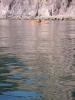
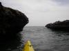
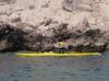
 Doug Hamilton paddling away from camp in the morning
Taken on 2007-04-10 .
Links to related images: Date. Proofs. Map. Story.
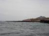
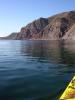 Calm water near camp in the morning
Taken on 2007-04-10 .
Links to related images: Date. Proofs. Map. Story.
 Doug Hamilton paddling away from camp in the morning
Taken on 2007-04-10 .
Links to related images: Date. Proofs. Map. Story.


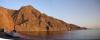
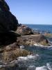
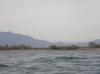
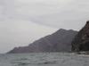
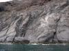
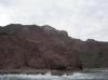
 The cliffs give way to low bluffs near Loreto
Taken on 2007-04-10 .
Links to related images: Date. Proofs. Map. Story.
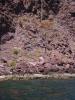
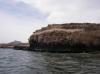
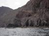
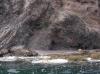
 Another osprey on a nest on a rock
Taken on 2007-04-10 .
Links to related images: Date. Proofs. Map. Story.
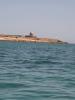
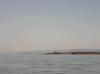
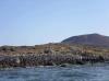
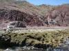
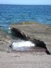
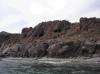
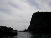
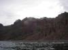
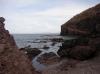
 Last rocky reef before Loreto
Taken on 2007-04-10 .
Links to related images: Date. Proofs. Map. Story.
 A chain link fence around a dirt airstrip
Taken on 2007-04-10 .
Links to related images: Date. Proofs. Map. Story.


 A hotel abandond partway through construction
Taken on 2007-04-10 .
Links to related images: Date. Proofs. Map. Story.
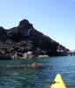
 Doug Hamilton approaching the outsirts of Loreto
Taken on 2007-04-10 .
Links to related images: Date. Proofs. Map. Story.
 A hotel abandond partway through construction
Taken on 2007-04-10 .
Links to related images: Date. Proofs. Map. Story.
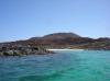
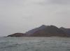
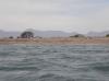
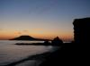 Isla Coronados from our camping beach
Taken on 2007-04-9 .
Links to related images: Date. Proofs. Map. Story.
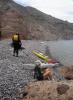
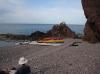
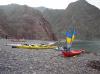
 Camping on the last arroyo beach before the congestion of Loreto
Taken on 2007-04-9 .
Links to related images: Date. Proofs. Map. Story.
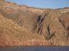 Cliffs south of our camp
Taken on 2007-04-9 .
Links to related images: Date. Proofs. Map. Story.

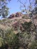
 Structure on Punta El Bajo De Tierra Firma
Taken on 2007-04-9 .
Links to related images: Date. Proofs. Map. Story.
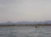
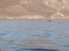 Dolphins swimming past me
Taken on 2007-04-9 .
Links to related images: Date. Proofs. Map. Story.
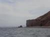
 Isla La Chollita
Taken on 2007-04-9 .
Links to related images: Date. Proofs. Map. Story.
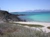
 Clear shallow water ofer the Punta Tierra Firme spit
Taken on 2007-04-9 .
Links to related images: Date. Proofs. Map. Story.
 The Punta Tierra Firme spit is part of Isla Coronados
Taken on 2007-04-9 .
Links to related images: Date. Proofs. Map. Story.
 Isla La Chollita viewed over the Punta Tierra Firme spit
Taken on 2007-04-9 .
Links to related images: Date. Proofs. Map. Story.
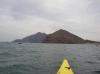
 Approaching Isla Coronados proper
Taken on 2007-04-9 .
Links to related images: Date. Proofs. Map. Story.
 Starting down the west shore of Isla Coronados
Taken on 2007-04-9 .
Links to related images: Date. Proofs. Map. Story.
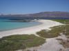
 Sandy beaches on west shore of Isla Coronados
Taken on 2007-04-9 .
Links to related images: Date. Proofs. Map. Story.
 Landed on a small sandy beach on Isla coronados
Taken on 2007-04-9 .
Links to related images: Date. Proofs. Map. Story.
 The old informative sign, in Espanol only
Taken on 2007-04-9 .
Links to related images: Date. Proofs. Map. Story.
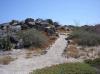 A trail on Isla Coronado, where could it go?
Taken on 2007-04-9 .
Links to related images: Date. Proofs. Map. Story.
 Answer, to a shrine for Our Lady of Guadalupe
Taken on 2007-04-9 .
Links to related images: Date. Proofs. Map. Story.
 Landed on a small sandy beach on Isla coronados
Taken on 2007-04-9 .
Links to related images: Date. Proofs. Map. Story.

 Back on the mainland, I found Andrea Wolf hiking up the beach
Taken on 2007-04-9 .
Links to related images: Date. Proofs. Map. Story.
 I also found Herb Howe on a hike
Taken on 2007-04-9 .
Links to related images: Date. Proofs. Map. Story.

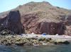
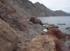
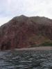
 Red rock shore near our camp
Taken on 2007-04-9 .
Links to related images: Date. Proofs. Map. Story.
 Back to our camping beach after rounding Isla Coronados
Taken on 2007-04-9 .
Links to related images: Date. Proofs. Map. Story.
 Doug Hamilton climbing straight up out of camp
Taken on 2007-04-9 .
Links to related images: Date. Proofs. Map. Story.
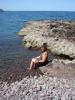 Kate DesLauriers keeping cool in camp
Taken on 2007-04-9 .
Links to related images: Date. Proofs. Map. Story.

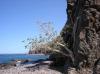
 Tenacious tree growing out of the cliff
Taken on 2007-04-9 .
Links to related images: Date. Proofs. Map. Story.
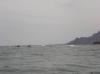
 Mild waves breaking between rocks
Taken on 2007-04-9 .
Links to related images: Date. Proofs. Map. Story.
 Tenacious tree growing out of the cliff
Taken on 2007-04-9 .
Links to related images: Date. Proofs. Map. Story.
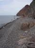
 The end of the beach near our camp
Taken on 2007-04-9 .
Links to related images: Date. Proofs. Map. Story.
 Looking back towards our camp from the end of the beach
Taken on 2007-04-9 .
Links to related images: Date. Proofs. Map. Story.
 Nest in a pocket in the cliff
Taken on 2007-04-9 .
Links to related images: Date. Proofs. Map. Story.
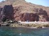
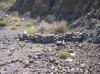 Man made wall of rocks, but what for?
Taken on 2007-04-9 .
Links to related images: Date. Proofs. Map. Story.

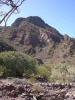
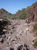
 The arroyo behind our camp
Taken on 2007-04-9 .
Links to related images: Date. Proofs. Map. Story.
 Kate Deslauriers in the arroyo behind our camp
Taken on 2007-04-9 .
Links to related images: Date. Proofs. Map. Story.

 Flowering trees in the arroyo behind our camp
Taken on 2007-04-9 .
Links to related images: Date. Proofs. Map. Story.
 Kate Deslauriers in the arroyo behind our camp
Taken on 2007-04-9 .
Links to related images: Date. Proofs. Map. Story.
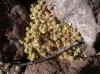
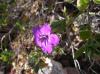 Flower in the arroyo behind our camp
Taken on 2007-04-9 .
Links to related images: Date. Proofs. Map. Story.
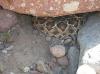
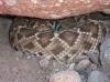 Rattlesnake in the arroyo behind our camp
Taken on 2007-04-9 .
Links to related images: Date. Proofs. Map. Story.
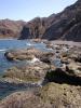
 Calm water over the reefs next to our camp
Taken on 2007-04-9 .
Links to related images: Date. Proofs. Map. Story.
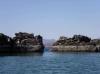
 Rock formations south of Ensenada el Mangle
Taken on 2007-04-8 .
Links to related images: Date. Proofs. Map. Story.
 Looking ahead to Isla Coronados
Taken on 2007-04-8 .
Links to related images: Date. Proofs. Map. Story.
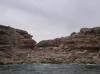
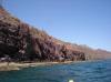
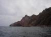
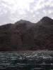
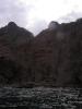
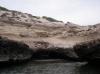 Cliffs and caves south of Ensenada el Mangle
Taken on 2007-04-8 .
Links to related images: Date. Proofs. Map. Story.
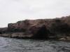
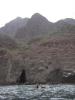
 Cliffs and caves north of Loreto
Taken on 2007-04-8 .
Links to related images: Date. Proofs. Map. Story.
 Shallow water in front of the Boca los Batequas
Taken on 2007-04-8 .
Links to related images: Date. Proofs. Map. Story.
 Locals camping out near the Boca los Batequas
Taken on 2007-04-8 .
Links to related images: Date. Proofs. Map. Story.
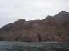
 The start of the cliffs north of Loreto
Taken on 2007-04-8 .
Links to related images: Date. Proofs. Map. Story.
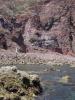
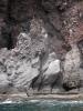 Osprey nest on the cliffs north of Loreto
Taken on 2007-04-8 .
Links to related images: Date. Proofs. Map. Story.
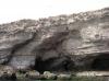
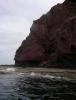
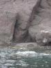
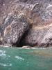 Cave in the cliffs north of Loreto
Taken on 2007-04-8 .
Links to related images: Date. Proofs. Map. Story.
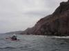
 Rock gardening north of Loreto
Taken on 2007-04-8 .
Links to related images: Date. Proofs. Map. Story.
 Everyone stopping for a break north of Loreto
Taken on 2007-04-8 .
Links to related images: Date. Proofs. Map. Story.
 Break beach north of Loreto
Taken on 2007-04-8 .
Links to related images: Date. Proofs. Map. Story.
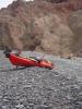 Doug Hamilton's kayak haning out at break beach
Taken on 2007-04-8 .
Links to related images: Date. Proofs. Map. Story.

 Rock gardening north of Loreto
Taken on 2007-04-8 .
Links to related images: Date. Proofs. Map. Story.
 Don Fleming close to shore north of Loreto
Taken on 2007-04-8 .
Links to related images: Date. Proofs. Map. Story.
 Kate DesLauriers north of Loreto
Taken on 2007-04-8 .
Links to related images: Date. Proofs. Map. Story.
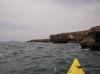
 Paddling close to shore north of Loreto
Taken on 2007-04-8 .
Links to related images: Date. Proofs. Map. Story.
 Kate DesLauriers north of Loreto
Taken on 2007-04-8 .
Links to related images: Date. Proofs. Map. Story.
 Paddling close to shore north of Loreto
Taken on 2007-04-8 .
Links to related images: Date. Proofs. Map. Story.
 The last arroyo beach before the congestion of Loreto
Taken on 2007-04-8 .
Links to related images: Date. Proofs. Map. Story.
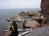
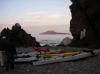 Camping on the last arroyo beach before the congestion of Loreto
Taken on 2007-04-8 .
Links to related images: Date. Proofs. Map. Story.
 The intrepid kayaker rock gardening in Baja
Taken on 2007-04-8 .
Links to related images: Date. Proofs. Map. Story.
All text and images Copyright © 2007 by Mike Higgins / contact