I spent a weekend working on bookkeeping tasks and catching up on some work for an approaching deadline. I spent both days looking out the window over a hot PC at the sunny summer weather. When I was on- line I checked the ocean buoy report and saw that the swell at sea was mild, under a meter all weekend. I considered going abalone diving but could not find a buddy and decided not to risk diving alone. However, after two full working days of this I had to get out. On Sunday afternoon I looked over my maps and decided to do an evening paddle south from Duncans Landing. There are areas here that I have been past only twice before with fairly rough conditions both times. This time I could do the rock garden thing (perhaps going through the arch in Arched Rock Beach) and stay out late enough to catch the sunset.
The trail down to the beach in Duncans Cove has finally been repaired so I carried my kayak down the new stairs and launched around 5:00 PM. I headed south behind the rocks close to shore. One advantage of going late in the day is that fishermen have climbed down all the cliffs along here and spooked all the seals off of most of the offshore rocks. So I can paddle anywhere I want without feeling guilty about driving wildlife away. Someone else assumes that karmic burden. So I got to go a bunch of places this day that I have avoided out of politeness to the seals on previous trips. The mild swell still rose up into intimidating waves on some of the points, so I had interesting water to paddle through. I scoped out many of the beaches as I paddled past and considered landing on some of them. But I had hopes that my emergency kit on my back could stay dry this trip. So I avoided surfing in for a landing since the chances of getting wet increased on launching.
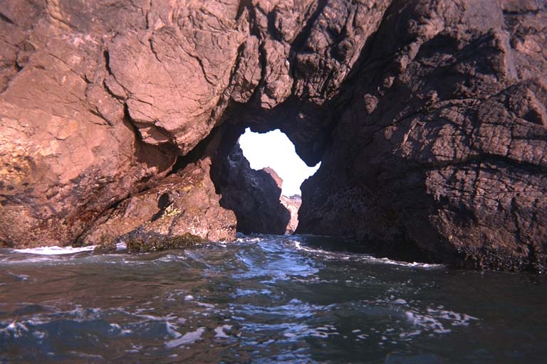
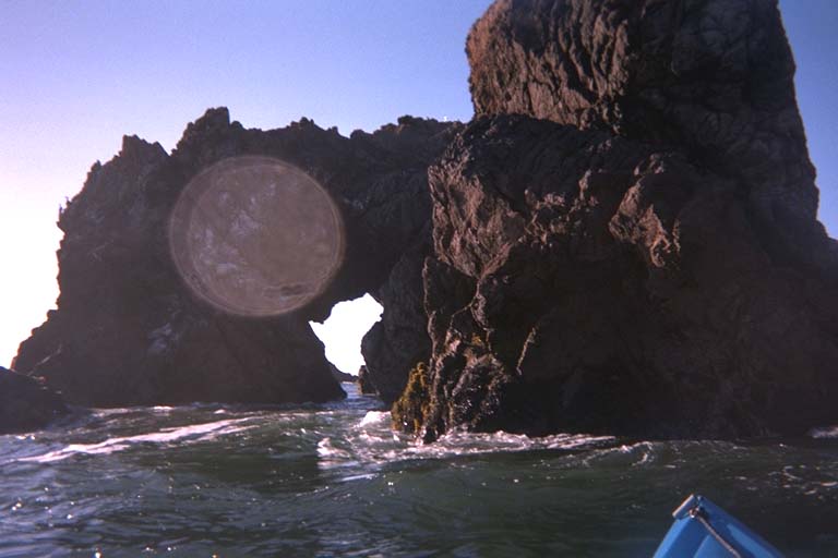
Soon I arrived at Arched Rock Beach where I was curious to see how this rock looked to me today. On previous trips past here it had been too rough, the tide was too low, or I was too chicken to try going through this arch. The cave has a bend in the middle of it and I once wondered if my short Frenzy kayak could even fit around the corner. To my more experienced eyes there was more than enough room for my longer Scupper kayak to fit. I waited for a few large waves to pass and paddled right in. One last fairly large wave followed me in and lifted the kayak up, churning the water to a white froth when the wave met itself in the middle. I easily held the kayak level and yelled "Yahoo!" in enthusiasm for the ride. When I came out the other side, I discovered that I had an audience. Two kids sitting on the shore had watched me go in the arch, heard me whooping it up and yelled their approval when they saw me come out the other side. When I came back going north a few minutes later we were all a little more sedate as I went back through the arch in the opposite direction.
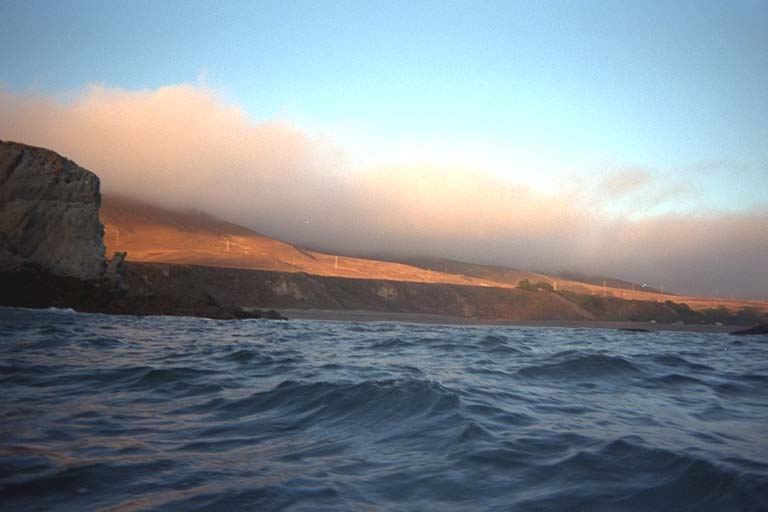
But first I paddled south until I came past the last few rocks before Salmon Creek Beach. The waves had started breaking farther and farther from shore and there were no rocks even close to shore on this long sandy beach. So I turned back and retraced my steps. It was almost ten kilometers round trip to get back to Duncans Landing, but I still made it earlier than expected, with thirty more minutes until sunset. It did not look like the sunset was going to be spectacular. Far out to sea there was a fog bank that would block the sun before it made it to the horizon.
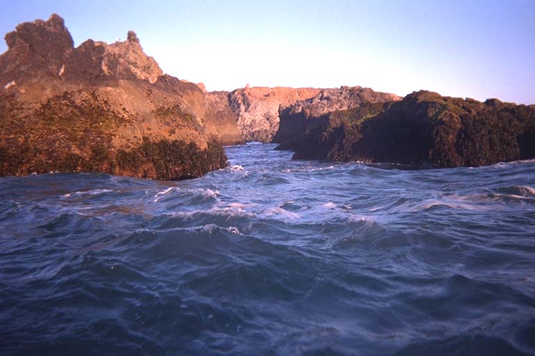
I paddled north around Duncans Point and went through The Crack in The Hogback. This channel through this large rock was reasonably calm and easy to paddle through on this day with mild swell. North of here was a long stretch of sandy beach (Wrights Beach, with beach-side camping) with just a few large rocks far offshore. I think I have never paddled all the way around these rocks. Every other time I have been past here these rocks have been covered with seals and I have stayed away. I looked at the position of the sun and figured I had time to sprint around these rocks and back. It would add another three kilometers total to my evening exercise and keep me on the water until the sun disappeared.
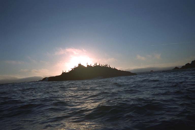
As I went behind these rocks and turned out to sea to paddle around them, I saw the fog bank approaching. Soon the sun disappeared in a glowing yellow smear of sky. For a while I could still see the sun shining on the coastal hills. Then the fog really thickened and closed my visibility down to less than one hundred meters. I couldn't see Duncans Point but kept the beach just within sight and followed it back to The Hogback, Duncans Point, around that into the Duncans Landing cove. I made and easy landing here and carried all my equipment back up the zigzag trail to the car in one trip. Suddenly the sky was clear again, and the ocean as well. The fog bank that had socked me in was just a thin arm of cloudy air that had swept over the shore and was climbing the coastal hills now. Another band of fog approached from out to sea, but did not arrive before I was ready to leave. I had clear sky, the golden glow of dusk over the ocean, and the first few bright stars to watch as I got dressed and packed to return home.