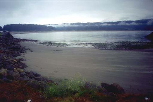
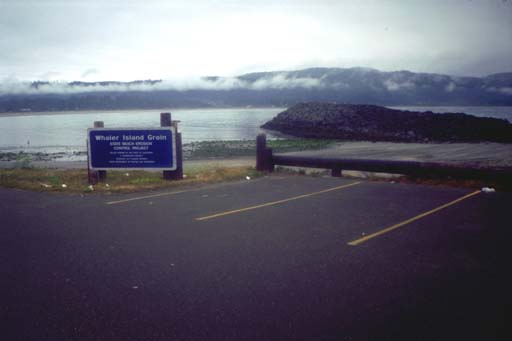
I drove around the harbor in Crescent City looking for the best place to launch. Way down on the southwest corner I found a sandy beach behind a "groin", an artificial rocky spit to hold sand in place and prevent erosion. This was on the corner of a former island named Whalers that has been connected to the shore as part of the breakwater system that makes up the harbor. Launching at the groin meant that I was already outside the harbor and did not have to wind my way through the breakwater with the motor boats. I cut across most of the sandy beach extending around from the breakwater and made it close to shore where I could see a small lagoon on the other side of the beach. I headed south for just a few more kilometers of sandy beach. I caught a glimpse of several dolphins again, which seems to be a very common occurrence in these waters. But when I stopped to look, the dolphins re-appeared several times and I think this was a pod of them. I never saw more than three on the surface at once but I think there were more. They were hanging out in one place to catch their breath or perhaps diving down to catch some schooling fish.
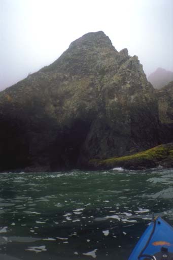
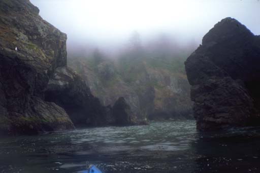
Soon the sandy beach ended and the fun really began for me. From this point on the shore was very rugged with lots of points and offshore rocks to paddle around. I reveled in working my way around the points and sprinted across the small bays to the next point or the next rock. On one of the points I found the first sea cave in Del Norte since starting down the coast from Oregon.
I had USGS maps in my car for all of Del Norte coastline, and NOAA charts for some of it. NOAA chart number 18603 goes as far south as "Midway Point" and the Sister Rocks. This is a reasonably high-resolution chart and printouts from this chart were working well. Below Midway Point you have to switch to a much lower resolution chart, and my chart software failed me here. I told it to blow up the areas south of here so they would have the same scale. The software claimed it was working. The printer chugged for the appropriate amount of time and paper came out. I grabbed them on my way out the door and sorted them out later only to find that all the printouts from the lower resolution chart were missing all the raster data from NOAA and only had the "vector chart". This consisted of a line down the middle of each page with blue on the left and brown on the right. I didn't find the time to transfer the coastline by hand from the paper USGS maps and figured I could find my own way the last 10 or 12 kilometers of this 24 kilometer day.
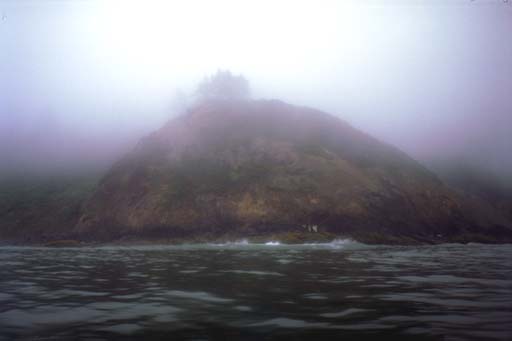
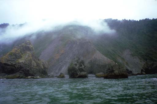
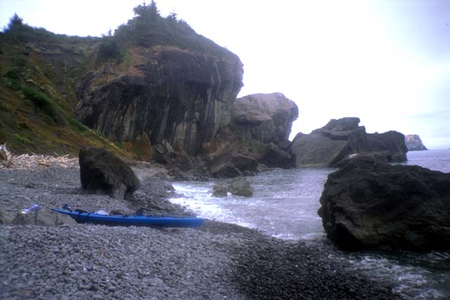
So after I passed Sister Rocks I was in aqua incognito and discovering rocks and points on my own. The shoreline here seems to be a lot greener than Mendocino and Sonoma Counties, with bright green brush growing down the cliffs and close to the water. Wildflowers in yellow and white were showing and darker green trees grew up out of the brush. The tops of the trees held on to wisps of fog and when the cliffs were tall enough they disappeared completely into the low overcast. Occasionally I would catch glimpses of cars going by on Highway 101 way overhead. I ran out of film just before going around a large rocky point and started looking for a place to land for lunch. As I started looking the shore broke up into piles of medium sized boulders (1/2 meter) with larger rocks scattered in the water offshore. I had fun paddling between the offshore rocks and getting as close as I dared to shore while looking for the best place to land. This continued for a while with no place looking particularly appealing until I caught a glimpse of Highway 101 running along the ocean just past the next point. I didn't want to have lunch next to the freeway so I finally chose a gravely beach next to the point and landed.
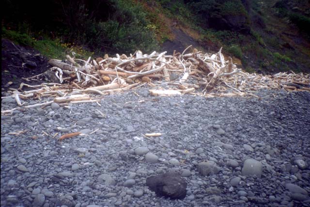
I had a leisurely lunch on a very interesting beach. The gravel was made out of black stone and the driftwood had been swept up into a crown at the top of the beach. I launched into the mild surf and paddled around the next point, only to discover that it was the last point before my destination! I could have skipped lunch until the trip was over, it would only have delayed it another 15 minutes. It was only 4 hours since I left Crescent City but I had already made it to the Redwood Youth Hostel! After making only 4 kilometers per hour on the previous day I had planned on this trip taking much longer. Apparently I made 6 kilometers an hour despite dawdling and playing around the rocks on the way. I have often said that if the shoreline is rocky and interesting I can paddle all day without getting tired, and apparently this also applies to paddling fast.
I paddled out around a group of rocks just offshore from the beach and chose my approach. I started paddling towards the sand and noticed a few submerged rocks in my path. They didn't look like trouble so I let the next wave accelerate me over them. The rocks made the wave rise up without breaking and I made the best kayak surf landing of any I can recall! I surfed right up onto the sand in front of some beachcombers and impressed everyone (especially myself).
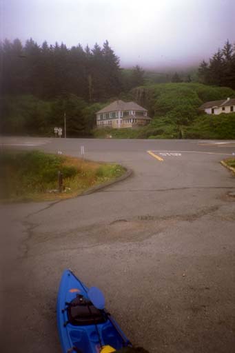
I pulled the kayak up to the parking lot and propped it up on my kayak wheels, which I had carried folded up inside the boat all day. In a break in the traffic, I rolled the boat across Highway 101 and up the driveway to the Redwood Youth Hostel. They were closed until 4:30, so I changed into my street clothes on their front steps, rather than scaring the women and children down on the beach. I left the kayak in the hostel parking lot and went back to the beach. I had planned this trip with the Redwood Coast Transit system in mind and I knew that I could get a ride back to Crescent City at 5:30. But I was very early and had nothing to do for 5 hours, so I tried hitch-hiking. I gritted my teeth because I hate to rely on this, but promised myself I would try for just an hour. Just a half an hour. Just 5 more minutes. Just the next group of cars. Just as I was about to give up a guy in a pickup truck pulled over for me. He turned out to be a Native American fisherman who gill-fished in the nearby Klamath River. His people used to paddle the river and occasionally the ocean here in redwood dugout canoes. I told him about the renaissance in Greenland style paddles and how native American inventions like that were finally getting the respect they deserved.
With the extra time hitch-hiking saved me, I bought some seals to fix an oil leak in my bus, bought some food to cook for dinner, and stopped at the Crescent City Public Library to check the weather forecasts. As I had hoped, the Library had public access internet browsers (running on NT workstations) and I could check all my normal sources. The Navy says things will remain about the same for 5 days, 3 to 6 foot swell. Scripps Institute wave forecast says the waves will rise from 3 to around 6 by Saturday. I've been spoiled by the calm weather and gotten used to hearing the weather radio report 3 foot swell every 10 seconds from all of the buoys all up and down the coast. I hope it holds out for another 4 days! By then I will have made it deep into Humbolt County.