There are a lot of rocks named "ship rock", but as I rounded Cape Mendocino two days before I saw one that actually looked like a ship! It had vertical sides up to a large flat area with a ridge on one end like the bridge of a modern ship. If rocks were named today this one would be called "Super Tanker". Looking at the charts later I found it was named "Steamboat Rock". Close enough! I drifted past this rock and saw that someone had lashed a flagpole to the "bridge".
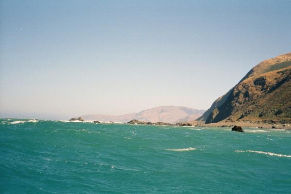
With the wind at my back I made good time past some rocks with names like "Devils Gate" and "Hells Gate" but I wanted to get past Punta Gorda so I stayed far from shore. Along this area I could occasionally see cars driving by on the Mattole Road that parallels the ocean for a while. The wind picked up and really started to blow behind me. The swell would sneak up behind me and combine with the whitecaps to break over the back of my boat. If I was not paying attention this would swamp the boat up above my spray-skirt and test my ability to brace and hold the boat upright. I promised myself that if the waves knocked me over even once, even if I successfully rolled back up, I would turn to shore and implement all the plans I had made for aborting the paddle. But if I was paying attention and saw the swell coming I could turn down the waves and try to surf down them. This rarely worked, but when it did I laughed at the waves because I had stolen energy from them when they were trying to dump on me.
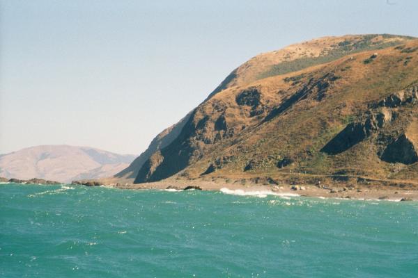
When the road turned inland I passed a rocky reef called Mussel Rock and started looking for a good place to land. I had originally planned to land somewhere between here and the Mattole River. But then Sid Taylor had convinced me not to try to land on this dumpy beach. Ken Kelton and Marvin Feldman once spent several days trying to launch at this spot. One or the other of them would make it out through the dumpy surf, but the second person would get tossed back on the beach again and again until he was exhausted and they would give up for a while. Eventually they both made it and paddled south. The wind was still howling past me so I considered stopping the trip here. It would be an honorable place to quit, just before a rugged point with notorious bad weather on a windy day. Stopping here I could come back and finish the trip later. There would be friendly campers ending their hike north through the Kings Range Lost Coast Trail and they would give me a ride. I looked at the dumping surf from a respectful distance. Oh well, why not continue? It was only a few more miles around Punta Gorda and then I would be past the worst of it and into smooth sailing for the rest of the week. The wind should die down and I would finish the trip as planned.
I had moved some weight from the bow to the stern compartment of the boat to try and make it track better in the wind, but apparently I didn't move enough because the boat still weathercocked perpendicular to the wind. Rather than fight this, I let the boat turn across the wind and away from shore and paddled out a little farther, then turned down wind which angled me closer to shore for a while. Running a zig-zag path I worked my way around Punta Gorda. Curiously the boat most wanted to weathercock across the wind when it was moving fast. If I slowed down it was always easy to turn the boat to point in any direction I wanted to go. Soon I passed the Punta Gorda Lighthouse. I had made it!
Now the wind should have calmed down behind the point but it did not. At one moment, while I was fiddling with my camera, the wind jerked the paddle out of my hand. It flew up end over end and landed far in front of the boat. Then the wind blew me towards it. I grabbed my paddle out of the water and maintained a death grip on it for the rest of the trip. I had a spare paddle strapped on the boat behind me, but I'm not confident I could keep my balance while tugging it out and putting it together under these conditions. Every once in a while the wind would rise to a shrieking fury that would shake the boat and test my grip on the paddle. I saw one of these wind squalls from shore later and they looked like little tornadoes on the surface, ripping the tips off the waves and throwing them around.
With a 20 knot tail wind and a little adrenaline, I made it to Spanish Flat by Lunchtime, averaging a speed of five knots. (Two knots is nice, three is considered reasonably fast). I had planned to camp here so I stopped for a landing. Once on land I was instantly unhappy. The wind whipped black sand particles off the beach and sand blasted me and my boat. It felt like the sand was working its way into the "water resistant" neck and cuff seals of my paddling jacket. For fear that might actually happen I left the jacket on and got hot on the sunny black sand beach. I needed to get more charts out and had packed them into the bag in the tip of the boat, so I unpacked and re-packed almost everything in the kayak while little black pellets banged off me and into everything. There was nowhere on Spanish Flat to get out of the wind or set up a tent. I decided I would be happier on the water and launched again. Maybe the wind will end around the next point.
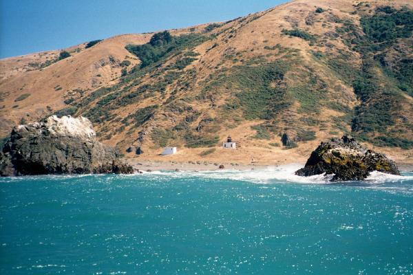
The land was turning east past Punta Gorda and some of the wind was reaching me over the land. I discovered if I turned away from shore the wind was cold and smelled of the sea. But closer to shore the wind was warm and smelled of trees or spicy plants. By traveling only eight more kilometers I would travel 48 kilometers this day and catch up to the place I had originally planned on being if I had not taken a day off.
Ever since passing the Mattole River I had seen groups of hikers on the Lost Coast Trail. At the start of the beach for Big Flat and Miller Flat there was an inviting little valley. I watched a group of four of these hikers turn up the valley for the evening. The landing there looked a little rough so I continued four more kilometers farther to a little cove, or at least a dent between two sandy points, on Miller Flat. As I approached I saw a grove of trees on the flat there and figured I could find shelter from the wind. The "cove" had pretty dumpy waves but clean white foam ran way up the beach. Sandy wash suggests violent water but this white foam suggested milder breakers. I came in for a reasonably easy landing.
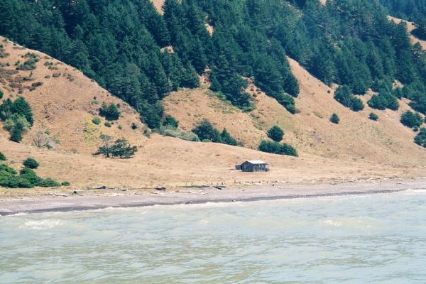
After exploring the thistles and poison oak under the trees I decided to camp in one of the "beach architecture structures" built out of driftwood and chinked with stones. I left my gear there and started to walk towards the Lost Coast Trail to see what the strange notation "W.C." marked on my USGS maps meant. I was hoping that it meant "water closet" and there would be a park bathroom with running water. However, on the way there I ran into some campers who turned out to be staying in a "beach architecture structure" a little south of mine! I had never noticed any sign of other people on the flat. They disappointed me about the W.C. and told me that all the buildings on the flat are part of a private lodge with a landing strip. However, they directed me to something else even more miraculous. All the way across the flat, 500 meters from the nearest tree, two kilometers from the nearest possible source of running fresh water, there is a black pipe sticking out of the sand with a faucet and a few meters of hose. Burned on pieces of driftwood plank are the words "Untreated Water", and "Use At Own Risk". My fellow campers attest to the drinkability but I wanted a bath/shower. After running who knows how long under the sandy soil of Miller Flat, the water was luke-warm. The warm wind dried me off in no time after my luxurious washing.
One other thing I learned about from the other campers was about "Little Bear", a small black bear that had been raiding campsites on the flat. The recommendation passed down from the rangers was to bury food under 20 centimeters of sand capped with stones. I had brought "ready cooked" bacon on this trip which was all gone but I still had bacon grease on my knife, my pants, and in plastic bags in my trash. I also had foil pouches left over from spicy Indian food. I was NOT prepared for bear! The locals believe that this bear is a transplant from Yosemite, where young bears that start learning bad habits are moved to "remote locations" to learn to forage on the wild. Apparently the King Range National Park is considered remote, but Little Bear has found a place to practice his bad habits. I re-arranged my food into one drybag and buried it next to my trash. I slept with my tent open facing my cairn, but it was never disturbed by a bear. In the morning I asked around and nobody had seen the bear. But while loading my boat the next morning I found little bear paw prints running down the wet sand of the beach below the late night high tide line.