One of the campers I had met the day before was a surfer, out to ride one of the best point breaks in Humboldt county. He had hiked in eleven kilometers with his board strapped to his backpack. I thought this was a bit extreme until another surfer arrived before dark. They didn't know each other but had mutual friends who were expected later in the week! I had thought I was a bit extreme camping in a driftwood structure, but it sounded like every log was soon going to have a surfer sleeping behind it. The surfers were pinned to the shore by the same wind that troubled my days but they were hoping for calmer weather. The wind did finally die down in the night and was calm for my launch at 8:00 AM.
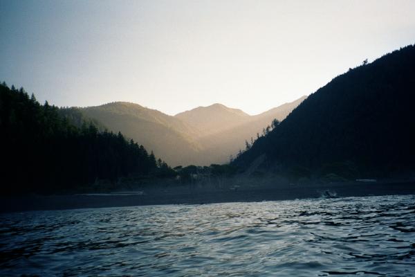
The sun came up behind the mountains and started peeking down on me as I went south. It dazzled my eyes, glared off my dirty sunglasses and made photographing the valleys and waterfalls difficult. I should have launched later! I went slowly, waiting for the sun to rise higher and finding reasons to look out to sea. Like watching pelicans fly and sea lions cavort. Every day, sometimes every hour of this trip, I had seen sea lions traveling north. They came singly but most often in pairs, sometimes in pods of as many as 6. Porpoiseing with their mouths open to gulp air, they traveled about the same distance from shore as I did and often surprised themselves when they saw me going the other way. I took up barking peremptorily at them whenever I saw them and laughing when they started and splashed out of my path.
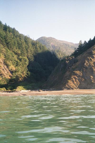
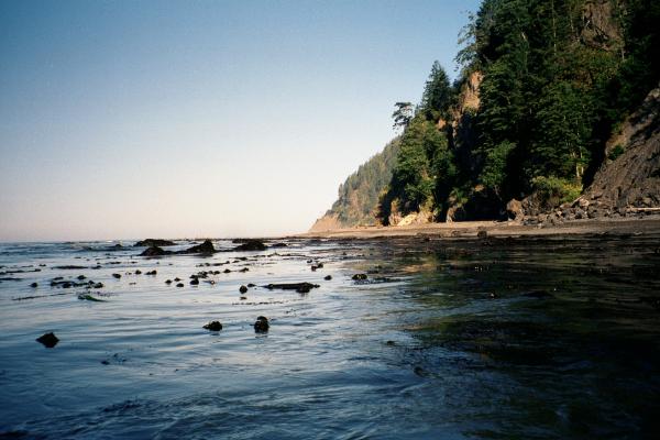
Between Miller Flat and Shelter Cove there is this place called Delgata Canyon. Most people don't know about it because it is under the sea and not visible from land. Sid Taylor deduced the existence of this canyon by noticing how calm the surface water was and guessing that it must be deep here. Looking at a chart he saw Delgada Canyon dropping away to 140 meters only a little way from shore! It is less than a kilometer wide where it ends at the shore but broadens as it goes out and down. There is a narrow rocky shelf near the shore with abundant kelp growing on it. Perhaps the canyon creates its own upwelling of nutrients here. My breath blew puffs of fog, perhaps confirming that cold deep water was rising here. This could be an interesting place to do a SCUBA dive!
I wondered why a deep canyon would make even the shore so calm as I was able to paddle within a meter of the sand. In deep water, waves get longer and shorter and hide their energy only to rise up again in the shallows. So why was the water over the shallow shelf so calm? Then the following explanation occurred to me: The canyon was acting like a giant diffusing lens! Waves approaching the shore here are refracted north and south. Making the point break at Miller Flat more fun for surfers and the shore more dangerous for kayakers approaching Shelter Cove.
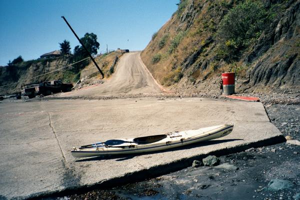
Shelter Cove is sheltered because it faces south away from the prevailing northern swell. But I had to work my way around the point from the north with the "Delgada Waves" rising up and breaking on the rocky shore. I tried to stay close to shore to save a few minutes of paddling but decided I had better sense than that. I went way around places I saw waves break and took an extra 20 minutes getting into the protection of the harbor. I pulled up to the sandy beach next to the boat ramp and a wave rose up to dump a load of smelly sandy dead seaweed on my boat as I made my landing. Welcome Home! Getting my dry clothes out I discovered that I was annoying the beach-goers who had to detour their 4x4 trucks around my kayak to get on and off the beach. But I had just finished the last leg of northern California! I have now paddled every inch of California from the Oregon border down to Half Moon Bay!
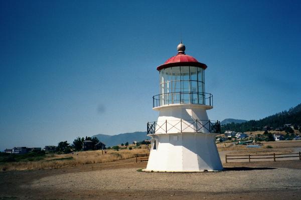
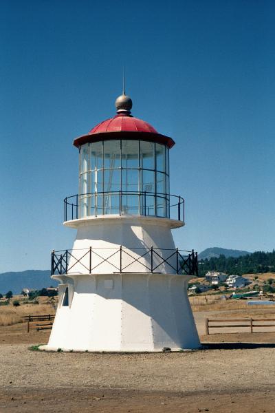
I was pleasantly surprised to find the answer to a retorical question I asked myself a few days ago: What happened to the old Cape Mendocino Lighthouse? The answer is that it was moved to down-town Shelter Cove and restored there! I remember that on previous trips to Shelter Cove I had seen a collection box (in the shape of a lighthouse) begging for quarters in the deli. If I had known THIS was what they were going to do with those quarters I would have inserted a $20 bill! I assume there will still be opportunities to do this later.
Now the difficult part of the trip started. I was 180 kilometers from my car and 35 kilometers from the nearest public transit. I rented a campsite in Shelter Cove where I parked my kayak and re-organized my belongings. I took everything of value, especially all the rolls of exposed film, some camping gear in case I spent the night on the road, and a liter of water which turned out to be a very good idea. I hiked up out of Shelter Cove and sat on the last intersection out of town with my thumb out. Nobody would stop to give me a ride so after a while I started hiking up the hill. I realized I was in trouble when I saw signs saying "Snow Chains May be Required". Checking the map later I found that the road climbs up to 760 meters. It is steepest near the shore and I actually climbed over half way up it and hiked over 8 kilometers. But I guess looking determined to get somewhere does pay off and I started getting rides. I left Shelter Cove at 3:00 PM and made it to Garborville by 6:50 before the next Greyhound bus was due.
The Greyhound bus schedule and the Redwood Park Information Center schedules beat against each other and guaranteed that it would take another day to get my car back. Since I made it to the 6:50 PM bus I would get to Orick too late to get my car out from behind the locked gate. I planned to stay the night in a motel in Orick. If I had missed the bus the next one was at 3:40 AM the following morning, so I would have stayed the night in Garborville. But I got a shower and a bed in Orick and got up at 7:00 AM to hike back to my car. The janitorial crew arrived at the Information Center by 8:00 AM so I was able to leave before Ranger Rickey came in to thank personally for allowing me to leave my car there. It was still there in good condition (well, about as good as I left it) and didn't have any tickets on it for illegally parking overnight. I quickly drove back to Shelter Cove and re-combined all my equipment for the trip home. For the record, the Fish and Chips at Shelter Cove is many orders of magnitude better than the Fish (sticks) and Chips in Orick.