Ken Kelton, of BASK, announced a kayak camping trip through the club email list server. I was at a convenient break in work, so I jumped at the chance to go on an open coast camping trip. I asked Ken what he was going to do with his car and how we could arrange a shuttle. I suggested this was the hardest part of a kayak camping trip, but he did not agree. He said he would talk to the rangers and find the best place to leave the cars before I arrived. I warned him about the no overnight parking run-ins I have had with rangers, but he didnt believe me. We arranged to meet at Gerstle Cove on Monday morning.
Ken called me up on Sunday afternoon and left a long message. Apparently he discovered the source of my concern about parking for a kayak trip: The increasingly regimented mindless bureaucracy and rule enforcement mentality of the Park Ranger. He said he made the mistake of telling a ranger what he was planning to do without first checking to see if she had a swastika on her uniform. The ranger told Ken that even landing on private land was forbidden. Ken quoted her the mean high tide line from the California Constitution, and she replied with some strange story that there are German Land Grants in northern California that superceded the state constitution and extended below the water line. German land grants? Spanish or Russian I could believe, but German? Ken was horrified when his friendly ranger would not even rent him a campsite to park his car in, for fear he would use it as a base of operations for kayak camping. She went so far as to threaten him by promising to keep a special lookout for his car and have it towed away if she saw it parked overnight anywhere on the coast near her jurisdiction.
Ken says that he remembers a different kind of ranger from his youth, a kind gentle person who was more likely to tell you the name of a tree than pull a gun on you and give you a parking ticket. Telling you the name of a tree is no longer part of the park rangers job, they dont have a budget for that kind of thing any more. Interpretive specialists now come from volunteer organizations like the Stewards of Slavianka. The rangers have been drafted into the War On Drugs, which is probably why they carry semi automatic pistols now, and spend all of their time enforcing rules without even trying to remember what the rules are intended to do. Ken rented a parking space (campground) from the nearby private Ocean Cove Campground. We spent $66.00 to reserve this spot for two cars for three nights, money the State Parks System presumably could have found a use for and could have had if they were more friendly and supportive.
I talked to some friendly, helpful campers at the Ocean Cove Camgound about our plans. They knew the people who owned the coastline north of us and said that The Robertsons are nice people. I asked them to give me the Robertsons phone number so I could ask permission to camp at Stewarts Point. Oh, dont do that, if you ask the answer will always be NO. You would be better off camping on the sly. It turns out that the Robertsons used to allow people to use their boat ramp at Stewarts Point and the beach at beautiful Fishermans Bay. But the liability insurance for that sort of operation became too expensive for them and they had to close off the access. Now to protect themselves from liability they patrol their own land and drive people off. So the loss of public access to Fishermans Bay can be blamed on the lawyers.
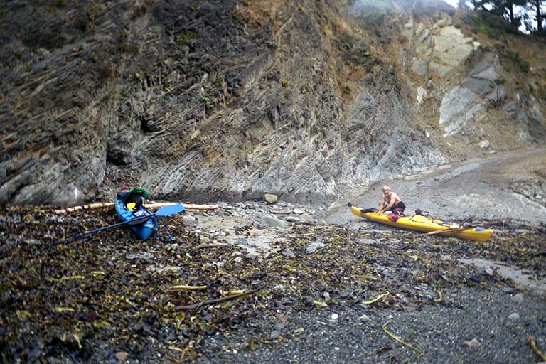
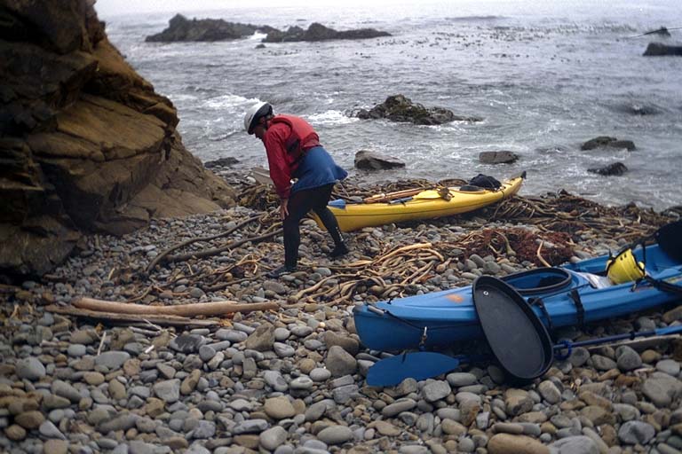
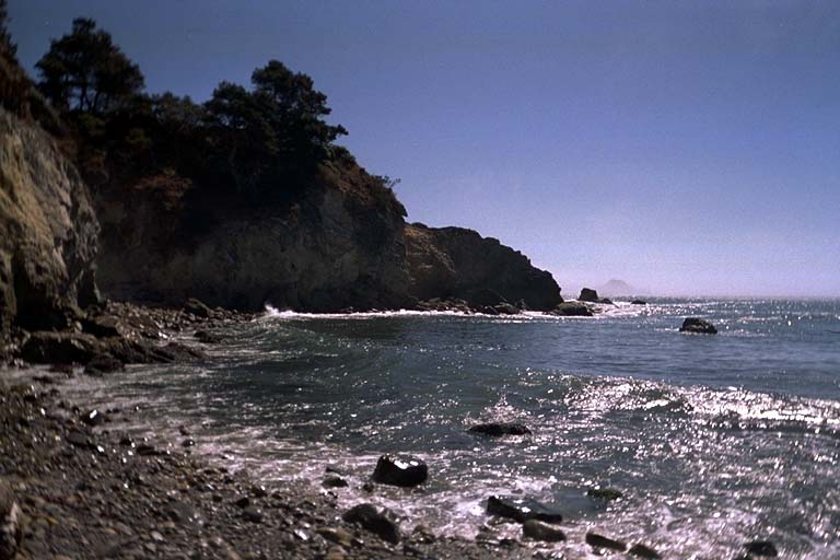
Ken an I launched from Ocean Cove and headed north past Gerstle Cove and Salt Point. At my urging we turned in to make a landing at Fisk Mill Cove, where I have spent some time before but never launched or landed until now. Then we continued north around the next point and across Horseshoe Cove. We breathed a sigh of relief as we left the jurisdiction of The Ranger From Hell. We hugged the shore and did some interesting rock gardening then stopped for another landing behind Rocky Point. From this point on we started studying the coastline in earnest, searching for a place to gorilla camp as Ken called it. Inside Fishermans Bay we found the perfect beach to camp on. Wide and flat and extending back into a creek valley filled with trees. Unfortunately it was spitting distance from several ranch houses and probably the first place the Robertsons would patrol. We went on to look at the beaches on Stewarts Point. Stewarts Point isnt a point any more, it is an island separated from the land by a narrow channel. Ive never had the nerve to paddle through this gap, because there are some sharp jagged rocks in shallow water at one end. I went around but Ken went through and surfed over the jagged parts on top of a wave. The beach behind the point was right next to the boat ramp and presumably easily patrolled. There was a sandy cove with a rather exposed place to camp closer to the island. But this was also close to the access and also a little too exposed. Ken suggested looking a little farther north before we considered staying there.
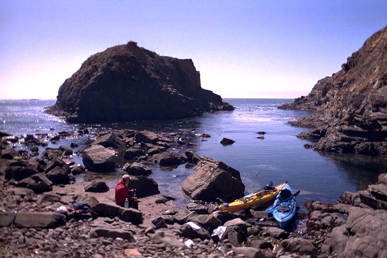
He headed for a crack in the cliff and as we paddled north the crack opened up into a 10 meter wide triangle of boulders. We landed to check it out, an exciting and fun trip through a field of offshore rocks. The offshore rocks broke the waves and made the water reasonably calm in front of our beach. The triangle of boulders was at least a meter above the waves at high tide and rose another meter in the back. A roll of tangled bull kelp along the shore protected the bottom of our boats during landing then absorbed the waves and prevented them from splashing. We checked the marine weather (continued mild swell) and the Tidelog before deciding to stay. The tide was already about as high as it would get, then would be low through the middle of the night. On two sides of our camp-spot the cliffs rose vertically with no way to climb out. I felt naked changing into dry street clothes with no place to go but the open ocean. They might roll boulders down on us from above, but we were unlikely to be found by anybody without another boat. The beach was strewn with dry driftwood and we started a campfire. By removing a layer of boulders close to the walls we found smaller gravel to set up our ground-cloths and inflate our mattresses on.
At dusk a heavy fog moved in and started drizzling moisture on everything. Ken said that this had happened the night before at Ocean Cove, but it stopped after a short time. We folded our ground-cloths up over our sleeping bags and tried to go to sleep. This time the drizzle never let up all night long and we both considered doing something about it. Ken considered tenting his ground-cloth up off his sleeping bag. I had a tent in my kayak, but it was too much trouble to get out and make room for it in the drizzle. Instead we both just suffered with a claustrophobic arrangement. My breath condensed on the plastic sheet over my head and dripped cold water down on me. Kens ground-cloth was a little porous and water seeped through it to soak the outside of his sleeping bag. Both of us were comfortable with our pads and warm in our bags, but would have been more comfortable with a shelter from the drizzling fog. When the tide was at its lowest point in the middle of the night a field of shallow rocks were exposed offshore. The waves made a lot of noise breaking over these and disturbed our sleep, making us wonder if THE BIG WAVE was about to suck us out of our camp-spot. In the morning, Ken put his wet sleeping bag inside a drysack and said that we had to stop early in the afternoon to dry his bag out before evening. We figured on doing this in the town of Gualala.
But first we had to paddle past the entire length of Sea Ranch. I asked Ken if he was keeping his eyes out for an emergency camping spot if we had to stop early. He replied that he wasnt even considering camping near Sea Ranch. There were too many houses near the cliff tops. Even a crack in the cliff that could not be seen from any house might be close to a private hiking trail and be visible from some angles. Also a campfire, which we needed on this foggy overcast day to dry out the sleeping bags, would have attracted attention. We had to get past Sea Ranch, so we set our sights on the campground just a mile up the Gualala River.
Along the way I impressed Ken with my knowledge of the local area. As we approached each public access beach I recalled the name of the beach and pointed out nearby caves and channels we could paddle into. Once north of Pebble beach we got into an area I had only paddled by once before on pretty rough days. So I was exploring close to shore for the first time as well. I saw one cave in the side of a narrow cove and considered going in. The cave turned right and disappeared with no light coming back out. I decided to pass it by, but went into the next narrow cove. Here I found another larger cave going the opposite direction, so I went in. In the back I found a narrow tunnel going west and turning left into the light. The other end of the cave I had just seen! I pointed into the tunnel and started in. Ken could not see it from where he was and watched me disappear into the wall. Just as I got inside a wave came around the corner and blasted past me. I bent down and managed to keep my head from banging on the ceiling, but it was the closest I have ever come to actually needing my helmet. When the wave passed, my boat was stalled in the middle of the cave. I didnt have enough room to paddle and started the boat moving by pushing off the walls with my hands. Soon I was around the corner and into the light again. I paused and waited where I could see back into the entrance, but never saw Ken line up to enter the tunnel. After a while I figured he had decided not to risk it so I continued out and around looking for him. But he finally went through the tunnel, after spending more time watching the waves than I did. So I missed him completely and had to run around the outside again before we managed to meet up.
During our passage of Sea Ranch we stopped to rest on an un-named beach with no public access near Pebble Beach, then later stopped on Walk-On Beach for a snack. From this point north there were no more public beaches and presumably no good places to stop By this time it was after 2:00 PM and we were concerned about getting someplace to dry out our equipment. So we stopped messing about close to shore and paddled straight and fast up the coast heading for Gualala. When we got to Gualala Rock I saw lots of breaking waves between the rock and the shore. Apparently there is a shallow area here and the waves were wrapping around the rock to break into themselves in the middle. I paddled out to the rock and hugged the deep water close to the rock to avoid this, going between several smaller rocks. Ken went straight through the shallow area and easily plowed over the breaking waves.
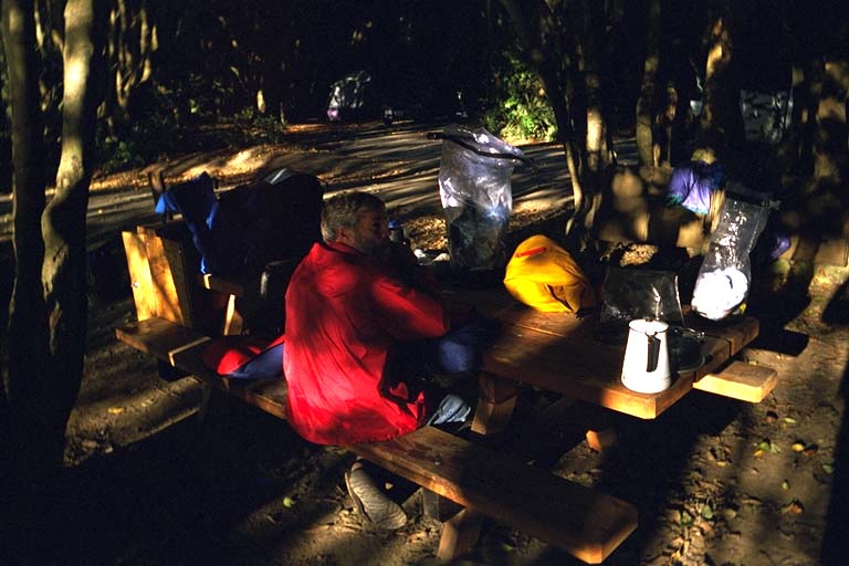
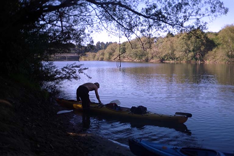
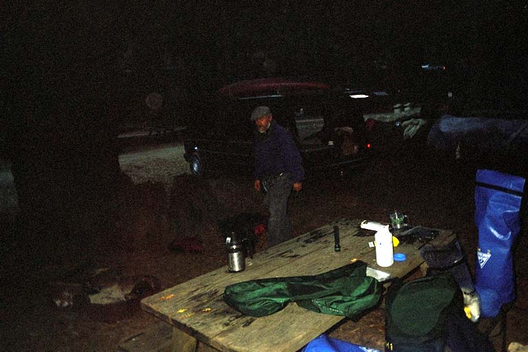
We landed on the long dumpy Gualala Beach and dragged our boats over the spit into the Gualala River. As we crossed over the spit the sun came up over us. The dreary foggy day we had been saddled with was just hugging the coast and only a short distance inland was a sunny day! We considered climbing up to the town of Gualala and looking for a Laundromat to dry our stuff in. But Ken decided that the sunny afternoon would be enough so we headed up river. A strong breeze was blowing from offshore and Ken opened up his kayak sail for the first time in two days. We held our two kayaks together and the wind was strong enough to pull both boats upriver and around the first corner near the Highway One bridge. We then paddled another kilometer up river until we saw tents through the trees an found the Gualala Regional Park Campground. We hung out our sleeping bags and they did dry before sunset. When the camp host came by I tried to convince him that since the camping fee was $15.00 per car and we had zero cars the total for us should be zero dollars. But he didnt fall for it. He did give us a discount because it was a Sonoma County park and I was a Sonoma County resident.
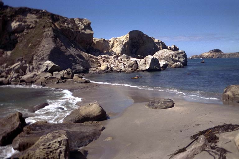
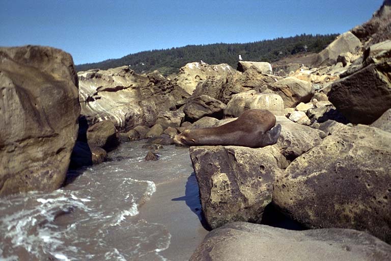
Despite the sunny afternoon I decided not to risk another damp night and set up my tent. This turned out, of course, to be totally unnecessary. There was no fog at all and we woke up to a sunny morning with clear skies. We packed up our equipment and paddled out to the ocean again to find that the wind was already blowing and there were whitecaps from the horizon to the shore. We hugged the shore and managed to stay out of this wind part of the time. However, most of the morning we just worked hard to work our way north. Behind Robertson point just offshore from Gualala is a channel that I paddled through once before after getting knocked off my boat and swimming ashore. We went north through this channel with none of the problems that I had on that trip. We went behind the rock that I call the Dr. Sues Rock, carved into fantastic shapes by the weather. Staying close to shore we stopped for lunch at Bourns Landing, a beautiful little cove with a mild rocky beach. We were protected from the wind and basked in the sun for a while. When it came time to launch, I pulled my boat over a shallow rocky channel and made it back into deeper water by going through an arch and into the next cove. Ken saw me struggling to drag my boat, heavy with camping equipment, over the rocks in the channel and decided to take the long way around.
Ken has had a lot more experience doing the things I like to do in a kayak so its interesting looking at my future. I certainly notice myself being comfortable doing things I was too nervous to try before. Then Ken paddles through an area where waves are breaking between the rocks and the cliffs. I often went around but watched Ken brace over the waves and paddle through without breaking stride. The wind became stronger in the afternoon and we slogged our way north to Anchor Bay. Fortunately we had not planned a long trip for this day.
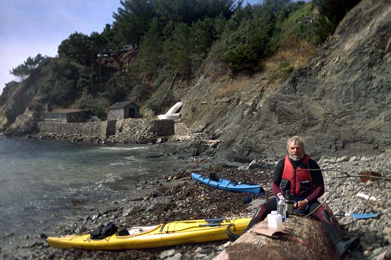
We had left both our cars down in Ocean Cove, now almost forty kilometers south of us. Kens plan was to hitch-hike back to the cars and shuttle them up to Anchor Bay. Im nervous about trusting my fate to hitch-hiking, but Ken assured me that this was an easy stretch of road to get a ride on. He suggested that we leave our wetsuits and PFDs on and someone would take pity on us and give us a quick ride. So we pulled the boats up onto the beach and talked to a local who was on his way to nearby Gualala. But that was the end of the ride, period. We stood on a corner in Gualala for three hours and never got a ride. Standing on the hot roadside in our wetsuits I could feel my feet turning into cheese. Eventually we decided to split up. I would try to hitch-hike back to the campground and see if the rising tide had taken away our boats yet. Ken would continue trying to get to the cars. If he got a ride first, I could give up hitch-hiking and wait in a local bar since he would be right back in a half an hour or so.
Ken soon got a ride, so I sat on the front porch of a local pub. But after an hour and a half waiting I gave up again and started trying to get another ride. This didnt work either until the MTA bus came through town and I flagged it down for a ride. This local transit bus goes through town once in the morning going south, then comes back north around 7:00 PM. So I spent five hours in Gualala to catch a bus out of town and make it ten kilometers back to our boats. Im confirmed in my distrust of hitch-hiking. I grabbed a schedule for the MTA bus, and the next time I do a camping trip in this area Im going to schedule the kayak trip around the times that you can ride the bus back to your car. After spending all day sampling the hospitality of the people in Gualala I refused to spend my money there. So we tried out the Fish Rock Cafe in the town of Anchor Bay (fish and chips, of course). Then we settled down for the night in the Anchor Bay Campground.
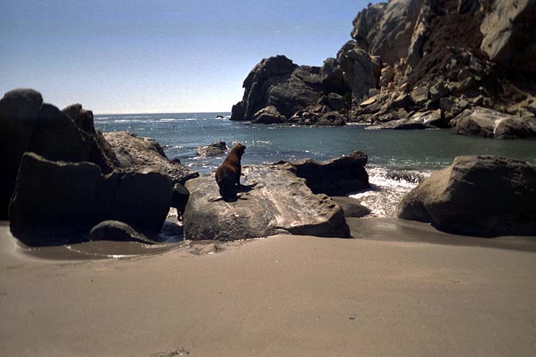
On Thursday I had to go home by evening, so we threw most of our stuff in Kens car and went on a day trip with light responsive boats. Ken wanted to paddle around the Fish Rock Islands so we paddled around these first. We went north and counter clockwise around both islands so we would have the northeast swell and wind at our backs as we went down the rugged outer shore. Then we turned and went north between the two islands. I had avoided this area the last time I was here because it was loaded with sea lions. There were fewer sea lions, but the water was very shallow between the two islands. I suspected that on low tides there is a sandbar and no water through here. (Then found out later that this was true). Ken did his best to surf the waves breaking through here while I timed my passage to be a little milder. He got caught by a wave and surfed into the rocks on one side of the channel and had an exciting time pushing himself off while a large sea lion threatened him for invading a private beach.
As we paddled north to the tip of Havens Neck the fog closed in, the wind came up, and the ocean got fairly choppy. Ken observed that these were pretty miserable conditions. We had both brought equipment to go abalone diving, but in these conditions we didnt feel like trying it out. We turned in towards land, plotting a course by compass in the thick fog, and pulled out of the fog into a sunny day on a mild beach north of the Neck. We almost considered going abalone diving here, but it didnt look like a place I would have expected to find them. We got back in our boats and continued north close to the shore.
Around noon we reached our planned turn-around point: Steens Landing. As we approached this point my memory started jangling and I remembered a cute little house close to the water with a large stone sea-wall built to protect it. We landed next to this sea-wall and sat on a log to eat our lunch. The fog had come back in on our trip north but during lunch it started clearing again. Every once in a while we could see a rock out in the water, hovering above the fog. We first thought it was a nearby rock but it turned out to be the tree-covered knoll at the tip of Havens Neck. Before we returned to our boats after lunch the sky cleared up completely. We headed straight south to give me time to get home by 5:00 PM. Ken raised his sail again and for a while I hitched a ride. But the wind barely pulled us along as fast as I could paddle.
On the way back to Anchor Bay we went between the Fish Rock islands again. This time I decided to land on the little beach where Ken got stuck and try to sneak up on a sea lion to take its picture. I saw one and landed my boat behind a rock out of view. I hurriedly pulled my boat up closer to this rock and sneaked around to try to take a picture. The seal heard me coming and ran into the water so all I got were pictures of it from behind. But as I turned my boat around I saw another one on a nearby rock. I had landed less than 5 meters from this seal and he hadnt bothered to jump up and run away like the other one! He let me walk up to within a few meters and take his picture and didnt do more than pry open his eyes to watch me. Ken and I turned back to the Anchor Bay Campground and landed around 3:00 PM, in plenty of time to drive down to Ocean Cove, get my van, and return home by 5:00.