After the Cabrillo trip, I continued north to do a camping trip I had planned over a year in advance. I wanted to fill in my map of Northern California by paddling past another large section of the coast. It takes such a long time to drive up to this part of the coastline I could only justify doing it if I stayed around for a while, did multiple trips or camped out. Del Norte is the northern-most county in the state of California and has only 60 kilometers of shoreline. If the weather co-operated I figured I could do the whole county in a week. I reserved two weeks in my calendar which should cover a lot of bad weather or allow me to keep paddling into Humbolt County to the south.
I stayed at the Redwood Youth Hostel on my way up the coastline on Sunday, so it took me until 11:00 on Monday to get the rest of the way to the Smith River and to get ready for a day paddle. I launched from just inside the mouth of the river as the tide was coming in (poor planning on my part). I found a channel with beach waves breaking on the spit to my left and waves breaking around the rocky Pyramid Point to my right. I paddled out with no problems, figuring it would be even easier at high tide later.
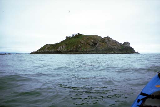
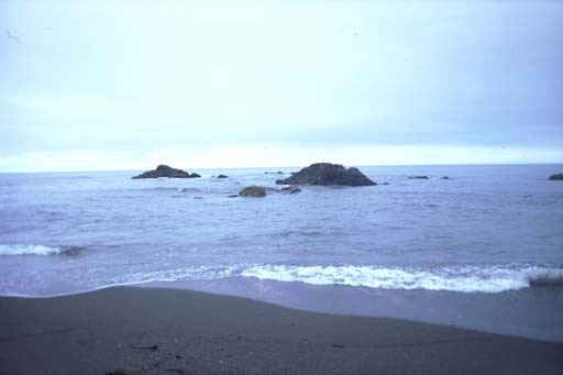
I turned around one point and Prince Island came into view, a large rock with grass, brush and a few trees. My "Coastal Resource Guide" says that almost half the California seabird nesting sites on rocks are found in this neighborhood.
Around the north side of Price Island I saw a huge dark cave half way up on the island. I imagined bats swarming out this in the evening. I vaguely considered landing and climbing up to explore the cave. Later on the trip back I found a deep cove or crack in the west side of the island that lead up to this huge hole in the north side! On stormy days when the swell is from the southwest, the waves must blast out this big hole in megaton quantities! This might be worth a trip back up here in the winter!
I went around the right side of the next island, Hunter Rocks, then worked my way closer to shore. There is a little park here on a sandy beach where I was considering spending the night. I had looked out over the waves early this morning, now I looked back in over the waves. It looked doable if the swell continued in the mild pattern of the last few weeks. Three feet every ten seconds is mild weather for a kayaker on the ocean.
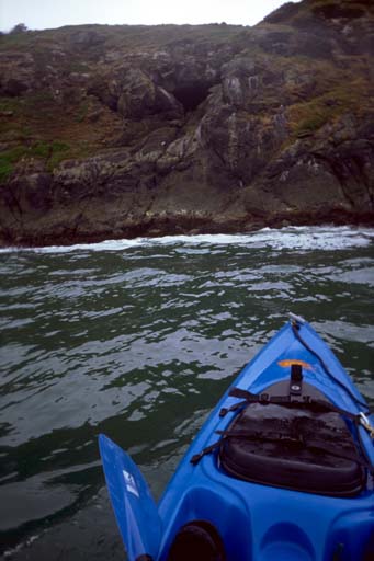
I stayed close to shore for the rest of the trip north, going behind small rocks but not taking many chances with the breakers. I had USGS maps to the border but did not have one for Oregon. I had printed out parts of the NOAA oceanographic charts, but they don't have a detail chart of this area.
When the USGS went to make maps of the land, they adopted a consistent system. Almost all of the USA is laid out on a grid of small high-resolution maps, the 7 1/2 grid series. If your house is old enough it will appear on one of these maps as a little black square. When the USGS ran into the ocean, they continued mapping the things that fell under their grid, points, harbors, and rocks. So I have found these maps to be a good source of information about the shoreline. The topographic lines on the shore tell me the contour of the land so I can tell where I am on the water.
When the NOAA went to make charts of the ocean, they did not adopt a consistant system. When they came near a port they did a high resolution chart. When there wasn't a port nearby, they did large low-resolution charts that cover large areas. All these charts overlap each other in a hodge-podge. Many of the charts aren't even oriented north-south. When NOAA's charts overlapped the land, they sometimes put in topographic lines to help you recognize the shore, but usually just painted it brown. With the differing scale on all the charts, as you go up the coast the amount of detail in your charts change. Apparently there is nothing at the Oregon-California border that NOAA though was worth charting, so all I had was a brown outline of the shore north of California with one river near the border.
The last section of California shoreline was rather plane with no features I could pick out to tell if I had crossed the border. I strained my eyes trying to see the dotted line in the water they show on the border on all the maps but never saw it. I estimated if I traveled two hours north I would easily cover the six kilometers from the mouth of the Smith River to the border. So I planned on turning back by 1:00 PM.
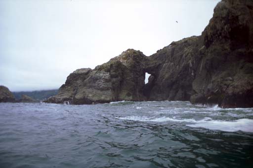
But my 12:00 noon I saw a river mouth to my right. Is this the Inchuck River in Oregon on the NOAA chart? I wasn't sure so I kept heading north. I soon came to a lot of interesting small rocks close to shore. There was nothing like this in California on the USGS maps. Looking at the "useless" NOAA chart again, I noticed that it did have offshore rocks and kelp fields and in fact it had all the information I needed. I just had to learn how to read it better. I was pretty sure I was in Oregon.
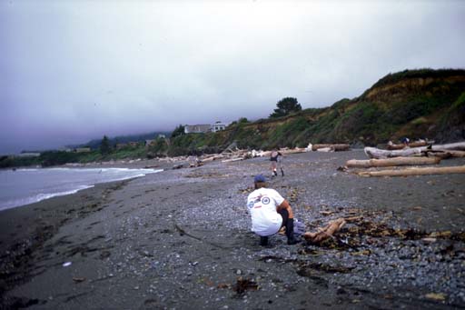
I saw a group of people fishing on a beach that looked reasonably mild. I worked my way through come rocks close to shore and landed near one of these fishermen. "How's the fishing"? "Rotten". "This may sound like a strange question, but Where Am I"? "You are in Oregon". Then he wanted to know where I paddled from and if these were rough conditions for kayaking. I apparently landed just south of Red Point.
I paused long enough to eat some lunch, then launched to start south. I stayed far from shore and went past all the larger offshore rocks, Camel Rock, Cone Rock, Hunter Rock and back to Price Island. I apparently paddled far enough northwest that I could see Castle Rock offshore and separate from the flatlands around Crescent City to the south. When the overcast lifted, I also caught glimpses of the old lighthouse twelve kilometers offshore. Between rocks the trip was monotonous and I started thinking about great white sharks. Instead I was rewarded by the spouting of a dolphin less than ten meters in front of me. I peered into the water in vain and didn't catch a glimpse of him going under me.
I went around the offshore side of Prince Island on the way back and was tempted to go into some of the seething cauldrons in cracks on the west and south sides of this rock. If it had been a hot sunny day, instead of cool and overcast, I might have tried them out. A dare-devil companion (like Don "ductape" Barch who was scheduled to join me in a week) might have made it easy to try out the rough water.
The waves reflecting off the northwest sides of Price Island belied the buoy reports which still claimed three feet every ten seconds. But behind the island the water calmed down and I turned back towards the Smith River. Around Pyramid Point I found the river rougher than I recalled. The tide had already tuned and I had to work hard to get in the mouth. The waves, despite looking rough and threatening to break on me, were no help at all. But soon I was landed and carting my equipment to the bus. A calm and successful shake-down paddle for the week to come.