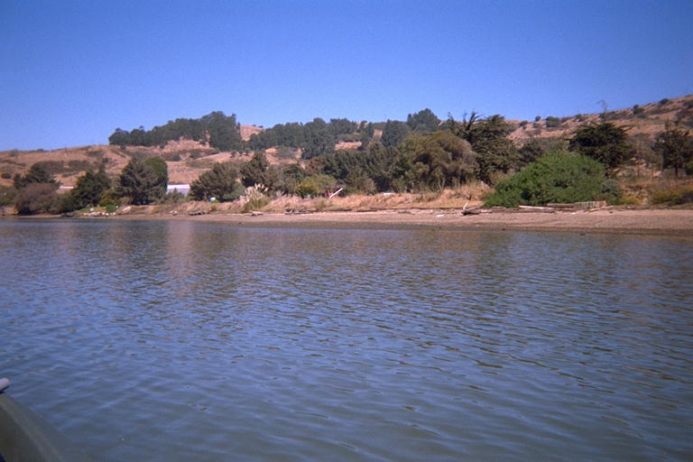
The waves at sea look like they are calming down from their high last week, so I'm starting to think about going out in the ocean again. A little over a week ago, I saw in the NOAA data an event: The swells at sea went from 7 feet (OK) to 13 feet high (YIPES!) in just two hours. Those would have been the wrong two hours to be out in the kayak. However, I was in Berkeley Monday morning and didn't want to drive all the way to the ocean, so I stopped on the east side of the Richmond Bridge and went to explore several islands there. I had seen an exit sign mentioning a lighthouse, so I figured there would be access to the water. I took the last off-ramp before the Richmond Bridge, and followed a pack of diesel trucks in-between the Standard Oil Company storage tanks. They turned up a private road to a quarry, and I followed the signs to the Point Molate Beach. This is a little county park with a playground, picnic tables, and BBQ equipment. "No open fires, Extremely Flammable material stored nearby.") There is a short but steep drop-off to a mixed sand and gravel beach. "Beach Closed", which I assume means it's OK to visit, but don't swim in the water.
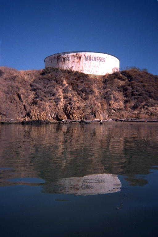
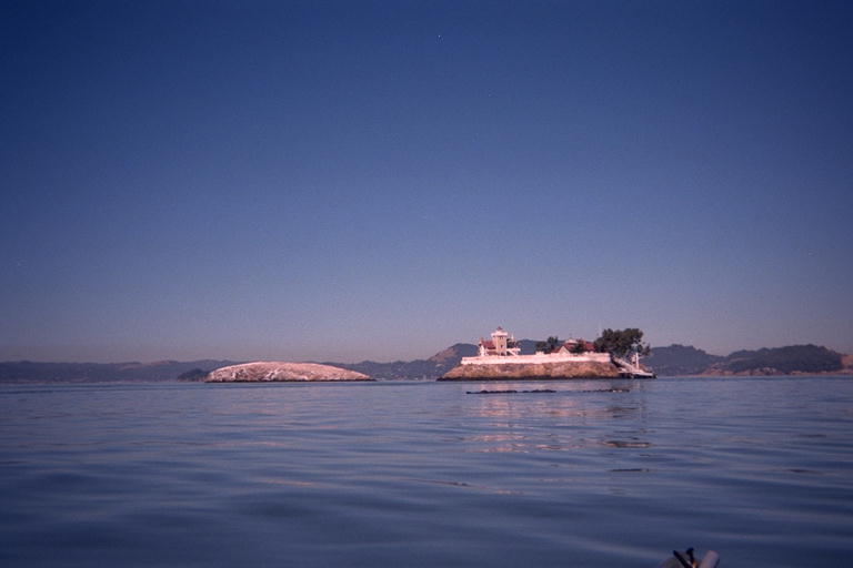
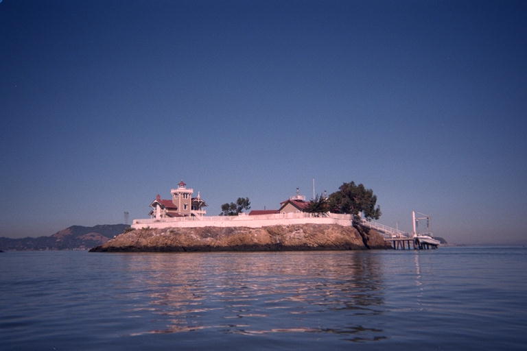
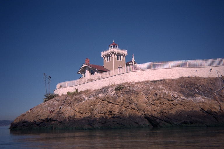
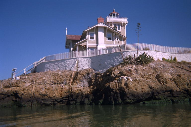
I put on the farmer john to my wetsuit, and got in my kayak. It was a bright sunny day, and I assumed my wetsuit was overkill, but better safe than sorry. I also had my life vest on, with lines around my neck for camera, hat, sunglasses, and watch. With all those, and the safety line from kayak to paddle, I definitely felt overdressed getting into placid water with virtually no waves. I headed northwest around Point Molate and under the pier holding up pipes that go to tankers almost a half a kilometer off shore. The water is too shallow closer than that. Despite all the piers and oil tanks, the shoreline did have it's attractive points. One tank on Point Orient said "Pacific Molasses", but I'm not sure if it really contained syrup, or if that is a pet name for black crude oil. Beyond this point, I could see the goal of my trip: two islands called "The Brothers". One of them has a clean white building, that I have wondered about when glimpsing it from the bridge. This turns out to be a beautiful old lighthouse, well maintained, with fancy detailing on the corners of the roof. There's a low white stone or concrete wall all the way around the island, with steep natural rock dropping almost vertically down from the fence to the water. No sand, no beaches. The only break in the wall is a raised dock on the west end, and a little stairway down to the water on the east end. As I went around the west side of this island, I saw a sign saying "East Brother Bed and Breakfast" with a phone number. What a fantastic place to spend an evening! But I'll bet it is a little pricey.
The water from Sam Pablo Bay squeezes out between Point San Pedro on Marin County, and Point San Pablo here, with The Brothers almost directly in the narrowest channel. The TideLog predicted a mild tide going out, but the water was moving so fast that these islands had wakes like boats! The water was only dropping 2 feet today, but tides as high as 6 feet are common. The current must be spectacular on a day when there is a real tide! I had no problem paddling into it, and went around the north side of East Brother, let the tide pull me back between them, and stopped in the backwater behind the Lighthouse to change cameras and get out a snack. While I was strapping my drysack back on the kayak, there was this INCREDIBLE NOISE! I almost jumped out of my wetsuit, and then realized that the lighthouse had a foghorn. At first, I could not tell where the sound was coming from. It seemed as if it was coming out of the rocky side of the island itself, and I could feel it coming up out of the water as well. I expected the water to rise up in little ripples and spit droplets in the air. Like a traditional fog horn sound, it started with one note, then dropped to a lower one. When the noise stopped and my wits came back, I paddled a little farther around the island until I could see the foghorn. It was pointing straight up, mounted on a little shed, with several people standing around to listen, a lot closer than I was. They set it off again while I watched. I wonder if guests get to pull the chain if they stay over here? Marty would hate it, I would have a great time!
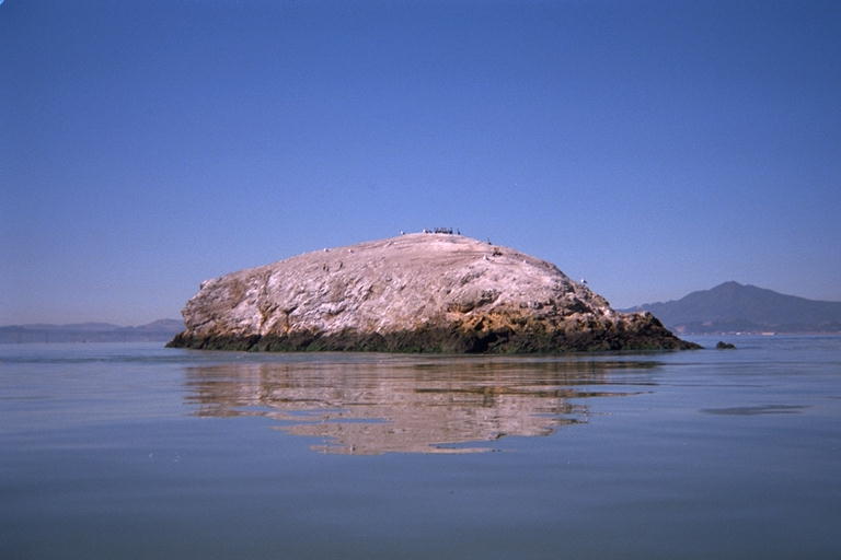
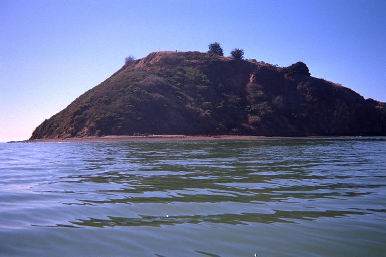
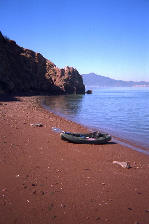
I went around the north side of West Brother, which is a smooth hard ball of rock only inhabited by cormorants. Across the narrow straight, I could see two smaller, but similar rocks sticking out of the water on the other side. They are called "The Sisters", and I'll see them from the other side one day. From here, I headed almost straight south back towards the bridge. There is a big island here, called "Red Rock". A friend of ours, John McDonald, recently pointed out to me that this island is legally a part of San Francisco, even though The nearest point of the San Francisco peninsula is 15 kilometers away, barely visible through the haze. If I landed there, I could claim that I had traveled across the bay to San Francisco and back. I debated not going there at all, because I was hot, it was getting late, and I didn't want to fight the tide to get back to my car. But a power boat went by and gave me a shove with it's wake, and I decided to go for it. It was only two more kilometers out of my way, and who knew when I would come by here again. Two more kilometers there, then 2 more back, would make this a 12 kilometer trip. I went under the Richmond Bridge and came straight south to the rock. It is made of a very red rock, and even the beaches are made of red sand. I went down the east side, and in-between the island and some smaller rocks on the south tip. As I did this, several large waves arrived out of nowhere and drenched me down my left side. That solved the problem of being too hot. I had debated dunking myself, and hadn't made up my mind before it was made up for me. All around the island, I looked for an easy access to climb up to the top, but did not see one. In places, it is nearly vertical, and in the sloping places the brush looks difficult to push through. I decided to come back one day with boots and better clothing to try to climb up there. But I did land on the red sand beach.
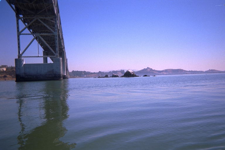
When I left, I could feel the tide, but if I paddled straight into it, I could make progress. I crabbed sideways along the bridge by pointing 45 degrees away from directly into the current. I wanted to visit the Castro Rocks, which you can just glimpse as you drive over the bridge. You usually see harbor seals sleeping on this rock, and I saw a few this day. So I gave them a wide berth, and went under the bridge and north of them. From there, all I could see on the rocks were cormorants, so I may have scared them all off, even from 300 meters away. As I headed north towards Castro Point and the beach, the paddling got a lot easier, so I must have found an eddy current. There was a lot more sand and gravel exposed on the beach when I landed, the tide had gone most of the way back out while I was exploring. John, who told me about Red Rock being in the San Francisco city limits, has a collection of samples of sand from around the world. After I landed, it occurred to me I should have collected a sample of the red beach sand for him. There's another reason for coming back soon.