Mike's Kayak Journal, all photos taken on 0-00-10
Click on the small image to see the full-sized one.
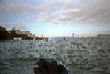
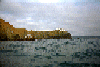
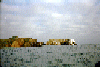
 The Golden Gate Bridge comes into view past the Boinita Lighthouse.
Links to related images: Nearby. Proofs. Map.
Approximate location: 37.8157501220703N / 122.531120300293W.
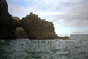
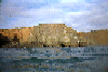
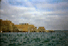
 Aproaching the Bonita Point Lighthouse.
Links to related images: Nearby. Proofs. Map.
Approximate location: 37.8215141296387N / 122.534812927246W.
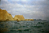
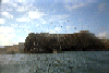
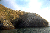
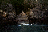
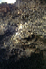
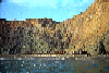
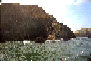
 Caves in the clifs south of Bird Rock.
Links to related images: Nearby. Proofs. Map.
Approximate location: 37.8230743408203N / 122.534896850586W.
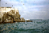
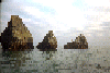
 Bird Rock near Rodeo Beach, viewed from the south.
Links to related images: Nearby. Proofs. Map.
Approximate location: 37.8236846923828N / 122.536781311035W.
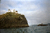
 Aproaching the Bonita Point Lighthouse.
Links to related images: Nearby. Proofs. Map.
Approximate location: 37.8236846923828N / 122.536781311035W.
 Approaching Bird Rock near Rodeo Beach.
Links to related images: Nearby. Proofs. Map.
Approximate location: 37.8297157287598N / 122.540130615234W.
 Rodeo Beach, south end.
Links to related images: Nearby. Proofs. Map.
Approximate location: 37.8266677856445N / 122.536865234375W.
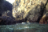
 A small cave throuh Bird rock.
Links to related images: Nearby. Proofs. Map.
Approximate location: 37.8244819641113N / 122.536865234375W.
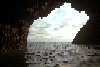
 Lighthouse through large Bird Rock Cave.
Links to related images: Nearby. Proofs. Map.
Approximate location: 37.8239898681641N / 122.537124633789W.
 Large cave in Bird Rock.
Links to related images: Nearby. Proofs. Map.
Approximate location: 37.824634552002N / 122.537254333496W.
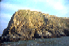 Tip of bird rock viewed from south.
Links to related images: Nearby. Proofs. Map.
Approximate location: 37.8233795166016N / 122.537216186523W.
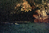
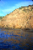 Reflections of cliff in water near Rodeo Beach.
Links to related images: Nearby. Proofs. Map.
Approximate location: 37.8250923156738N / 122.53532409668W.
 Rodeo beach viewed from behind Bird Rock.
Links to related images: Nearby. Proofs. Map.
Approximate location: 37.8237686157227N / 122.536331176758W.
 Small grotto behind Bird Rock.
Links to related images: Nearby. Proofs. Map.
Approximate location: 37.8238525390625N / 122.535949707031W.
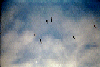 Pelicans flying overhead.
Links to related images: Nearby. Proofs. Map.
Approximate location: 37.8238525390625N / 122.535949707031W.
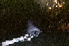
 A mist-breathing dragon: A blowhole in the cliff.
Links to related images: Nearby. Proofs. Map.
Approximate location: 37.8224296569824N / 122.534210205078W.
 Inside a dark cave near Rodeo Beach.
Links to related images: Nearby. Proofs. Map.
Approximate location: 37.8217849731445N / 122.533325195312W.
 Mouth of a large cave near Rodeo Beach with nesting cormerants.
Links to related images: Nearby. Proofs. Map.
Approximate location: 37.8217163085938N / 122.533668518066W.
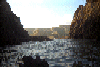
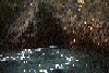
 Sunlight falling inside the large cave near Rodeo Beach.
Links to related images: Nearby. Proofs. Map.
Approximate location: 37.8194618225098N / 122.531700134277W.
 looking out the large cave near Rodeo Beach.
Links to related images: Nearby. Proofs. Map.
Approximate location: 37.8194618225098N / 122.531700134277W.
 Sunlight falling inside the large cave near Rodeo Beach.
Links to related images: Nearby. Proofs. Map.
Approximate location: 37.8194618225098N / 122.531700134277W.
 Reflected light inside the big cave near Rodeo Beach.
Links to related images: Nearby. Proofs. Map.
Approximate location: 37.8194618225098N / 122.531700134277W.
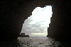
 Entrance to the big cave near Rodeo Beach.
Links to related images: Nearby. Proofs. Map.
Approximate location: 37.8193435668945N / 122.532188415527W.
 Pelicans on rocks near Bonita Point:
Links to related images: Nearby. Proofs. Map.
Approximate location: 37.8175315856934N / 122.531761169434W.
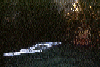
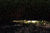
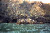
 Scrap iron is all that remains near Point Bonita of this wrecked ship.
Links to related images: Nearby. Proofs. Map.
Approximate location: 37.8204956054688N / 122.532173156738W.
 Pelicans on rocks near Bonita Point:
Links to related images: Nearby. Proofs. Map.
Approximate location: 37.818904876709N / 122.532188415527W.
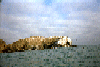
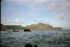
 Arches under the Bonita Lighthouse:
Links to related images: Nearby. Proofs. Map.
Approximate location: 37.8155975341797N / 122.529121398926W.

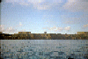
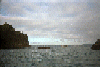
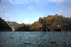
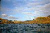
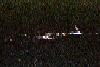
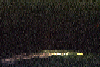
 Rounding Point Bonita to see inside The Bay.
Links to related images: Nearby. Proofs. Map.
Approximate location: 37.8166847229004N / 122.526397705078W.
All text and images Copyright © 1994 by Mike Higgins / contact