The following images were all taken near the same location, ~37.818904876709/122.532188415527:
Click on the small images to see the full-sized ones.
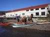
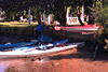
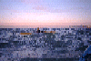
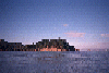
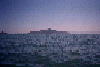
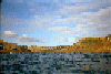
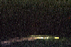
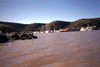
 Our tents drying in the morning at Paradise Park on Tiburon
Taken on 2011-10-18 .
Links to related images: Date. Proofs. Map.
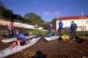
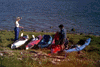
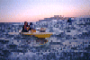
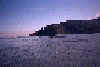
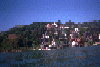
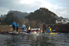
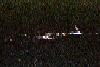
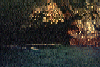
 Dinner at Paradise Park on Tiburon
Taken on 2011-10-17 .
Links to related images: Date. Proofs. Map.
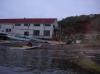
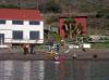
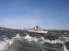
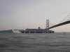
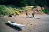
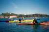
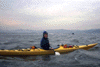
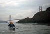
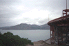
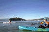
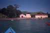
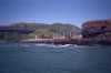
 I was the only one to launch from Horseshoe Cove
Taken on 2011-10-16 .
Links to related images: Date. Proofs. Map.
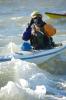
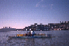
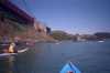
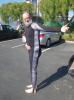 The intrepid kayaker showing off his new custom dive skin
Taken on 2011-09-29 .
Links to related images: Date. Proofs. Map.
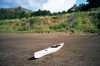
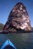
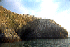
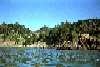
 Island 15, Angel Island
Taken on 2011-03-19 .
Links to related images: Date. Proofs. Map. Story.

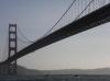
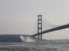
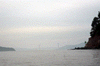
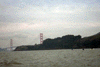
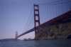
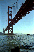
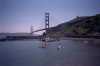
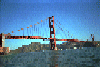
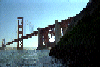
 Heading back through the Golden Gate
Taken on 2009-09-7 .
Links to related images: Date. Proofs. Map.
 My ride drops me off and heads back to harbor inside the San Francisco Bay
Taken on 2009-09-7 .
Links to related images: Date. Proofs. Map.
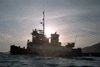
 The intrepid captain, Ken Kelton, at the helm of the Cando.
Taken on 2009-09-6 .
Links to related images: Date. Proofs. Map. Story.
 I borded the yacht at Horseshoe Cove
Taken on 2009-09-6 .
Links to related images: Date. Proofs. Map. Story.


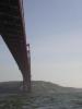
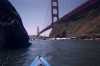
 Sailing under the Golden Gate Bridge and into the fog
Taken on 2009-09-6 .
Links to related images: Date. Proofs. Map. Story.
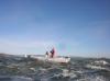
 Passing Point Bonita
Taken on 2009-09-6 .
Links to related images: Date. Proofs. Map. Story.
 Thurseve Paddlers landed at Kirby Cove
Taken on 2008-10-16 .
Links to related images: Date. Proofs. Map. Story.

 Thurseve Paddlers Partying at Kirby Cove
Taken on 2008-10-16 .
Links to related images: Date. Proofs. Map. Story.


 John Boeschen apparently partied too much at Kirby Cove
Taken on 2008-10-16 .
Links to related images: Date. Proofs. Map. Story.
 Please point out the real Mike Higgins
Taken on 2008-08-27 .
Links to related images: Date. Proofs. Map. Story.


 Six Mike Higgins impersonators, but There Can Be Only One
Taken on 2008-08-27 .
Links to related images: Date. Proofs. Map. Story.


 Fred Cooper emcees the Who is the Real Mike Higgins Show
Taken on 2008-08-27 .
Links to related images: Date. Proofs. Map. Story.
 Mike Higgins number six has a calculator that does not do RPN, he is an imposter!
Taken on 2008-08-27 .
Links to related images: Date. Proofs. Map. Story.
 But Mike Higgins number five has three RPN calculators!
Taken on 2008-08-27 .
Links to related images: Date. Proofs. Map. Story.
 Gordon Schanck is Mike Higgins number one.
Taken on 2008-08-27 .
Links to related images: Date. Proofs. Map. Story.
 And then there were only five Mike Higgins impersonators.
Taken on 2008-08-27 .
Links to related images: Date. Proofs. Map. Story.

 Gordon Schanck is Mike Higgins number one.
Taken on 2008-08-27 .
Links to related images: Date. Proofs. Map. Story.


 Marjorie Little is Mike Higgins number two.
Taken on 2008-08-27 .
Links to related images: Date. Proofs. Map. Story.
 Dave Littlejohn John Somers and Jesse Meyer are Mike Higgins number three four and five.
Taken on 2008-08-27 .
Links to related images: Date. Proofs. Map. Story.
 John Sumers, Jesse Meyer and Don Barch are Mike Higgins number four, five and six.
Taken on 2008-08-27 .
Links to related images: Date. Proofs. Map. Story.
 Jesse Meyer and Don Barch are Mike Higgins number five and six.
Taken on 2008-08-27 .
Links to related images: Date. Proofs. Map. Story.


 John Sumers, Jesse Meyer and Don Barch are Mike Higgins number four, five and six.
Taken on 2008-08-27 .
Links to related images: Date. Proofs. Map. Story.


 Jesse Meyer and Don Barch are Mike Higgins number five and six.
Taken on 2008-08-27 .
Links to related images: Date. Proofs. Map. Story.

 Marjorie Little and Dave Littlejohn are Mike Higgins number one and two.
Taken on 2008-08-27 .
Links to related images: Date. Proofs. Map. Story.
 Dave Littlejohn, Mike Higgins impersonator, answers a question.
Taken on 2008-08-27 .
Links to related images: Date. Proofs. Map. Story.

 The real Mike Higgins can count in binary on his fingers, Don Barch cannot.
Taken on 2008-08-27 .
Links to related images: Date. Proofs. Map. Story.

 The Intrepid Kayaker is crowned THE CZAR of the LEFT COAST
Taken on 2008-08-27 .
Links to related images: Date. Proofs. Map. Story.

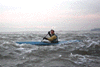
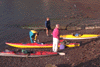
 The last swimmers make it to the beach
Taken on 2008-06-8 .
Links to related images: Date. Proofs. Map. Story.
 Dennis Holton getting ready to launch at Horseshoe Cove
Taken on 2008-03-9 .
Links to related images: Date. Proofs. Map. Story.
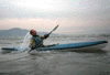
 Paula Hubbard launching from Horseshoe Cove
Taken on 2008-03-9 .
Links to related images: Date. Proofs. Map. Story.
 Richard Pieper cooling off at the end of the Brooks Island Breakwater
Taken on 2008-03-9 .
Links to related images: Date. Proofs. Map. Story.


 Dave Brown launching his Greenland kayak at Horseshoe Cove
Taken on 2008-03-8 .
Links to related images: Date. Proofs. Map. Story.

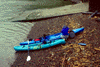
 Nessie the Sea Monster: logs in Horseshoe Cove
Taken on 2008-03-8 .
Links to related images: Date. Proofs. Map. Story.

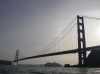
 Golden Gate Bridge in the morning
Taken on 2008-03-4 .
Links to related images: Date. Proofs. Map.
 Launching at Oh-Dark-Hundred Hours for the Mini Gonzo
Taken on 2008-02-18 .
Links to related images: Date. Proofs. Map. Story.
 The Intrepid Kayaker disorganizing tables at China Camp State Park
Taken on 2008-02-18 .
Links to related images: Date. Proofs. Map. Story.
 The Intrepid Kayaker with Fred Cooper, Gordon Schanck and Dennis Holton
Taken on 2008-02-18 .
Links to related images: Date. Proofs. Map. Story.
 Don Fleming and Rich going under the Golden Gate Bridge
Taken on 2008-02-16 .
Links to related images: Date. Proofs. Map. Story.
 Proof that I went under the Golden Gate Bridge
Taken on 2008-02-16 .
Links to related images: Date. Proofs. Map. Story.

 Fred Cooper rounding Lime Point and passing the North Tower
Taken on 2008-02-16 .
Links to related images: Date. Proofs. Map. Story.

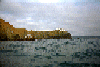
 Ten Coasters at the Coaster Only Paddle
Taken on 2007-12-22 .
Links to related images: Date. Proofs. Map.
 Elizabeth and Norm christening new and old Coasters with champange
Taken on 2007-12-22 .
Links to related images: Date. Proofs. Map.
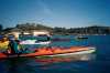
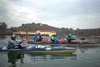
 BASKers launching at the Precidio Yacht Club
Taken on 2007-12-9 .
Links to related images: Date. Proofs. Map. Story.
 Kate DesLauriers with her Brand New Coaster
Taken on 2007-12-9 .
Links to related images: Date. Proofs. Map. Story.
 Peter Lyons taking my picture in Yellow Bluff
Taken on 2007-12-9 .
Links to related images: Date. Proofs. Map. Story.
 The inrepid kayaker taking pictures in Yellow Bluff
Taken on 2007-12-9 .
Links to related images: Date. Proofs. Map. Story.
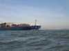
 Container ship passing behind me crossing the San Francisco Bay
Taken on 2007-02-4 .
Links to related images: Date. Proofs. Map. Story.

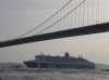
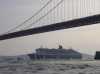 The Queen Mary 2 passes under the Golden Gate Bridge
Taken on 2007-02-4 .
Links to related images: Date. Proofs. Map. Story.
 The fire ship precedes the Queen Mary 2 passes under the Golden Gate Bridge
Taken on 2007-02-4 .
Links to related images: Date. Proofs. Map. Story.

 The Queen Mary 2 passes under the Golden Gate Bridge
Taken on 2007-02-4 .
Links to related images: Date. Proofs. Map. Story.
 A Coast Guard Helicoptor approaches the Golden Gate Bridge
Taken on 2007-02-4 .
Links to related images: Date. Proofs. Map. Story.

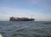
 A cargo ship exits under the Golden Gate Bridge
Taken on 2007-02-4 .
Links to related images: Date. Proofs. Map. Story.
 Kate DesLauriers safely accross to Belvedere in the fog
Taken on 2006-12-31 .
Links to related images: Date. Proofs. Map.
 Don Fleming safely accross to Belvedere in the fog
Taken on 2006-12-31 .
Links to related images: Date. Proofs. Map.
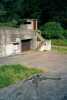
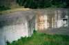 The bunker at Kirby Cove
Taken on 2002-04-27 .
Links to related images: Date. Proofs. Map. Story.
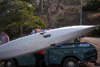
 Bo Barnes and my kayak ready to launch at Kirby Cove
Taken on 2002-04-27 .
Links to related images: Date. Proofs. Map. Story.
 Maryly Snow paddling from Horseshoe Cove
Taken on 2000-12-30 .
Links to related images: Date. Proofs. Map.
 Maryly packing for burrial at sea
Taken on 1999-04-17 .
Links to related images: Date. Proofs. Map. Story.
 The urn the ashes came in
Taken on 1999-04-17 .
Links to related images: Date. Proofs. Map. Story.
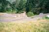
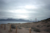
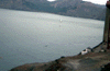
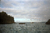
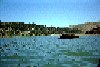
 Horseshoe Bay is a popular place to start and end kayak trips.
Taken on 1999-01-31 .
Links to related images: Date. Proofs. Map. Story.
 Launching kayaks in Sausalito.
Taken on 1998-06-13 .
Links to related images: Date. Proofs. Map. Story.
 Maryly Snow crossing Richardson Bay.
Taken on 1998-06-13 .
Links to related images: Date. Proofs. Map. Story.
 Landing behind a restaurant in Mill Valley.
Taken on 1998-06-13 .
Links to related images: Date. Proofs. Map. Story.
 Loading up kayaks in Marin, loading up on food in San Diego, trying to remember
Taken on 1998-04-4 .
Links to related images: Date. Proofs. Map.
 Approaching Yellow Bluff from Raccoon Strait.
Taken on 1997-12-12 .
Links to related images: Date. Proofs. Map. Story.
 Just south of Sausalito is Yellow Bluff, which has famous tidal rip
currents tha
Just south of Sausalito is Yellow Bluff, which has famous tidal rip
currents tha
Taken on 1997-12-12 .
Links to related images: Date. Proofs. Map. Story.

 Roger Lamb demonstrates his roll.
Taken on 1997-12-12 .
Links to related images: Date. Proofs. Map. Story.
 Approaching Yellow Bluff from Raccoon Strait.
Taken on 1997-12-12 .
Links to related images: Date. Proofs. Map. Story.
 fuzzy view south
Taken on 1997-10-1 .
Links to related images: Date. Proofs. Map. Story.
 Ocean Beach
Taken on 1997-10-1 .
Links to related images: Date. Proofs. Map. Story.
 fireboat u/bridge
Taken on 1997-10-1 .
Links to related images: Date. Proofs. Map. Story.
 Fireboat
Taken on 1997-10-1 .
Links to related images: Date. Proofs. Map. Story.
 SF Bridge
Taken on 1997-10-1 .
Links to related images: Date. Proofs. Map. Story.
 Me out bridge
Taken on 1997-10-1 .
Links to related images: Date. Proofs. Map. Story.
 Me ouside GGBr
Taken on 1997-10-1 .
Links to related images: Date. Proofs. Map. Story.
 Base of Bridge
Taken on 1997-10-1 .
Links to related images: Date. Proofs. Map. Story.
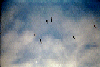
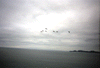 Pelikins over bay
Taken on 1997-10-1 .
Links to related images: Date. Proofs. Map. Story.
 Fireboat u/Bridge
Taken on 1997-10-1 .
Links to related images: Date. Proofs. Map. Story.
 Fireboat at Bridge
Taken on 1997-10-1 .
Links to related images: Date. Proofs. Map. Story.
 Fireboat
Taken on 1997-10-1 .
Links to related images: Date. Proofs. Map. Story.
 Fireboat b/trees
Taken on 1997-10-1 .
Links to related images: Date. Proofs. Map. Story.
 City b/Bridge
Taken on 1997-10-1 .
Links to related images: Date. Proofs. Map. Story.
 out horseshoe cove
Taken on 1997-10-1 .
Links to related images: Date. Proofs. Map. Story.

 packing for trip
Taken on 1997-10-1 .
Links to related images: Date. Proofs. Map. Story.
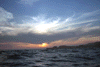 Sun setting over Point Bonita from China Beach.
Taken on 1997-05-21 .
Links to related images: Date. Proofs. Map. Story.
 Jamie and Peter at China Beach with Point Bonita sunset behind them.
Taken on 1997-05-21 .
Links to related images: Date. Proofs. Map. Story.
 Tug boat passing China Beach near sunset
Taken on 1997-05-21 .
Links to related images: Date. Proofs. Map. Story.
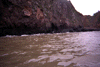
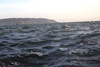 Choppy water off China Beach, Lands end visible.
Taken on 1997-05-21 .
Links to related images: Date. Proofs. Map. Story.
 China Beach, San Francisco.
Taken on 1997-05-21 .
Links to related images: Date. Proofs. Map. Story.
 John Reed's ductape patch job on his kayak
Taken on 1997-05-11 .
Links to related images: Date. Proofs. Map. Story.
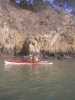
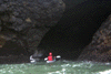 john in cave
Taken on 1997-05-11 .
Links to related images: Date. Proofs. Map. Story.
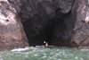
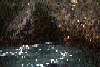
 another cave
Taken on 1997-05-11 .
Links to related images: Date. Proofs. Map. Story.
 jamie in a cave
Taken on 1997-05-11 .
Links to related images: Date. Proofs. Map. Story.
 fuzzy picture
Taken on 1997-05-11 .
Links to related images: Date. Proofs. Map. Story.
 Just south of Sausalito is Yellow Bluff, which has famous tidal rip
currents tha
Just south of Sausalito is Yellow Bluff, which has famous tidal rip
currents tha
Taken on 1997-02-7 .
Links to related images: Date. Proofs. Map. Story.
 Pictures from the 1997/1998 Angel Island New Years Eve Campout.
Taken on 1997-01-1 .
Links to related images: Date. Proofs. Map.
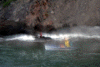
 Joan in the Yellow Bluff tidal rip
Taken on 1996-11-24 .
Links to related images: Date. Proofs. Map. Story.

 Late in the day at Yellow Bluff
Taken on 1996-11-24 .
Links to related images: Date. Proofs. Map. Story.
 Pictures from several tidal rip paddles to Yellow Bluff.
Taken on 1996-11-24 .
Links to related images: Date. Proofs. Map. Story.
 Pictures from several tidal rip paddles to Yellow Bluff.
Taken on 1996-11-24 .
Links to related images: Date. Proofs. Map. Story.

 Pictures from several tidal rip paddles to Yellow Bluff.
Taken on 1996-11-24 .
Links to related images: Date. Proofs. Map. Story.
 BASKers landing in Horseshoe Cove
Taken on 1996-04-27 .
Links to related images: Date. Proofs. Map. Story.
 BASKers paddling below the end of the Golden Gate Bridge
Taken on 1996-04-27 .
Links to related images: Date. Proofs. Map. Story.
 Turbulent water at the North Tower of the Golden Gate Bridge
Taken on 1996-04-27 .
Links to related images: Date. Proofs. Map. Story.
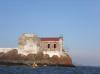
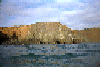
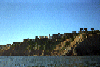
 The old building on Lime Point
Taken on 1996-04-27 .
Links to related images: Date. Proofs. Map. Story.
 Lime point and the North Tower of the Golden Gate Bridge
Taken on 1996-04-27 .
Links to related images: Date. Proofs. Map. Story.

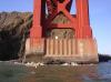
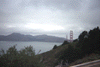
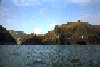
 The Golden Gate Bridge viewed from the north
Taken on 1996-04-27 .
Links to related images: Date. Proofs. Map. Story.
 Needles Rock near the Golden Gate Bridge
Taken on 1996-04-27 .
Links to related images: Date. Proofs. Map. Story.
 Golden Gate Bridge on-ramp behind Needles Rock
Taken on 1996-04-27 .
Links to related images: Date. Proofs. Map. Story.
 Needles Rock, BASKers and the Golden Gate Bridge
Taken on 1996-04-27 .
Links to related images: Date. Proofs. Map. Story.
 Marin side of the Golden Gate Bridge
Taken on 1996-04-27 .
Links to related images: Date. Proofs. Map. Story.
 "Brown Beach" next to the sewage treatment plant
Taken on 1996-04-27 .
Links to related images: Date. Proofs. Map. Story.
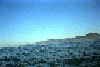
 Angel Island from the Sausalito area
Taken on 1996-04-27 .
Links to related images: Date. Proofs. Map. Story.
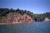
 Houses at the shoreline in Saucalito
Taken on 1996-04-27 .
Links to related images: Date. Proofs. Map. Story.
 Breakwater shoreline of Saucalito
Taken on 1996-04-27 .
Links to related images: Date. Proofs. Map. Story.
 Houses at the shoreline in Saucalito
Taken on 1996-04-27 .
Links to related images: Date. Proofs. Map. Story.
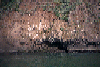
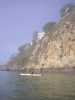
 Cormerants on the cliff south of Saucalito
Taken on 1996-04-27 .
Links to related images: Date. Proofs. Map. Story.
 Suiting up at Horseshoe cove
Taken on 1996-01-1 .
Links to related images: Date. Proofs. Map.
 Crossing horseshoe cove
Taken on 1996-01-1 .
Links to related images: Date. Proofs. Map.
 The view back under the bridge from inside the bay:
Taken on 1995-07-15 .
Links to related images: Date. Proofs. Map. Story.
 A series of pictures as I paddled towards the Golden Gate Bridge:
Taken on 1995-07-15 .
Links to related images: Date. Proofs. Map. Story.
 Fort Miley Vetrans Hospital, and very expensive houses looking over
the Golden
Fort Miley Vetrans Hospital, and very expensive houses looking over
the Golden
Taken on 1995-07-15 .
Links to related images: Date. Proofs. Map. Story.
 Fort Mason
Taken on 1995-07-15 .
Links to related images: Date. Proofs. Map. Story.
 Aquatic park beach, with kayak
Taken on 1995-07-15 .
Links to related images: Date. Proofs. Map. Story.
 Tall ships in Hide Street pier
Taken on 1995-07-15 .
Links to related images: Date. Proofs. Map. Story.
 View of Alcatraz Island
Taken on 1995-07-15 .
Links to related images: Date. Proofs. Map. Story.
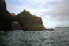
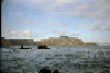
 The Golden Gate Bridge comes into view past the Boinita Lighthouse.
Taken on ~1994 .
Links to related images: Date. Proofs. Map.
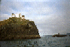
 Aproaching the Bonita Point Lighthouse.
Taken on ~1994 .
Links to related images: Date. Proofs. Map.
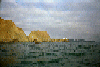
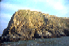
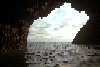
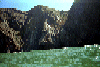
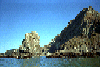
 Caves in the clifs south of Bird Rock.
Taken on ~1994 .
Links to related images: Date. Proofs. Map.
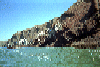
 Bird Rock near Rodeo Beach, viewed from the south.
Taken on ~1994 .
Links to related images: Date. Proofs. Map.
 Aproaching the Bonita Point Lighthouse.
Taken on ~1994 .
Links to related images: Date. Proofs. Map.
 Approaching Bird Rock near Rodeo Beach.
Taken on ~1994 .
Links to related images: Date. Proofs. Map.
 Rodeo Beach, south end.
Taken on ~1994 .
Links to related images: Date. Proofs. Map.
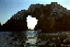
 A small cave throuh Bird rock.
Taken on ~1994 .
Links to related images: Date. Proofs. Map.
 Lighthouse through large Bird Rock Cave.
Taken on ~1994 .
Links to related images: Date. Proofs. Map.
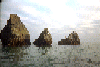
 Large cave in Bird Rock.
Taken on ~1994 .
Links to related images: Date. Proofs. Map.
 Tip of bird rock viewed from south.
Taken on ~1994 .
Links to related images: Date. Proofs. Map.
 Reflections of cliff in water near Rodeo Beach.
Taken on ~1994 .
Links to related images: Date. Proofs. Map.
 Rodeo beach viewed from behind Bird Rock.
Taken on ~1994 .
Links to related images: Date. Proofs. Map.
 Small grotto behind Bird Rock.
Taken on ~1994 .
Links to related images: Date. Proofs. Map.
 Pelicans flying overhead.
Taken on ~1994 .
Links to related images: Date. Proofs. Map.
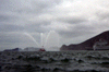
 A mist-breathing dragon: A blowhole in the cliff.
Taken on ~1994 .
Links to related images: Date. Proofs. Map.
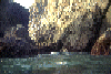
 Inside a dark cave near Rodeo Beach.
Taken on ~1994 .
Links to related images: Date. Proofs. Map.
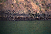
 Mouth of a large cave near Rodeo Beach with nesting cormerants.
Taken on ~1994 .
Links to related images: Date. Proofs. Map.
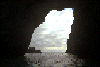
 Sunlight falling inside the large cave near Rodeo Beach.
Taken on ~1994 .
Links to related images: Date. Proofs. Map.
 looking out the large cave near Rodeo Beach.
Taken on ~1994 .
Links to related images: Date. Proofs. Map.
 Sunlight falling inside the large cave near Rodeo Beach.
Taken on ~1994 .
Links to related images: Date. Proofs. Map.
 Reflected light inside the big cave near Rodeo Beach.
Taken on ~1994 .
Links to related images: Date. Proofs. Map.
 Entrance to the big cave near Rodeo Beach.
Taken on ~1994 .
Links to related images: Date. Proofs. Map.
 Pelicans on rocks near Bonita Point:
Taken on ~1994 .
Links to related images: Date. Proofs. Map.
 Scrap iron is all that remains near Point Bonita of this wrecked ship.
Taken on ~1994 .
Links to related images: Date. Proofs. Map.
 Pelicans on rocks near Bonita Point:
Taken on ~1994 .
Links to related images: Date. Proofs. Map.
 Arches under the Bonita Lighthouse:
Taken on ~1994 .
Links to related images: Date. Proofs. Map.

 Rounding Point Bonita to see inside The Bay.
Taken on ~1994 .
Links to related images: Date. Proofs. Map.
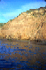
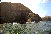
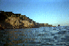
 Rocky shoreline north of Rodeo Beach
Taken on ~1994 .
Links to related images: Date. Proofs. Map. Story.
 Tennessee Cove
Taken on ~1994 .
Links to related images: Date. Proofs. Map. Story.
 Looking ahead past Rodeo Beach
Taken on ~1994 .
Links to related images: Date. Proofs. Map. Story.
 White rocks south of Muir Beach
Taken on ~1994 .
Links to related images: Date. Proofs. Map. Story.
 Could this be Pirates Cove?
Taken on ~1994 .
Links to related images: Date. Proofs. Map. Story.
 Nearshore rock south of Muir Beach
Taken on ~1994 .
Links to related images: Date. Proofs. Map. Story.
 Looking back at Muir Beach
Taken on ~1994 .
Links to related images: Date. Proofs. Map. Story.
 Houses on the hill north of Muir Beach
Taken on ~1994 .
Links to related images: Date. Proofs. Map. Story.
 BASKers in Horseshoe Cove with the Golden Gate Bridge behind
Taken on ~1994 .
Links to related images: Date. Proofs. Map. Story.
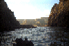
 Turbulent water around Point Cavallo near Yellow Bluff
Taken on ~1994 .
Links to related images: Date. Proofs. Map.
 The Golden Gate Bridge sticking up above Yellow Bluff
Taken on ~1994 .
Links to related images: Date. Proofs. Map.
 Golden Gate Bridge poking out past Point Cavallo near Yellow Bluff
Taken on ~1994 .
Links to related images: Date. Proofs. Map.
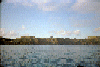
 Some views of the city, and Fort Mason, the goal of the trip:
Taken on ~1994 .
Links to related images: Date. Proofs. Map.
 Aquatic park, the Hide Street Pier, and a view of Alcatraz Island: the
goal of
Aquatic park, the Hide Street Pier, and a view of Alcatraz Island: the
goal of
Taken on ~1994 .
Links to related images: Date. Proofs. Map.
 Some views of the city, and Fort Mason, the goal of the trip:
Taken on ~1994 .
Links to related images: Date. Proofs. Map.
 The view back under the bridge from inside the bay:
Taken on ~1994 .
Links to related images: Date. Proofs. Map.
 A series of pictures as I paddled towards the Golden Gate Bridge:
Taken on ~1994 .
Links to related images: Date. Proofs. Map.
 The view back under the bridge from inside the bay:
Taken on ~1994 .
Links to related images: Date. Proofs. Map.
 Fort Miley Vetrans Hospital, and very expensive houses looking over
the Golden
Fort Miley Vetrans Hospital, and very expensive houses looking over
the Golden
Taken on ~1994 .
Links to related images: Date. Proofs. Map.
 Horseshoe Bay is a popular place to start and end kayak trips.
Taken on ~1994 .
Links to related images: Date. Proofs. Map.
 I went on a trip initiated by Jamie Morgan to try (unsucessfully) to
catch an e
I went on a trip initiated by Jamie Morgan to try (unsucessfully) to
catch an e
Taken on ~1994 .
Links to related images: Date. Proofs. Map.
All text and images Copyright © by Mike Higgins / contact