Mendocino Russian Gulch Camping Trip September 27th 1996.
Click on the small image to see the full-sized one.
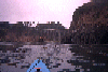
 This is the view south into the first opening. Nobody was foolhardy enough to
Links to related images: Nearby. Proofs. Map.
Approximate location: 39.2652702331543N / 123.788642883301W.
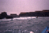
 A steel trestle bridge under Highway One on the Mendocino coast
Links to related images: Nearby. Proofs. Map.
Approximate location: 39.2155303955078N / 123.773986816406W.
 BASKers going through the Mendocino Headlands
Links to related images: Nearby. Proofs. Map.
Approximate location: 39.3120536804199N / 123.811668395996W.
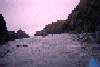
 Rugged Mendocino coasline
Links to related images: Nearby. Proofs. Map.
Approximate location: 39.3114891052246N / 123.811157226562W.
 BASKers entering the Mendocino Headlands
Links to related images: Nearby. Proofs. Map.
Approximate location: 39.3140144348145N / 123.809226989746W.
 BASKers paddling around the Mendocino Headlands
Links to related images: Nearby. Proofs. Map.
Approximate location: 39.3141136169434N / 123.810508728027W.
All text and images Copyright © 1996 by Mike Higgins / contact