The following images were all taken near the same location, ~39.2155303955078/123.773986816406:
Click on the small images to see the full-sized ones.
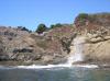
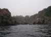
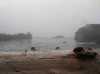
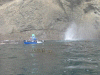
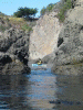
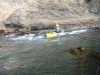
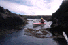
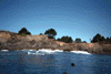
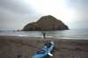
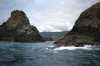
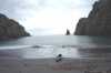
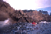
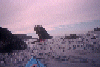
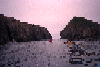
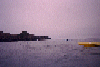
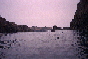
 The waves at Smugglers Cove were still good the next day
Taken on 2009-09-27 .
Links to related images: Date. Proofs. Map.

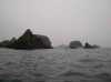
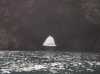
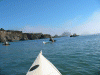
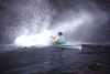
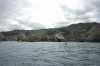
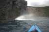
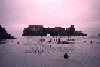
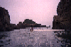
 Bill Vonnegut riding a glassy wave at Smugglers Cove
Taken on 2009-09-26 .
Links to related images: Date. Proofs. Map. Story.
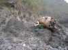
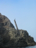
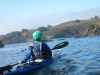
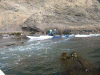
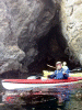
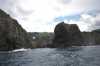
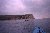
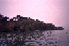
 My kayak parked 25 feet above the water while I dove for abalone
Taken on 2009-09-25 .
Links to related images: Date. Proofs. Map. Story.
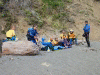
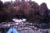
 Wolfgang Brinck and John Petersen at TAKS registration
Taken on 2008-10-3 .
Links to related images: Date. Proofs. Map. Story.
 Kate DesLauriers and Rich Luibrand at TAKS registration
Taken on 2008-10-3 .
Links to related images: Date. Proofs. Map. Story.

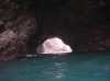
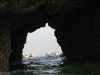
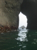
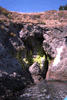
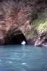
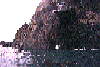
 Linda Brown goes through a low arch
Taken on 2008-09-14 .
Links to related images: Date. Proofs. Map. Story.
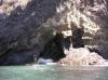
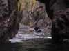
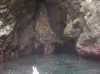
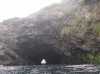
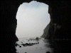
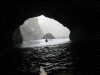
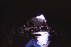
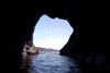
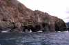
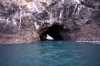
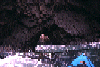
 BASKers in a large cave
Taken on 2008-09-14 .
Links to related images: Date. Proofs. Map. Story.
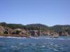
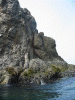
 Joe Petolino south of Van Damme Beach
Taken on 2008-09-14 .
Links to related images: Date. Proofs. Map. Story.
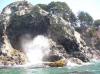
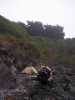
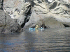
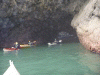
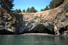
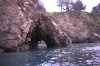
 Abalone divers inside the Cemetary Cave
Taken on 2008-09-14 .
Links to related images: Date. Proofs. Map. Story.
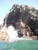
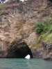
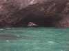
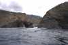
 South exit of the Cemetary Cave
Taken on 2008-09-14 .
Links to related images: Date. Proofs. Map. Story.
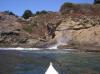
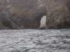
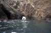
 Joe Petolino exiting a cave
Taken on 2008-09-14 .
Links to related images: Date. Proofs. Map. Story.
 Mary Ann Furda and Don Barch at the entrance of a cave
Taken on 2008-09-14 .
Links to related images: Date. Proofs. Map. Story.
 The side entrance to Mikes Cave of Doom
Taken on 2008-09-14 .
Links to related images: Date. Proofs. Map. Story.
 Linda Brown enters Mikes Cave of Doom
Taken on 2008-09-14 .
Links to related images: Date. Proofs. Map. Story.

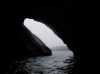
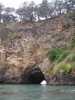
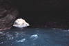
 Inside the Waterfall Cave
Taken on 2008-09-14 .
Links to related images: Date. Proofs. Map. Story.
 Jonathan Purcell exits from the crack leading to the Waterfall Cave
Taken on 2008-09-14 .
Links to related images: Date. Proofs. Map. Story.

 Mary Ann Furda goes over a washover
Taken on 2008-09-14 .
Links to related images: Date. Proofs. Map. Story.
 BASKers stopping for a lunch break
Taken on 2008-09-14 .
Links to related images: Date. Proofs. Map. Story.


 More BASKers in caves
Taken on 2008-09-14 .
Links to related images: Date. Proofs. Map. Story.
 Don Barch and Joe Petolino outside our last cave of the day
Taken on 2008-09-14 .
Links to related images: Date. Proofs. Map. Story.
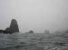
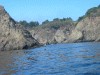
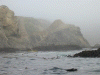
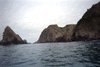
 A blowhole north of Greenwood Cove
Taken on 2007-09-16 .
Links to related images: Date. Proofs. Map.
 BASKers approaching Cuffeys Cove
Taken on 2007-09-16 .
Links to related images: Date. Proofs. Map.
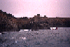
 Buckhorn Cove at minus tide in the morning
Taken on 2006-06-25 .
Links to related images: Date. Proofs. Map.
 Leaving Buckhorn Cove in the morning
Taken on 2006-06-25 .
Links to related images: Date. Proofs. Map.
 Inside the Cemetary Cave
Taken on 2006-06-25 .
Links to related images: Date. Proofs. Map.
 Ralph and Renee Higgins entering Cemetary Cave
Taken on 2006-06-25 .
Links to related images: Date. Proofs. Map.

 Ralph Higgins and a kayak tour group inside Mikes Cave of Doom
Taken on 2006-06-25 .
Links to related images: Date. Proofs. Map.
 Looking back through cave from cove
Taken on 2006-06-24 .
Links to related images: Date. Proofs. Map. Story.
 Colapsed stairs into small cove
Taken on 2006-06-24 .
Links to related images: Date. Proofs. Map. Story.
 Rock garden at Cuffey Point
Taken on 2006-06-24 .
Links to related images: Date. Proofs. Map. Story.
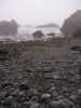
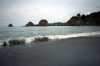
 The camping beach at Cuffey Cove
Taken on 2006-06-24 .
Links to related images: Date. Proofs. Map. Story.
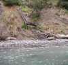
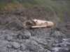
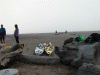
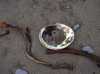 Abalone shells on Cuffey Cove Beach
Taken on 2006-06-24 .
Links to related images: Date. Proofs. Map. Story.
 Out the back of the big cave through Cuffey Point
Taken on 2006-06-24 .
Links to related images: Date. Proofs. Map. Story.
 Cave through a rock north of Cuffey Point
Taken on 2006-06-24 .
Links to related images: Date. Proofs. Map. Story.
 Small rocky cave north of Cuffey Point
Taken on 2006-06-24 .
Links to related images: Date. Proofs. Map. Story.
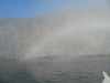
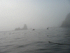
 Foggy rock garden north of Cuffey Point
Taken on 2006-06-24 .
Links to related images: Date. Proofs. Map. Story.
 Cave to a driftwood beach north of Cuffey Point
Taken on 2006-06-24 .
Links to related images: Date. Proofs. Map. Story.

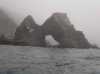
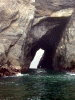
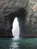
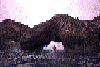
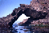
 Huge arch north of Cuffey Point
Taken on 2006-06-24 .
Links to related images: Date. Proofs. Map. Story.
 Rock garden south of the Navaro River
Taken on 2006-06-24 .
Links to related images: Date. Proofs. Map. Story.

 Arch of the Navaro
Taken on 2006-06-24 .
Links to related images: Date. Proofs. Map. Story.
 Ninja campsite on Salmon Point
Taken on 2006-06-24 .
Links to related images: Date. Proofs. Map. Story.
 Small cave through Salmon Point
Taken on 2006-06-24 .
Links to related images: Date. Proofs. Map. Story.
 North side of Salmon Point
Taken on 2006-06-24 .
Links to related images: Date. Proofs. Map. Story.
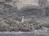 Great Blue Heron in Albion Cove
Taken on 2006-06-24 .
Links to related images: Date. Proofs. Map. Story.
 Fog horn in Albion Cove
Taken on 2006-06-24 .
Links to related images: Date. Proofs. Map. Story.

 Ninja campsite in Albion Cove
Taken on 2006-06-24 .
Links to related images: Date. Proofs. Map. Story.
 Arch north of Albion
Taken on 2006-06-24 .
Links to related images: Date. Proofs. Map. Story.
 The long cave under Heritage House
Taken on 2006-06-24 .
Links to related images: Date. Proofs. Map. Story.
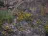 Flowers above the cave entrance under Heritage House
Taken on 2006-06-24 .
Links to related images: Date. Proofs. Map. Story.
 Perfect ninja camp location in Buckhorn Cove
Taken on 2006-06-24 .
Links to related images: Date. Proofs. Map. Story.
 One of the arches in Gunderson Rock.
Taken on 2002-09-22 .
Links to related images: Date. Proofs. Map. Story.
 Joe Petolino in front of the filigree arches in Greenwood Cove.
Taken on 2002-09-22 .
Links to related images: Date. Proofs. Map. Story.
 The big arch through Warf Rock.
Taken on 2002-09-22 .
Links to related images: Date. Proofs. Map. Story.
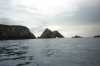
 The beautiful coastline from Gunderson Cove to Cuffey Point:
Taken on 2002-09-22 .
Links to related images: Date. Proofs. Map. Story.
 Rich Luibrand rock gardening near Cuffey Point
Taken on 2002-09-22 .
Links to related images: Date. Proofs. Map. Story.
 Riding a 'washover' on one of the fingers of Cuffey Point.
Taken on 2002-09-22 .
Links to related images: Date. Proofs. Map. Story.
 BASKers hanging out for lunch on the beach inside Cuffeys Cove.
Taken on 2002-09-22 .
Links to related images: Date. Proofs. Map. Story.
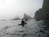
 Paddling north of Cuffeys Cove.
Taken on 2002-09-22 .
Links to related images: Date. Proofs. Map. Story.
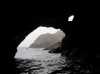
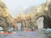
 Caves and arches!
Taken on 2002-09-22 .
Links to related images: Date. Proofs. Map. Story.
 The fog-bow in the air over the cliffs.
Taken on 2002-09-22 .
Links to related images: Date. Proofs. Map. Story.
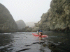
 Kayaks paddling into the fog.
Taken on 2002-09-22 .
Links to related images: Date. Proofs. Map. Story.
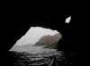
 More caves and arches!
Taken on 2002-09-22 .
Links to related images: Date. Proofs. Map. Story.
 The long carry across the sand at the Navaro River.
Taken on 2002-09-22 .
Links to related images: Date. Proofs. Map. Story.
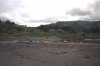
 Loading the boats back on our cars.
Taken on 2002-09-22 .
Links to related images: Date. Proofs. Map. Story.
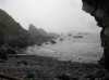
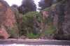
 rocky shore
Taken on 1997-09-12 .
Links to related images: Date. Proofs. Map.
 Roger Lamb in front of mossy cliff near Van Damme
Taken on 1997-09-12 .
Links to related images: Date. Proofs. Map.
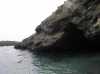
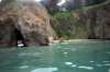
 shallow cave exit
Taken on 1997-09-12 .
Links to related images: Date. Proofs. Map.
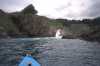
 Joe Petolino in shallow water near Van Damm Beach
Taken on 1997-09-12 .
Links to related images: Date. Proofs. Map.
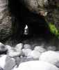
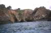
 cave exit
Taken on 1997-09-12 .
Links to related images: Date. Proofs. Map.
 Max at Van Damme
Taken on 1997-09-12 .
Links to related images: Date. Proofs. Map.
 double exit cave
Taken on 1997-09-12 .
Links to related images: Date. Proofs. Map.
 Roger Lamb in front of blow-hole near Van Damme
Taken on 1997-09-12 .
Links to related images: Date. Proofs. Map.
 narrow crack
Taken on 1997-09-12 .
Links to related images: Date. Proofs. Map.
 Roger Lamb in pocket beach near Van Damme
Taken on 1997-09-12 .
Links to related images: Date. Proofs. Map.
 Roger under cliff houses at Van Damme Beach
Taken on 1997-09-12 .
Links to related images: Date. Proofs. Map.
 VanD mossy cliff
Taken on 1997-09-12 .
Links to related images: Date. Proofs. Map.
 Roger outside cave near Van Damme
Taken on 1997-09-12 .
Links to related images: Date. Proofs. Map.
 VanDam beach
Taken on 1997-09-12 .
Links to related images: Date. Proofs. Map.
 Roger in narrow cave near Van Damme
Taken on 1997-09-12 .
Links to related images: Date. Proofs. Map.
 Landed in side cave beach near Cuffey Point.
Taken on 1997-04-6 .
Links to related images: Date. Proofs. Map. Story.
 The 'side cave' runs sidways into a beach near Cuffey Cove.
Taken on 1997-04-6 .
Links to related images: Date. Proofs. Map. Story.
 Looking through 'side cave' to the beach behind, near Cuffey Cove.
Taken on 1997-04-6 .
Links to related images: Date. Proofs. Map. Story.
 Cave through one of the points of Cuffey Cove.
Taken on 1997-04-6 .
Links to related images: Date. Proofs. Map. Story.
 Looking back through cave through one finger of Cuffey Point.
Taken on 1997-04-6 .
Links to related images: Date. Proofs. Map. Story.
 Waves breaking out caves at Cuffeys Point.
Taken on 1997-04-6 .
Links to related images: Date. Proofs. Map. Story.

 Narrow crack in Cuffeys Point, not navigable.
Taken on 1997-04-6 .
Links to related images: Date. Proofs. Map. Story.
 Cave to sinkhole near Cuffeys Cove.
Taken on 1997-04-6 .
Links to related images: Date. Proofs. Map. Story.
 Devils Basin, north of Cuffeys Cove.
Taken on 1997-04-6 .
Links to related images: Date. Proofs. Map. Story.
 Arch near Devils Basin.
Taken on 1997-04-6 .
Links to related images: Date. Proofs. Map. Story.

 Arch near Saddle Point.
Taken on 1997-04-6 .
Links to related images: Date. Proofs. Map. Story.
 Approaching Saddle Point.
Taken on 1997-04-6 .
Links to related images: Date. Proofs. Map. Story.
 Point south of the Navaro River mouth.
Taken on 1997-04-6 .
Links to related images: Date. Proofs. Map. Story.


 Landing on secluded beach near Cuffey Cove.
Taken on 1997-04-6 .
Links to related images: Date. Proofs. Map. Story.
 Caves at Devils Basin.
Taken on 1997-04-6 .
Links to related images: Date. Proofs. Map. Story.
 Cave in Devils Basin.
Taken on 1997-04-6 .
Links to related images: Date. Proofs. Map. Story.
 Close to rocks on Saddle Point.
Taken on 1997-04-6 .
Links to related images: Date. Proofs. Map. Story.
 Greenwood Beach
Taken on 1997-04-6 .
Links to related images: Date. Proofs. Map. Story.
 My kayak on the steep beach at Greenwood Cove.
Taken on 1997-04-6 .
Links to related images: Date. Proofs. Map. Story.
 Couple and their terrier Asta on the beach at Greenwood Cove.
Taken on 1997-04-6 .
Links to related images: Date. Proofs. Map. Story.
 South end of Greenwood Cove.
Taken on 1997-04-6 .
Links to related images: Date. Proofs. Map. Story.
 A cave or arch in Gunderson Rock.
Taken on 1997-04-6 .
Links to related images: Date. Proofs. Map. Story.
 One end of Gunderson Rock
Taken on 1997-04-6 .
Links to related images: Date. Proofs. Map. Story.
 Filigree arches in Greenwood Cove, from a distance.
Taken on 1997-04-6 .
Links to related images: Date. Proofs. Map. Story.
 Small arches in Warf Rock in Greenwood Cove.
Taken on 1997-04-6 .
Links to related images: Date. Proofs. Map. Story.
 The telephone pole and chains on the entrance to Warf Rock in Greenwood Cove.
Taken on 1997-04-6 .
Links to related images: Date. Proofs. Map. Story.
 Approaching the large arch in Warf Rock in Greenwood Cove.
Taken on 1997-04-6 .
Links to related images: Date. Proofs. Map. Story.
 Another exit from Secret Cove back to Greenwood Cove.
Taken on 1997-04-6 .
Links to related images: Date. Proofs. Map. Story.
 View back out cave from inside Secret Cove.
Taken on 1997-04-6 .
Links to related images: Date. Proofs. Map. Story.
 Cave that leads to a Secret Cove.
Taken on 1997-04-6 .
Links to related images: Date. Proofs. Map. Story.
 An arch near Cuffey Cove.
Taken on 1997-04-6 .
Links to related images: Date. Proofs. Map. Story.
 Arches in Greenwood Cove.
Taken on 1997-04-6 .
Links to related images: Date. Proofs. Map. Story.
 The inside of Cuffey Cove.
Taken on 1997-04-6 .
Links to related images: Date. Proofs. Map. Story.
 Arch at Cuffey Cove.
Taken on 1997-04-6 .
Links to related images: Date. Proofs. Map. Story.
 Blowhole near Cuffey Cove.
Taken on 1997-04-6 .
Links to related images: Date. Proofs. Map. Story.
 Gap between two fingers of Cuffeys Point.
Taken on 1997-04-6 .
Links to related images: Date. Proofs. Map. Story.
 Looking into and back out of Cuffeys Inlet.
Taken on 1997-04-6 .
Links to related images: Date. Proofs. Map. Story.
 The entrance to the short cut through Cuffeys Point.
Taken on 1997-04-6 .
Links to related images: Date. Proofs. Map. Story.
 Arch that connects to another inlet of Cuffeys Point.
Taken on 1997-04-6 .
Links to related images: Date. Proofs. Map. Story.
 More caves in Cuffeys Point.
Taken on 1997-04-6 .
Links to related images: Date. Proofs. Map. Story.
 Blowhole near Cuffeys Point.
Taken on 1997-04-6 .
Links to related images: Date. Proofs. Map. Story.
 A trip from Albion that I paddled with Paul Futcher
ended here.
A trip from Albion that I paddled with Paul Futcher
ended here.
Taken on 1996-11-9 .
Links to related images: Date. Proofs. Map. Story.
 The view back towards Albion
Taken on 1996-11-9 .
Links to related images: Date. Proofs. Map. Story.
 Paul Futcher paddling between rocks
Taken on 1996-11-9 .
Links to related images: Date. Proofs. Map. Story.
 Baskers going south out of albion
Taken on 1996-11-9 .
Links to related images: Date. Proofs. Map. Story.
 long cave
Taken on 1996-09-28 .
Links to related images: Date. Proofs. Map.
 caves in point
Taken on 1996-09-28 .
Links to related images: Date. Proofs. Map.
 arch in rock
Taken on 1996-09-28 .
Links to related images: Date. Proofs. Map.
 house on cliff
Taken on 1996-09-28 .
Links to related images: Date. Proofs. Map.
 fuzzy arch rock
Taken on 1996-09-28 .
Links to related images: Date. Proofs. Map.
 cave
cave
Taken on 1996-09-28 .
Links to related images: Date. Proofs. Map.
 Barch fuzzy
Taken on 1996-09-28 .
Links to related images: Date. Proofs. Map.
 Don Barch in front of cave
Taken on 1996-09-28 .
Links to related images: Date. Proofs. Map.
 rocky point
Taken on 1996-09-28 .
Links to related images: Date. Proofs. Map.
 open sea
Taken on 1996-09-28 .
Links to related images: Date. Proofs. Map.
 cave
cave
Taken on 1996-09-28 .
Links to related images: Date. Proofs. Map.
 more vandamme
Taken on 1996-09-28 .
Links to related images: Date. Proofs. Map.
 outside cave
Taken on 1996-09-28 .
Links to related images: Date. Proofs. Map.
 cave up close
Taken on 1996-09-28 .
Links to related images: Date. Proofs. Map.
 cave in point
Taken on 1996-09-28 .
Links to related images: Date. Proofs. Map.
 fuzzy rock
Taken on 1996-09-28 .
Links to related images: Date. Proofs. Map.
 BASKers
Taken on 1996-09-28 .
Links to related images: Date. Proofs. Map.
 fuzzy rock
Taken on 1996-09-28 .
Links to related images: Date. Proofs. Map.
 fuzzy arch
Taken on 1996-09-28 .
Links to related images: Date. Proofs. Map.
 long cave
Taken on 1996-09-28 .
Links to related images: Date. Proofs. Map.
 safe again
Taken on 1996-09-28 .
Links to related images: Date. Proofs. Map.
 view back out
Taken on 1996-09-28 .
Links to related images: Date. Proofs. Map.
 outside arch
Taken on 1996-09-28 .
Links to related images: Date. Proofs. Map.
 people entering N
Taken on 1996-09-28 .
Links to related images: Date. Proofs. Map.
 View out notch
Taken on 1996-09-28 .
Links to related images: Date. Proofs. Map.
 Notch in
Taken on 1996-09-28 .
Links to related images: Date. Proofs. Map.

 VD Secret Beach
Taken on 1996-09-28 .
Links to related images: Date. Proofs. Map.
 VD House Cliff
Taken on 1996-09-28 .
Links to related images: Date. Proofs. Map.
 Rock gardening near VanDamm Beach
Taken on 1996-09-28 .
Links to related images: Date. Proofs. Map.
 Vandamme rocks
Taken on 1996-09-28 .
Links to related images: Date. Proofs. Map.
 VanDamme Beach
Taken on 1996-09-28 .
Links to related images: Date. Proofs. Map.
 Van Damme Vent
Taken on 1996-09-28 .
Links to related images: Date. Proofs. Map.
 This is the view south into the first opening. Nobody was foolhardy enough to
Taken on 1996-09-27 .
Links to related images: Date. Proofs. Map. Story.
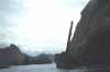
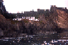
 A steel trestle bridge under Highway One on the Mendocino coast
Taken on 1996-09-27 .
Links to related images: Date. Proofs. Map. Story.
 A few views of the coast near the mouth of the Navaro River:
Taken on ~1994 .
Links to related images: Date. Proofs. Map.
All text and images Copyright © by Mike Higgins / contact