Mission Bay to the Mexican Border, September 30th 2005.
Click on the small image to see the full-sized one.
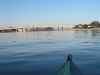 Early morning in Mission Bay
Links to related images: Nearby. Proofs. Map.
Approximate location: 32.7737617492676N / 117.230987548828W.
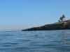
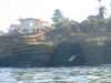
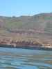
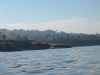 Low cliffs of Point Loma
Links to related images: Nearby. Proofs. Map.
Approximate location: 32.7385406494141N / 117.260566711426W.
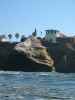
 A sculpture of a pterodactyl on the San Diego coastline?
Links to related images: Nearby. Proofs. Map.
Approximate location: 32.7385406494141N / 117.260566711426W.
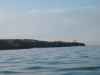
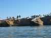
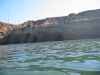
 Low cliffs of Point Loma
Links to related images: Nearby. Proofs. Map.
Approximate location: 32.7385406494141N / 117.260566711426W.
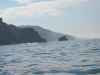
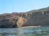
 Caves in the cliffs of Point Loma that I did not have time to go into
Links to related images: Nearby. Proofs. Map.
Approximate location: 32.7385406494141N / 117.260566711426W.
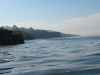
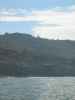
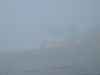
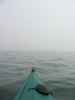
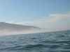 Fog socks me in as I paddle down Point Loma
Links to related images: Nearby. Proofs. Map.
Approximate location: 32.7385406494141N / 117.260566711426W.
 Caves in the cliffs of Point Loma that I did not have time to go into
Links to related images: Nearby. Proofs. Map.
Approximate location: 32.7385406494141N / 117.260566711426W.
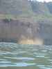 A piece of the cliff calved off and fell into the sea as I paddled by!
Links to related images: Nearby. Proofs. Map.
Approximate location: 32.6809310913086N / 117.252517700195W.
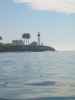
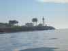
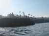
 The fog lifted long enough to see the lighthouses at the tip of Point Loma
Links to related images: Nearby. Proofs. Map.
Approximate location: 32.6643295288086N / 117.246520996094W.
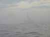
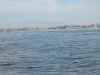
 Then the fog came back when I wanted to cross the channel
Links to related images: Nearby. Proofs. Map.
Approximate location: 32.6643295288086N / 117.246520996094W.

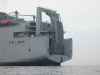
 A floating dock appeared out of the fog as I paddled south
Links to related images: Nearby. Proofs. Map.
Approximate location: 32.6406517028809N / 117.179481506348W.
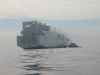
 This tugboat is from San Francisco, what's it doing in San Diego?
Links to related images: Nearby. Proofs. Map.
Approximate location: 32.6407012939453N / 117.179000854492W.

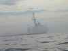
 Some kind of navy ship also apeared
Links to related images: Nearby. Proofs. Map.
Approximate location: 32.6406517028809N / 117.179481506348W.
 I could see the motel I would stay in, but still had miles to go
Links to related images: Nearby. Proofs. Map.
Approximate location: 32.5794982910156N / 117.150001525879W.
 I'm at the border, I can hear Spanish music, but I cannot see anything!
Links to related images: Nearby. Proofs. Map.
Approximate location: 32.5340995788574N / 117.128997802734W.
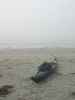 The last landing of the trip at Imperial Beach
Links to related images: Nearby. Proofs. Map.
Approximate location: 32.5810012817383N / 117.133003234863W.
All text and images Copyright © 2005 by Mike Higgins / contact