Stengel Beach to Stump Beach, November 24th 2007.
Click on the small image to see the full-sized one.
 Dave Littlehohn attempting to look like the Intrepid Kayaker
Links to related images: Nearby. Proofs. Map.
Approximate location: 38.4728600515938N / 123.04914951324W.
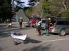 Collecting gear at the Stengel Beach parking lot
Links to related images: Nearby. Proofs. Map.
Approximate location: 38.7168163078908N / 123.45812737942W.
 Dave Littlejohn carbo-loading before kayaking
Links to related images: Nearby. Proofs. Map.
Approximate location: 38.7167367820099N / 123.45808446407W.
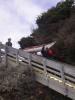
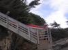
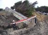
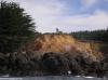
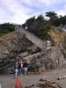 The beautiful access stairs/sculpture at Stengel Beach
Links to related images: Nearby. Proofs. Map.
Approximate location: 38.7159540751979N / 123.45992982388W.
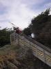
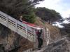
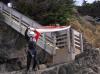
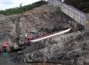
 The Stengel Beach access is not set up for kayaks
Links to related images: Nearby. Proofs. Map.
Approximate location: 38.715878733983N / 123.46011221409W.
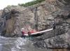
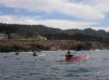
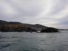
 Launching from Stengel Beach
Links to related images: Nearby. Proofs. Map.
Approximate location: 38.7149955615979N / 123.46089541912W.
 A photograph of a photographer photographing kayaks launching at Stengel Beach
Links to related images: Nearby. Proofs. Map.
Approximate location: 38.7145309499439N / 123.46053063869W.
 John Somers, Ruth Cooper and Don Fleming paddling south from Stengel Beach
Links to related images: Nearby. Proofs. Map.
Approximate location: 38.7138737913669N / 123.45945239067W.
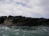
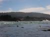
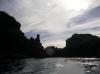
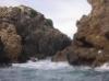
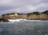
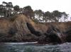
 Beautiful offshore rocks south from Stengel Beach
Links to related images: Nearby. Proofs. Map.
Approximate location: 38.7119776247925N / 123.45698475838W.
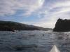
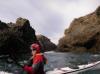
 John Somers likes to go behind the offshore rocks
Links to related images: Nearby. Proofs. Map.
Approximate location: 38.6925442513387N / 123.43950748444W.
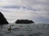
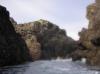
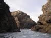
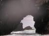 I have been through this arch on calmer days
Links to related images: Nearby. Proofs. Map.
Approximate location: 38.6921925431992N / 123.43931436539W.
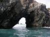
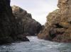
 The arch closes out on John Somers
Links to related images: Nearby. Proofs. Map.
Approximate location: 38.6921925431992N / 123.43931436539W.
 A slot in Black Point, can a kayak fit through there?
Links to related images: Nearby. Proofs. Map.
Approximate location: 38.6823105125535N / 123.43560218811W.
 John Somers paddling out the Black Point slot
Links to related images: Nearby. Proofs. Map.
Approximate location: 38.6813808614727N / 123.43442201614W.
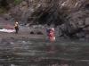
 Dörte Mann paddling out the Black Point slot
Links to related images: Nearby. Proofs. Map.
Approximate location: 38.6814143626223N / 123.434497118W.
 Dave Littlejohn paddling out the Black Point slot
Links to related images: Nearby. Proofs. Map.
Approximate location: 38.6814143626223N / 123.434497118W.
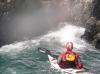
 John Somers side surfing over a washover at Black Point
Links to related images: Nearby. Proofs. Map.
Approximate location: 38.6801915605012N / 123.43371391296W.
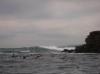 The large waves breaking outside the rocks at Black Point
Links to related images: Nearby. Proofs. Map.
Approximate location: 38.6799486726612N / 123.43283414841W.
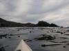
 Launchin after lunch in Fishermans Bay
Links to related images: Nearby. Proofs. Map.
Approximate location: 38.6495728226815N / 123.40032577515W.
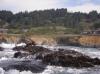
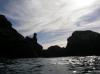
 Beautiful rock formations in Fishermans Bay
Links to related images: Nearby. Proofs. Map.
Approximate location: 38.648868982333N / 123.40099096298W.
 False Rocky Point
Links to related images: Nearby. Proofs. Map.
Approximate location: 38.6384781537642N / 123.39622735977W.
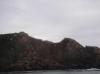
 The true Rocky Point
Links to related images: Nearby. Proofs. Map.
Approximate location: 38.6316730206663N / 123.39090585709W.
 Horseshoe Point
Links to related images: Nearby. Proofs. Map.
Approximate location: 38.6086045136022N / 123.37255954742W.
 Dörte Man wearing Ruth Cooper's spare hat
Links to related images: Nearby. Proofs. Map.
Approximate location: 38.5679315647547N / 123.33024501801W.
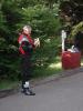
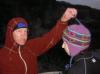 John Somers showing off Ruth Cooper's hat
Links to related images: Nearby. Proofs. Map.
Approximate location: 38.5679483418528N / 123.33028793335W.
All text and images Copyright © 2007 by Mike Higgins / contact