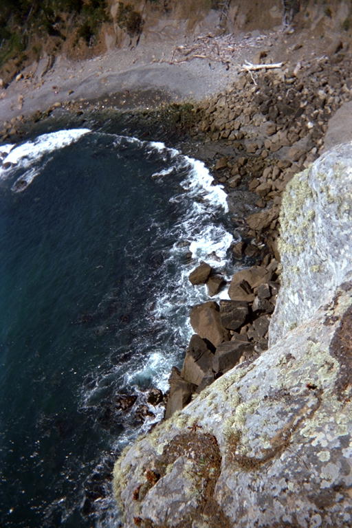
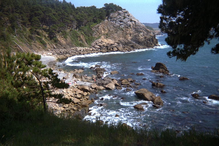
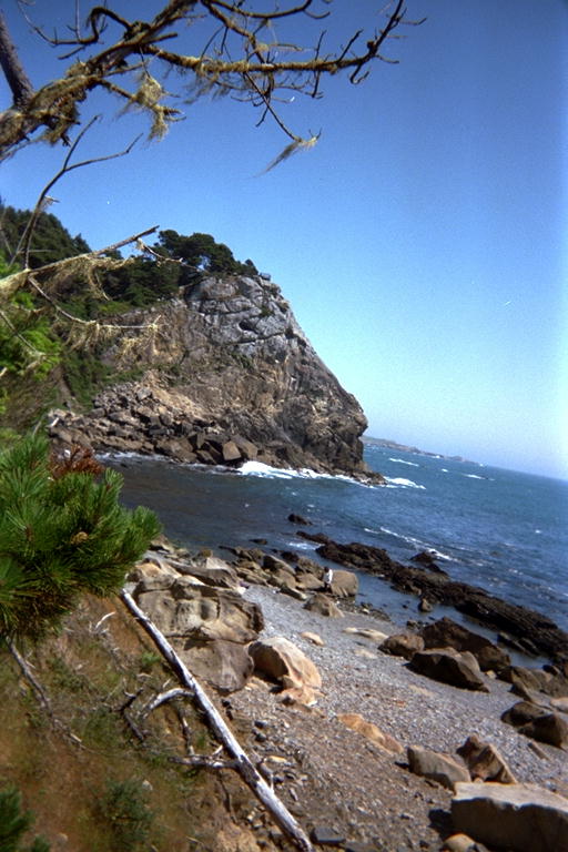
Fisk Mill Cove has the northern most parking lot in the Salt Point State park where they charge $3.00 to park there. We parked in the northernmost of 3 lots and headed north to Sentinel Rock and Fisk Mill Cove itself. Just out of the parking lot the trail splits in several unmarked direction, and one of the unmarked trails goes up the back of Sentinel Rock, to a lovely wooden deck with a railing (which made Marty feel safe) and a bench. This deck is on the peak of a rock that must be 150 meters tall, and drops almost vertically into the water. Fantastic views. The warm sun and mild breeze almost put Mary to sleep. But the tide was out, and Fisk Mill Cove looked like fantastic tide pooling. From above, we could see that there were plates of rock sticking up at an angle creating several rows of pools. Between these plates were a lot of large (1 to 6 meter) rounded sandstone boulders. The waves came in over a field of these boulders, and lost most of their energy before getting to the tide pool area. Higher up, the 'beach' is made out of large gravel, with no sand to be seen anywhere. It was a short walk from the Sentinel, down a babbling brook to a flight of wooden stairs that ended almost a meter above the beach. I'm not kidding: The supports have been washed out from under the stairs, and they are hanging on to the cliff by one side. We sat by a tide pool for a while watching Hermit Crabs and the tide come in. The water rose so gently in this pool that the surface tension would leave dry circles on the tops of rocks until the water was several millimeters above the rock. Then the tension would break, and the water would swallow the dry circle and cover the rock.
We looked for a trail heading further north, but saw nothing definite and headed south. Back at the parking lot, we read a sign describing the trail. It did not mention the obelisk, but did mention that the trails were hard to follow, and that they did go further north to Horseshoe Cove. But there is no way to get to Horseshoe Cove by car, so I figured the obelisk would be south, near one of the Fisk Mill parking lots. We took the trail south along the top of the bluff, which sometimes weaves in under the trees and crosses brooks on wooden bridges. From the kayak in the water I had seen two sets of stairs, but we didn't find the second one until we looked back across the southernmost cove. It looked like the top 3 meters of the stairs were missing, and from directly above it, you couldn't see the lower part. Knowing where to look, we found the ruins of the stairs on the walk back. It looks like there used to be an impressive set of stairs going over the cliff edge, but several Monterey pines had fallen on them, and the resulting kindling had been hauled away years ago and never replaced. Someone had tied a rope to one of the foundation piers at the top, and I climbed down the almost vertical drop (lots of hand and foot holds, the rope was unnecessary but helpful on the trip back up). From there, the stairs used to zig back down the side of the bluff. But only the outside edge of the steps remained, acting as a retaining wall to hold dirt onto a well used trail. From the water, this edge still looked like stairs to a kayaker, but the treads have rotted away or been removed. I am disturbed to see both of these stairs in such poor repair, and wonder why the state park service is letting them rot away.
When we got to the south end of Fisk Mill park, the trees thinned out, and it looked like it was grassy all the rest of the way to Stump Beach. I recalled the obelisk being surrounded by trees, so it cannot be here. Marty started joking about me making the whole thing up, or seeing it someplace else. She mentioned that weird sculpture at Timber Cove Lodge, but honest, that's not what I saw up here! What I saw from the kayak was a much smaller, possibly concrete obelisk, like the Washington Monument but only 2 or 3 meters tall, on top of a rounded or spherical base. We looked for it again on our trip back north to the parking lot, but never found it. I'm going to have to paddle along here in the kayak and find it again. Next time I'll take note of the nearby landmarks so I can find it from the trails.