![]()
![]()
![]()
![]()
![]()
![]()
BASK is always looking for people to schedule trips and especially in the winter to fill out the scant offerings in the calendar. Joan Weiner is often doing Yellow Bluff paddles and just had one on the first of January. These are always scheduled on the strong ebb tides to play in the tidal rip at Yellow Bluff. Big ebb trips are popular for many reasons but one reason is that the ebb tide can pull you very rapidly down the bay without paddling very hard. It occurred to me that if you picked a day with the right tides, you could get the flood tide in the morning to pull you up one side of the bay, and the ebb tide to pull you back down the other side in the afternoon. I thought this would be a fun way to see all the islands in the San Francisco bay in one day. In my new 1999 Tidelog I checked out the possibilities and working out the current speed at different times of the day using the SF Bay current charts. Unfortunately the SF Bay has two lobes and the tide splits to go north and south so I had to give up on seeing ALL the islands in one day. By skipping Yerba Buena, Treasure, and Alcatraz we could still see as many as ten islands in one day. I chose Sunday January 31st as being the best time to do this. I submitted the trip description in time for the January BASK newsletter. Maryly Snow wanted to do a trip that didn’t involve paddling the whole 30 mile round trip and suggested meeting me half way. The ebb tide is always stronger than the flood tide, so the second half of the trip would be quicker and easier. Maryly submitted this to the BASK calendar and called it the “Eight Island Fifteen Mile Wimps’ Auxiliary Bay Tour” and my version of the trip somehow ended up being called the “Ten Island 30 Mile Gonzo Bay Tour”.
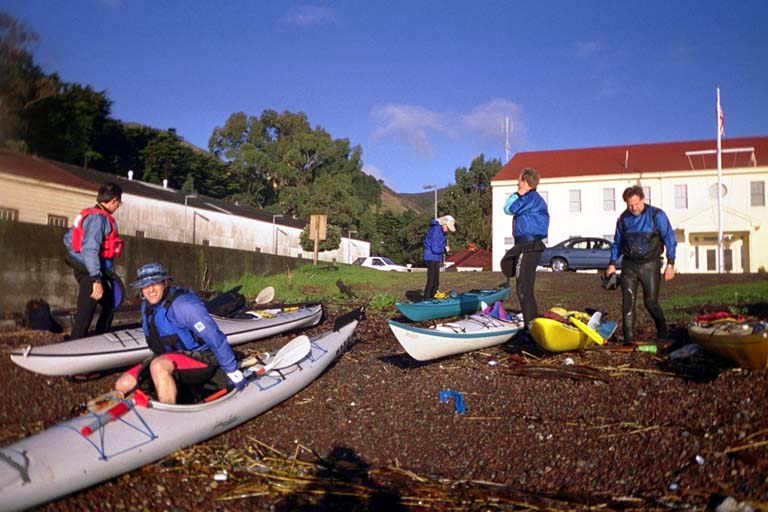
It rained the night before and the Weather Service was predicting scattered showers for Sunday. (“Scattered sunshine with gusts of calm wind” was how one BASK member translated that). I was determined to go unless there was a strong wind. When I listened to the weather radio in the morning, it had mild wind coming from all different direction all over the bay but mostly from the south. The prediction for the afternoon was the return of the normal northwesterly winds. I hoped that this meant we would have some of the tattered remains of the stormy wind from the south in the morning to help us on our way, and the normal pattern to help us home. Eight people showed up at Horseshoe Cove (Fort Baker) and we all got ready to go and in the water in record time by 8:35 AM. Time and Tide waits for no man.
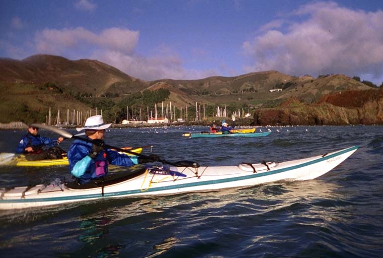
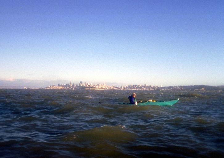
The maximum flood was only 3.3 knots and was supposed to happen around 10:00 AM. I was anxious to get going because the tide already looked as high as it was going to get. We had no problems paddling across to Angel Island (number one of the day). This island is covered with trees, buildings, roads, and trails. It is a State Park with access only by boat or ferry. Between Angel Island and the nearest land we went through narrow Racoon Strait. In the strait we could still feel the flood tide going strong and helping us along. A river of water came out of the strait and slowly curved a little to the west. We let it pull us along.
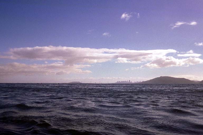
As we came out from behind the Tiburon Peninsula a strong wind came up from the west that was perhaps 10 knots. I had just read an article about kayak navigation (in Sea Kayaker February 1999 VOL. 15 NO. 6) about using “natural ranges” which means you can tell how far you are drifting off course by sighting past a nearby object at something far away. The Richmond Bridge supplied lots of pylons to sight through and I was able to keep a straight course despite the wind. To steer towards the Marin Islands, however, I had to point my boat around 30 degrees up-wind from the direct path. Two other kayakers in fast hard-shell boats pulled way ahead of the pack but they let the wind bend their course far to the right of the islands. I thought this would mean that I could beat them to the next island.
As we approached the Marin Islands the rest of us huddled out of the wind behind a rusty old barge and saw that the hard-shell boats had beaten us there and were huddled behind the East Marin Island. The Marin Islands are a pair of little-known tree-covered islands in the shallow water east of the city of San Rafael. These islands are a bird sanctuary and no boats are allowed to land here. The wind made traveling around the West Marin Island a chore, but I wanted to say that I had traveled AROUND all the islands today. I slogged into the wind to work my way around the island and everyone else followed. I was sorely tempted to give it up and just duck between the islands. Once around the west end, however, we turned mostly down wind and zoomed towards Point San Pedro. Two more islands under our belt. Off this next point are two rocks called The Sister Islands and we quickly chalked up two more (five so far now). I pulled out my marine radio and tried to contact the “Wimp’s Auxiliary” who should have been waiting to meet us for lunch. I got no answer, even after I came around the point and could see our lunch landing spot at China Camp. I checked my radio and discovered that it had somehow gotten into Canadian mode, and was on a duplex version of the USA channel 64a. I had to remove my gloves and take the radio out of its bag before I could get it back in the right mode and make contact.
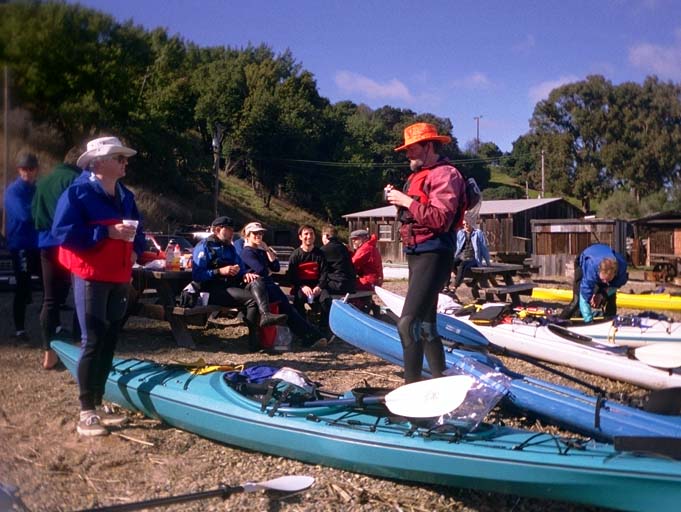
Stopping to fiddle with the radio I was surprised to discover that I had drifted backwards a quarter of a mile to the Sister Islands again. Around Point San Pedro we were facing into the west wind again and I suspect the ebb tide may have started early because of all the rain the night before. I had to work hard to make up the lost ground and could feel that I was low on energy reserves. We had gone 15 miles in 4.5 hours and they had not all been easy miles with the flood tide. When I finally landed (dead last) I found the Wimps’ Auxiliary group had a stove going with hot chocolate ready to re-supply my drooping blood sugar. We arrived at China Camp a little late, around 1:00 PM when the slack was already in progress or perhaps over. I gulped down lunch and was eager to get going again.
I described my plan for the return trip, which involved first paddling another quarter mile the wrong way to go around one more island, called Rat Rock. A few of the people from the first half of the trip were not as dedicated as I and were unwilling to make this extra effort. To get everyone going again, I jumped in my boat and lead the charge east to Rat Rock. The people not doing this island were supposed to paddle out to meet us as we came back past China Camp. As I feared the ebb tide was already going strong and there was a tidal rip boiling around BOTH SIDES of Rat Rock. I paddled up as close to the mainland shore as I could to stay out of the current and wind, then cut across at the last minute. A few people followed farther from shore and managed to go against the current. A few more decided not to buck the current and turned back before circumnavigating the island. Once around the island, (our sixth so far this day), I relaxed and stopped paddling to let the current carry me back. To my dismay I found myself zooming past China Camp at a good clip watching people still packing their boats and not ready to launch yet. Marvin Feldman behind me had a GPS unit with him and he reported that we were moving at 4.4 miles an hour without even paddling!
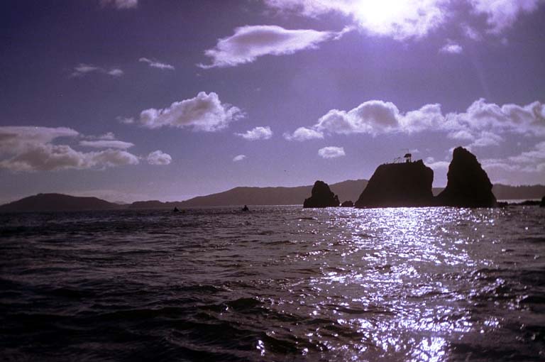
The first six people to launch with me kept on paddling and pulled way ahead with the help of the current. At 4.4 miles per hour I pulled ahead of the people who were still launching. We were getting spread all over the bay! As people passed me I suggested that everyone wait for us to bunch up again at Ayala Cove on Angel Island, but it was too late to tell half of the group. I quickly drifted past the Sister Islands, which are just two balls of bare rock sticking out of the water. and then across the San Pablo Strait. The current was roaring around The Brother Islands (numbers seven and eight) and I saw a few of the kayaks ahead of me go between these two islands. I went around the east side of the East Brother which has a landing dock there for the bed and breakfast hotel on the island.
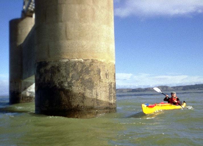
As we headed for Red Rock Island, the wind started to come back up again. Way behind me I saw Ken Kelton’s red kayak sail and he was doing a great job of tacking across the wind. He did such a good job that he went way west of the pack and missed three of the islands. He passed up all the kayakers and was one of the first boats to get back to Horseshoe Cove, making the 15 mile return trip in two hours. The late starting kayaks caught up with me and I could still see most of the kayaks far ahead of me as little black specks on the water. I tried to keep track of where everyone was going and wished I had set a schedule of waiting behind each island for the rest to catch up. Marvin was behind me as we went under the Richmond-San Rafael Bridge and around Red Rock (island number nine). But then I lost track of him and wondered if he had gotten in trouble. I spent a lot of time worrying about him and stopped a few times waiting for him to come out from behind the island. Only to discover later that he had passed me and I was looking the wrong way. By this time I was the last kayaker in the pack.
After Red Rock, the wind increased during every stroke of the way across to Angel Island. This was the same area we had found a strong wind on the way up and apparently it was still here, getting stronger. The NOAA report later confirmed that we had winds as high as 14 knots. The wind had a wide expanse of water to fetch across and build up large waves. By the time we got close to Angel Island again we had whitecaps breaking across the prows of our boats from the side. I had told everyone to skip Brooks Island, and now I was glad. Brooks Island would have taken us a few kilometers farther west and out of the main current. It would have been a lot of work into the wind to come back from there. I also told everyone to go back through Racoon Strait to take advantage of the current, which turned out to be another mistake.
I caught up with three kayakers rafted up and learned that one of them, Christian Echeverria, had cramps and diarrhea. About the time I caught up with them they decided to take off and try to get to a restroom as soon as possible. Christian and one other kayaker, Lee Apple, had fast boats and took off towards Tiburon. I figured they were aiming for a little public park on the shore there. But as time passed they swung across the mouth of Racoon Strait and seemed to be heading for Angel Island again. As Marvin and I made it close to the island I relaxed in a rip tide figuring it would pull me into the strait. I saw Christian’s kayak on the beach and Lee offshore. Lee was paddling to the right but his boat was drifting to the left! Was he caught in an eddy current? I looked over my shoulder and watched in amazement as one of the cliffs on Angel Island marched towards me! I was drifting backwards as well and at an incredible clip.
Looking around I figured out what was going on. The ebb tide was particularly strong because of the rain the night before. The water was backing up in Racoon Strait and was unable to go through it fast enough, so it was running north around the end of the island, backwards from what we expected! This same current had pulled Christian and Lee across my path earlier and made them head for Angel Island instead of Tiburon. And it was moving faster than I could paddle. Marvin was behind me and loosing ground faster than I was. I signaled to him to head for shore and demonstrated by heading there as fast as I could. My plan was to find an eddy current or milder water close to the island and work my way into the strait. Marvin kept trying to paddle upstream and got farther and farther behind. Eventually Lee saw him give up and turn around as if he was going to go around the east side of the island. I wanted to do that myself, but felt compelled to check up on Christian and make sure he made it OK.
After watching Christian land at China Cove on Angel Island, Lee had stayed in the water and had been swept backwards around the end of the cove. He was having trouble paddling back into the cove for a landing. I had the same trouble! I suggested that he follow me close to shore. Just at the north end of the cove there were some rocks with water pouring between them. I tried to paddle through and was washed back. Every once in a wile a wave would come by and level out the water for a few seconds and it would have been possible. But our timing never worked out. With a visible step down in the water we couldn’t climb over it and the shallow water would not give our paddles any purchase. I tried pulling my boat through, and then gave up and jumped out into the shallow water. I was able to grab Lee’s boat and push it into the cove, then walk in dragging my boat behind me. Then we easily paddled along the beach and landed next to Christian’s boat.
Unknown to me, a more serious drama had unfolded in this same neighborhood a half an hour earlier. I was unaware of this and have only pieced the story together from everyone’s stories later. One of the kayakers, Jorje Purras, was in a large triple kayak. It was more of a partially canopied canoe with one large cockpit and a spray skirt that had tubes for three people sticking out of it. Jorje was in the middle tube and had the other two tied closed. But in the wind and rough water coming across from Red Rock, the front tube had come open and let water into the boat. Half full of water and unstable, when Jorje hit the rip currents north of Racoon Strait his boat was rolled over. Guy Jett and Rob Nevitt tried to help him get his boat emptied, but in the rough water they could not get the water out. Two larger boats came over to assist, Sean Penn (the actor) arrived in a motor boat, and a yacht out of Sausalito named the “Joker’s Wild”. They tried to toss a rope to Jorje but he was unable to reach it. Rob grabbed the rope with the intention of delivering it to Jorje, but a tug on the rope pulled Rob’s boat over! By this time Jorje had been in the water for twenty minutes, so they decided to pull everyone out of the water. Guy never ended up in the water, but he decided to let the yacht tow him back to Sausalito so he could follow up with the other two kayakers. The yacht was able to rescue the kayaks as well as the kayakers. This all happened while I was still crossing over from Red Rock. They tried to contact me by VHF marine radio, but my batteries were low and I had turned it off.
Back at China Cove on Angel Island, Lee and I waited for Christian to finish his business in the restroom, which took over twenty minutes. We huddled behind the corner of one of the buildings to get out of the wind which was seriously chilling us down in our wet wetsuits. When Christian felt up to launching again, we turned and hugged the shore to Ayala Cove with the hope of meeting everyone else there. They had waited for us but figured we had decided to go around the far side of the island with the main current. So everyone else left without us and I was the last boat again, unless you counted Marvin on the other side of the island. In Racoon Strait we found very little wind and finally had a current going our way again. We expected to find the strong winds again as we crossed over in front of Richardson Bay, but were happy to find the air calm again. We had missed the maximum ebb so we paddled directly into the rip current with no problems crossing over to it. The mild remains of the Deadly Yellow Bluff Rip Current were nothing compared to some of the water we had seen earlier in the day. Even with Christian’s 25 minute delay, we still made the 15 mile trip in 3 hours.
As I landed I asked if Marvin had made it yet, and found that only 11 kayakers (counting me) had made it so far. A few minutes later, Rob showed up and told us that he and the other two kayakers were OK. So Marvin was the only missing boat. We stood around in a circle on the boat launch and reassured each other that Marvin is a very good kayaker. I described the situation at the north end of Angel Island and Lee told us that he had seen Marvin purposefully turn to go the long way around. Ken has done a lot of paddling with Marvin and assured us he was a good paddler, but a slow one. Petty Officer Faine wasn’t convinced and told us a lone kayaker out this late was not a good idea. Petty Officer Faine? One of the people in our circle of friends was not wearing a wet suit. He was wearing a Coast Guard uniform with FAINE on the pocket. So this answered the tricky question of whether or not to notify the Coast Guard.
Ken drove over to Yellow Bluff and tried to see Marvin or contact him with my marine radio. No luck. The Coast Guard started getting their boat ready to go. Ken went back up on top of Yellow Bluff, but quickly drove back down to tell us that he had sighted Marvin. I went into the Coast Guard office to tell them to abort the boat ride, only to discover that they already knew. They had put out an alert on channel 16 about a missing kayaker, and Marvin himself had answered to tell them he was OK.