This weekend was supposed to be the weekend that we shingled some exterior walls at the house in Berkeley. I was suspicious that it would take quite a while to decide what to do, and went kayaking in the morning to occupy myself elsewhere until work could be started. I decided to return to Red Rock Island and climb it this time. I had scouted the Point Richmond area a long time ago looking for access to the bay, and found a small park called Keller Beach. I went there this day, and packed my steel toed work boots (the closest thing I own to climbing boots), a pair of jeans, and a long sleeved shirt into my drysack, with the normal emergency kit. With all that stuff strapped on the back of the kayak, it was noticeably heavier and unbalanced carrying it the short distance to the water from the parking on the side of the road.
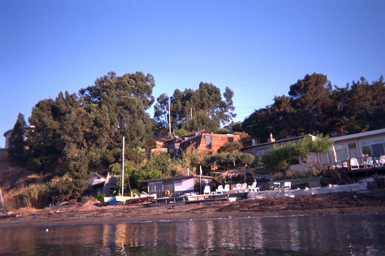
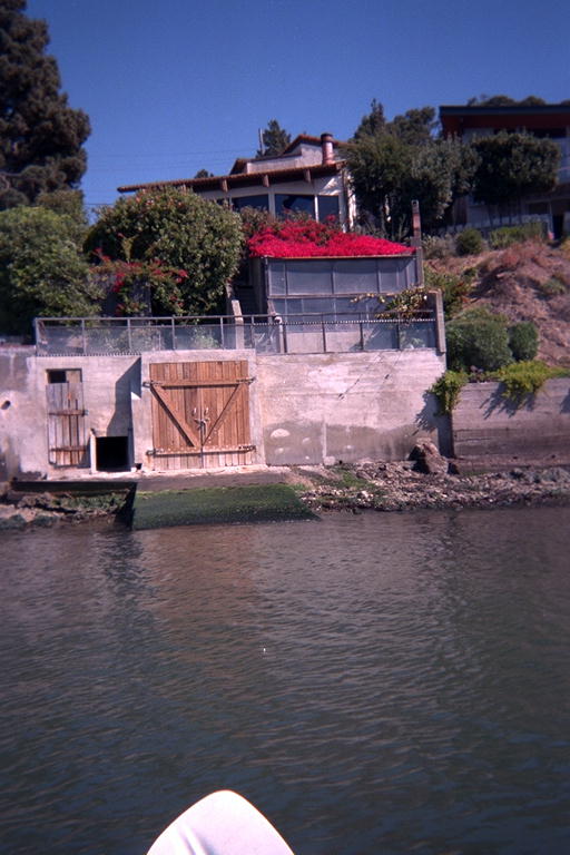
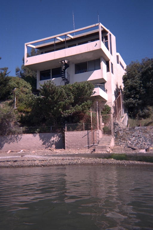
The water and air were calm, the sky clear, and the air warm as I got in the water and headed up the coast past an array of interesting houses. The shore here is lined with classic beach shacks, funky hand built houses from before the crackdown of housing regulation, and more recent large expensive houses. There were houses with garage doors in their sea walls, and one with an old handmade electric winch powered boat trailer. Where there were sandy beaches, the tiny little beach houses had their doors open on this sunny morning. Then next door would be a mansion with a spiral staircase between the three layers of decks. But the mansions would have chain link fences, keep out signs, and no doors open to the morning breeze. I imagine there are two strong forces competing to control the prices of property in this neighborhood: proximity to the water, and the proximity of the Standard Oil Refinery next door. I paddled close past all of these houses to see them all, even though it brought me a bit out of my way and closer than I wanted to get to Standard Oil's pier.
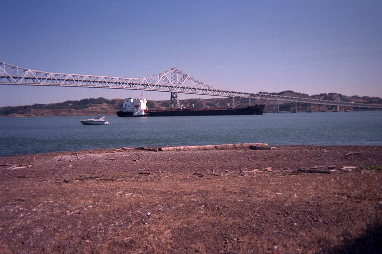
I didn't want to get close to the pier because I didn't know if I could get under it. If I could not, I would have to paddle two kilometers out into the bay to get around it. When I got close enough to see that there were large gaps between the cement piers, I could also read the signs warning all private craft to stay 100 feet away from the pier. I went under anyway. The pier is mostly there to carry heated pipes (some leaking steam) out to the deeper water where tankers dock. But there is a road up there on the pier that I could see a little shuttle bus driving on. Once under the pier and safely 100 feet away, I turned away from the coast. The coast from the pier to the Richmond Bridge was lined with oil storage tanks, and did not look especially scenic.
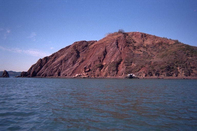
The Standard Oil Pier is shaped like a large T, and after going under the base near shore, I passed near the tip of the crossbar 2 kilometers from shore. I headed for the Castro Rocks, and when I did not see any harbor seals hauled out, I got close enough to take some pictures. These rocks had an interesting color scheme: The tops were bright white with a layer of guano from the cormorants that roost there. Under that was a layer of light brown rock. Close to the waterline, the rock was stained a dark brown, probably seepage from the oil tankers. But at the waterline, and above at this low time of the tide, the rocks were ringed with a vivid bright green of seaweed. I believe the tenacity of life will survive anything puny humans can throw at it. Although there were no seals hauled out on the rocks, there were a few in the water, and some were splashing the surface with their flippers. At first I thought they were warning each other that I was approaching, but as soon as they did notice me, they stopped, stared at me for a while, and disappeared.
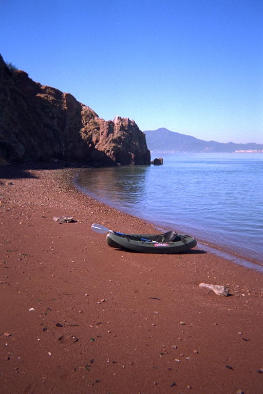
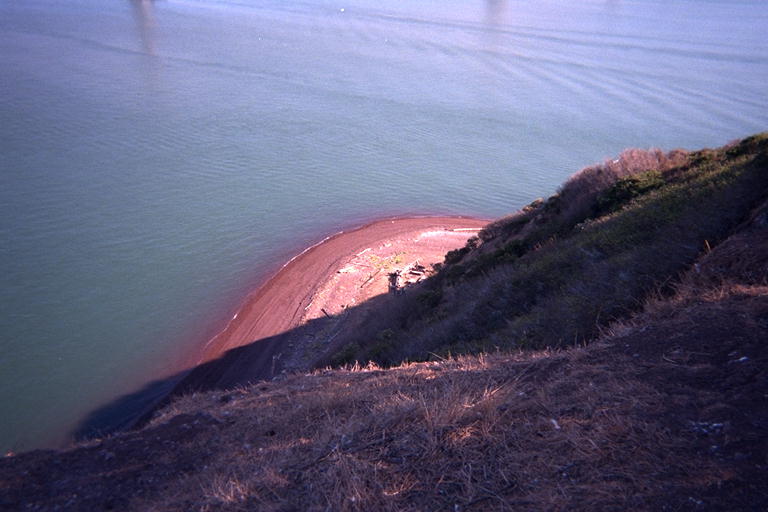
I turned from the Castro Rocks and headed toward Red Rock Island. I had recently made a brief landing on this island, which is technically inside the city limits of San Francisco but actually 14 kilometers from any other piece of the city. This time, I had my boots with me and would climb to the top of the island. I paddled around the island and picked out the area that looked like it would be the easiest place to climb. On close examination, it looked like people had worn trails into the side of the island in several places. But it was impossible to tell which trails made it to the top. After circling the island, I landed on the red sand beach on the north end, hauled my kayak far out of the water for safety, and started changing into dry clothes. It felt strange getting out of the wetsuit and into jeans and boots in the middle of the water, even if on a small island. I felt insecure walking out of sight of my kayak and my only means of getting back to shore. I imagined a couple of rednecks zooming up in a motor boat and pushing my kayak into the tidal current just for yuks and stranding me here. But I was determined to explore every part of the island that I could while I was here.
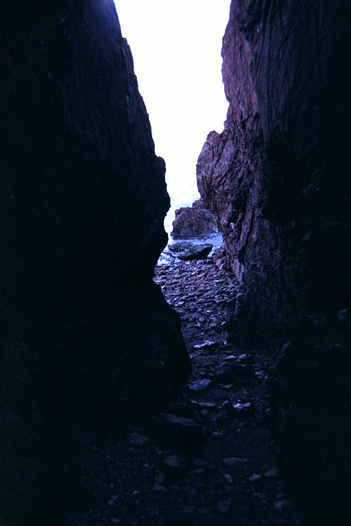
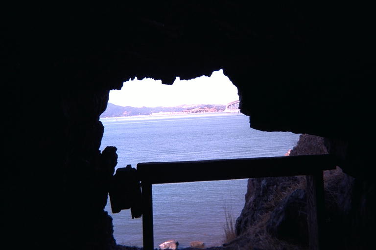
The northern tip of the island has a steep rocky cliff with no beach, which should have prevented me from walking around to the west side of the island. But from the water, I had noticed a cave or arch through this cliff that allowed access from the red sand beach to the narrow rocky beach on the west side. This allowed me to walk almost all the way around the island, except for the south end which had steep rocky cliffs, no beach, and no cave this time. However, halfway down the west shore, there was a cave in the side of the cliff with a trail leading up to it. I climbed up and looked into this, and discovered that it sloped up quite a ways, then seemed to turn down while the ceiling got higher. I decided to go get my flashlight and explore this farther.
But once I got back to the kayak, I felt like continuing down the east side of the island and finding my path to the peak first. The trail I chose was a short tallus to a bowl shaped depression in the side of the island. I expected to walk around the lip of this bowl, but when I got to it, there was a well worn trail almost straight up and to the right. I was not really sure if it was a trail, or a gully of gravel washed clean of plants by winter rains. I followed this for a while, then cut straight up the bowl to the top of the island. The last thirty meters was a little difficult, and when I got to the top, I saw that following the gully and then the lip of the bowl would have been much easier. Later, I took this easier route back down.
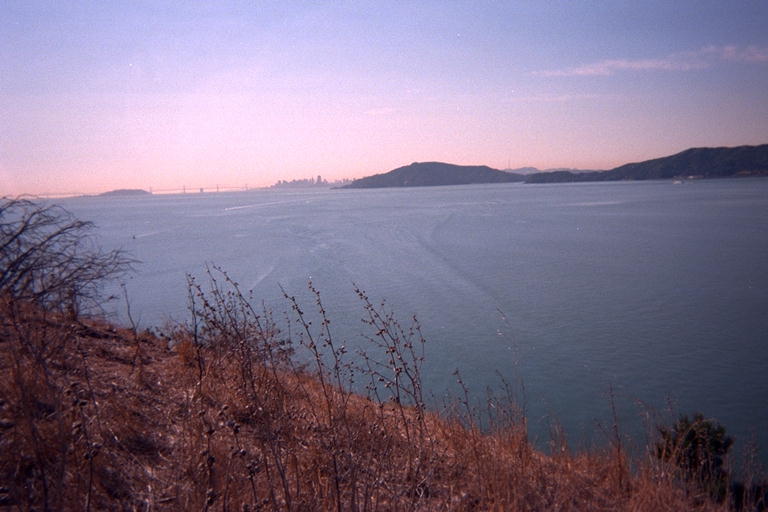
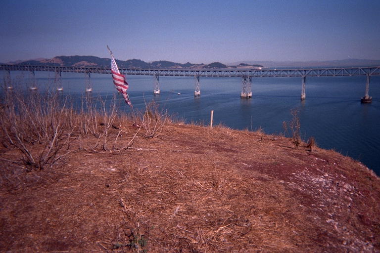
On the very top of the island, besides a beautiful view of the San Francisco Bay, there was a pole with an American flag collapsed at the foot of it. I re-strung the flag onto the pole, and shouted: "I claim this island in the name of Emperor Norton!". Then I sat down and ate a snack while watching sailboats go by. I walked over to the south side of the island until I had a view of my kayak at the bottom of the cliff. A motor boat turned and headed slowly towards the island. I got a little paranoid (still worried about loosing my kayak) and headed back down to the beach.
I picked up my flashlight and went around to the cave again. From the west side, I saw the motor boat slowly passing the island and turning around the south end. But I went into the cave and followed it all the way in. It went in 30 or 40 meters, with a ceiling 9 meters tall near the back. The floor sloped up most of the way at various different angles, and the ceiling was peaked and irregular. This makes me think it is natural, although the opening was squarish, and partially blocked with a wooden railing mounted across two fence posts . From inside the mouth of the cave, I had a view directly across the bay to San Quentin Penitentiary. There was a dead sea gull near the mouth of the cave (not smelling very bad), and a fly-like insect flew up and bit my arm. I hurried out and back to my kayak. The motor boat was just coming around to the north side of the island, and soon left the area. Nobody came ashore to bother my equipment.
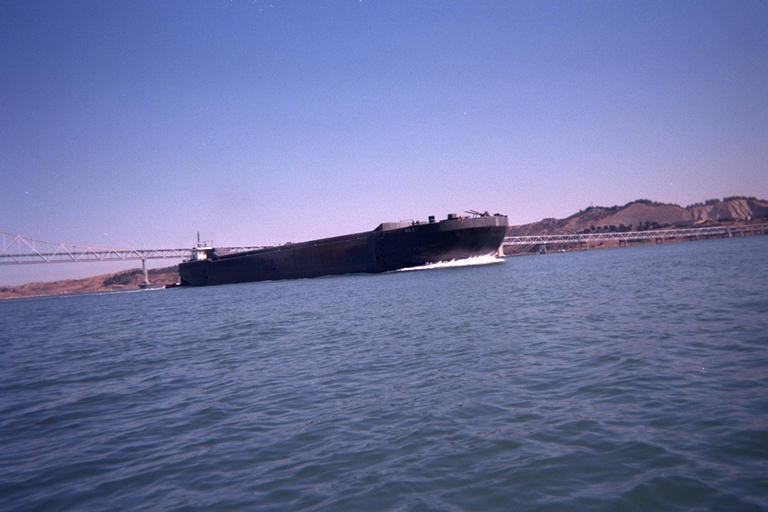
As I was changing back into my wetsuit, two huge super tankers came towards me. One continued across the bay while the other, pushed by a tug boat, went between the island and the shore. I considered getting in the water and following it back to the pier, but just as I was ready to go, my feet tangled in a long strand of fishing line. Stuff like this tangles up in the feet and wings of birds, maiming, strangling, or tying them down until they starve. I stopped to wind up 200 meters of the stuff and take it away. I brought it to Marty as a gift, and told her about all the evidence of birds I had seen all over the island. Then I got in the water and headed back the long way around the Standard Oil Pier, with the tidal current helping me on my way. I followed the super tanker as it made it's final approach to the pier.
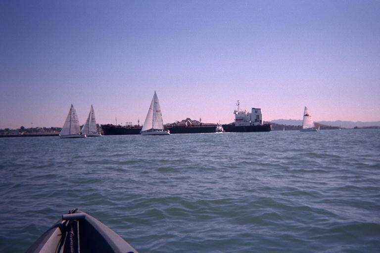
As I got near the pier, a hundred sailboats came by and tacked back and forth around the super tanker. I went from worrying about getting plowed under by a tanker, to getting smacked by one of these much smaller craft. Some of the sailboats went between the tanker and the pier it was trying to dock at, and the tanker blasted its horn 5 times, signaling danger. Hearing the danger signal over and over again made me look around nervously, wondering if he is really just honking at the stupid sailboaters or if it was a message for me. When I looked behind me, I saw what looked like another tanker coming under the bridge and heading towards me. Its heading would take it between me and the pier, so I turned to parallel the pier for a while and gave it the right of way. But its heading kept turning, as if it was turning towards me, and by then the tug boat had turned the first tanker halfway around, blocking a wide stretch of water. I felt crowded and turned to paddle a little way back out into the bay. The approaching boat turned out to be a barge pushed by a tug, and not a tanker at all. It zoomed by, turning farther out into the bay, and cut through all the sailboats without slowing down. The wake of the barge was amazingly calm and flat as I paddled over it and past the docking tanker.
I managed to paddle all the way around the tanker in time to watch it get pushed into the dock. It touched the two-meter thick rubber bumpers so gently there was no noise, until the rubber compressed and slipped up a little with a squeaking noise. Then the huge tanker bounced back out a half a meter while the tugboat revved his engine to try to hold it in place. It took two more bounces to get the tanker pinned in place so it could be tied up.
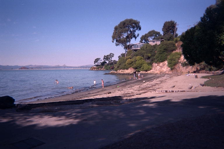
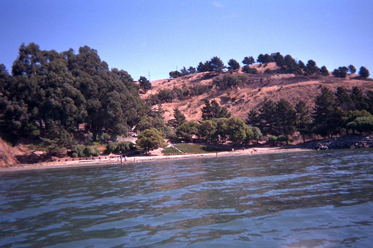
Then I headed back to Keller beach. There were several families on the beach, with screaming kids splashing in the waves and throwing toys for their dog to swim after. The beach is so shallow here, I was able to step out of the water meters from shore, stow my paddles and wade ashore. On this warm sunny weekend day, most of the picnic tables were occupied, and I had difficulty finding a place to re-arrange my equipment and change into dry clothes.