The following images were all taken near the same location, ~31.5973/116.68094:
Click on the small images to see the full-sized ones.
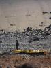
 Charles Harris at Punta Santo Tomas
Taken on 2007-10-12 .
Links to related images: Date. Proofs. Map. Story.
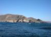
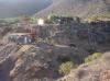
 El Puerto, the town on Punta Santo Tomas
Taken on 2007-10-12 .
Links to related images: Date. Proofs. Map. Story.
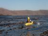
 Charles Harris doing the seal launch off Punta Santo Tomas
Taken on 2007-10-12 .
Links to related images: Date. Proofs. Map. Story.
 Gregg Berman doing the seal launch off Punta Santo Tomas
Taken on 2007-10-12 .
Links to related images: Date. Proofs. Map. Story.
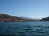 The town of La Bocana viewed from the sea
Taken on 2007-10-12 .
Links to related images: Date. Proofs. Map. Story.

 Charles Harris in calm water
Taken on 2007-10-11 .
Links to related images: Date. Proofs. Map. Story.
 Old freighter anchored offshore
Taken on 2007-10-11 .
Links to related images: Date. Proofs. Map. Story.
 Diver down, no-one on board
Taken on 2007-10-11 .
Links to related images: Date. Proofs. Map. Story.
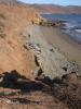
 Coastline too rough to camp here
Taken on 2007-10-11 .
Links to related images: Date. Proofs. Map. Story.
 Charles Harris in a kelp bed
Taken on 2007-10-11 .
Links to related images: Date. Proofs. Map. Story.
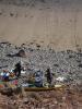
 Campsite on Punta Santo Tomas
Taken on 2007-10-11 .
Links to related images: Date. Proofs. Map. Story.
 Gregg Berman at Punta Santo Tomas
Taken on 2007-10-11 .
Links to related images: Date. Proofs. Map. Story.
 Charles Harris and Gregg Berman at Punta Santo Tomas
Taken on 2007-10-11 .
Links to related images: Date. Proofs. Map. Story.
 El Puerto, the town on Punta Santo Tomas
Taken on 2007-10-11 .
Links to related images: Date. Proofs. Map. Story.
All text and images Copyright © 2007 by Mike Higgins / contact