The following images were all taken near the same location, ~37.841869354248/122.556343078613:
Click on the small images to see the full-sized ones.
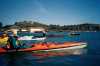
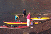
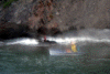
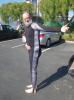 The intrepid kayaker showing off his new custom dive skin
Taken on 2011-09-29 .
Links to related images: Date. Proofs. Map.

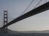
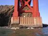
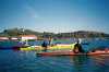
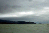
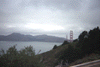
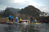
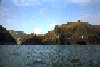
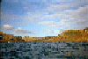
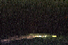
 Heading back through the Golden Gate
Taken on 2009-09-7 .
Links to related images: Date. Proofs. Map.


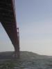
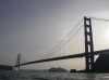
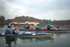
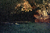
 Sailing under the Golden Gate Bridge and into the fog
Taken on 2009-09-6 .
Links to related images: Date. Proofs. Map. Story.
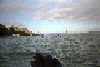
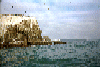
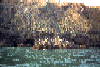
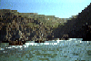
 Passing Point Bonita
Taken on 2009-09-6 .
Links to related images: Date. Proofs. Map. Story.
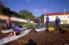
 Thurseve Paddlers landed at Kirby Cove
Taken on 2008-10-16 .
Links to related images: Date. Proofs. Map. Story.

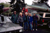
 Thurseve Paddlers Partying at Kirby Cove
Taken on 2008-10-16 .
Links to related images: Date. Proofs. Map. Story.


 John Boeschen apparently partied too much at Kirby Cove
Taken on 2008-10-16 .
Links to related images: Date. Proofs. Map. Story.
 Don Fleming and Rich going under the Golden Gate Bridge
Taken on 2008-02-16 .
Links to related images: Date. Proofs. Map. Story.
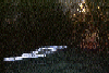
 Proof that I went under the Golden Gate Bridge
Taken on 2008-02-16 .
Links to related images: Date. Proofs. Map. Story.

 Fred Cooper rounding Lime Point and passing the North Tower
Taken on 2008-02-16 .
Links to related images: Date. Proofs. Map. Story.

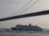
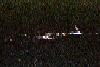
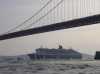 The Queen Mary 2 passes under the Golden Gate Bridge
Taken on 2007-02-4 .
Links to related images: Date. Proofs. Map. Story.
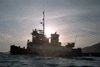
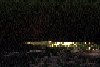
 The fire ship precedes the Queen Mary 2 passes under the Golden Gate Bridge
Taken on 2007-02-4 .
Links to related images: Date. Proofs. Map. Story.

 The Queen Mary 2 passes under the Golden Gate Bridge
Taken on 2007-02-4 .
Links to related images: Date. Proofs. Map. Story.
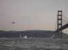 A Coast Guard Helicoptor approaches the Golden Gate Bridge
Taken on 2007-02-4 .
Links to related images: Date. Proofs. Map. Story.

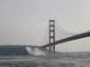
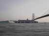
 A cargo ship exits under the Golden Gate Bridge
Taken on 2007-02-4 .
Links to related images: Date. Proofs. Map. Story.
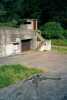
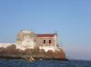
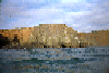
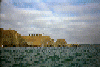
 The bunker at Kirby Cove
Taken on 2002-04-27 .
Links to related images: Date. Proofs. Map. Story.
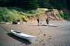
 Bo Barnes and my kayak ready to launch at Kirby Cove
Taken on 2002-04-27 .
Links to related images: Date. Proofs. Map. Story.
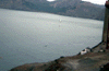
 Maryly Snow paddling from Horseshoe Cove
Taken on 2000-12-30 .
Links to related images: Date. Proofs. Map.
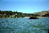
 Horseshoe Bay is a popular place to start and end kayak trips.
Taken on 1999-01-31 .
Links to related images: Date. Proofs. Map. Story.
 Loading up kayaks in Marin, loading up on food in San Diego, trying to remember
Taken on 1998-04-4 .
Links to related images: Date. Proofs. Map.
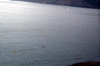
 fuzzy view south
Taken on 1997-10-1 .
Links to related images: Date. Proofs. Map. Story.
 Ocean Beach
Taken on 1997-10-1 .
Links to related images: Date. Proofs. Map. Story.
 fireboat u/bridge
Taken on 1997-10-1 .
Links to related images: Date. Proofs. Map. Story.
 Fireboat
Taken on 1997-10-1 .
Links to related images: Date. Proofs. Map. Story.
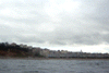
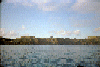
 SF Bridge
Taken on 1997-10-1 .
Links to related images: Date. Proofs. Map. Story.
 Me out bridge
Taken on 1997-10-1 .
Links to related images: Date. Proofs. Map. Story.
 Me ouside GGBr
Taken on 1997-10-1 .
Links to related images: Date. Proofs. Map. Story.
 Base of Bridge
Taken on 1997-10-1 .
Links to related images: Date. Proofs. Map. Story.
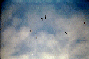
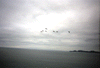 Pelikins over bay
Taken on 1997-10-1 .
Links to related images: Date. Proofs. Map. Story.
 Fireboat u/Bridge
Taken on 1997-10-1 .
Links to related images: Date. Proofs. Map. Story.
 Fireboat at Bridge
Taken on 1997-10-1 .
Links to related images: Date. Proofs. Map. Story.
 Fireboat
Taken on 1997-10-1 .
Links to related images: Date. Proofs. Map. Story.
 Fireboat b/trees
Taken on 1997-10-1 .
Links to related images: Date. Proofs. Map. Story.
 City b/Bridge
Taken on 1997-10-1 .
Links to related images: Date. Proofs. Map. Story.
 out horseshoe cove
Taken on 1997-10-1 .
Links to related images: Date. Proofs. Map. Story.

 packing for trip
Taken on 1997-10-1 .
Links to related images: Date. Proofs. Map. Story.
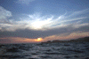 Sun setting over Point Bonita from China Beach.
Taken on 1997-05-21 .
Links to related images: Date. Proofs. Map. Story.
 Jamie and Peter at China Beach with Point Bonita sunset behind them.
Taken on 1997-05-21 .
Links to related images: Date. Proofs. Map. Story.
 Tug boat passing China Beach near sunset
Taken on 1997-05-21 .
Links to related images: Date. Proofs. Map. Story.
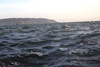 Choppy water off China Beach, Lands end visible.
Taken on 1997-05-21 .
Links to related images: Date. Proofs. Map. Story.
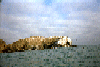
 China Beach, San Francisco.
Taken on 1997-05-21 .
Links to related images: Date. Proofs. Map. Story.
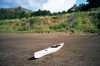
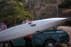 John Reed's ductape patch job on his kayak
Taken on 1997-05-11 .
Links to related images: Date. Proofs. Map. Story.
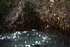
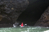 john in cave
Taken on 1997-05-11 .
Links to related images: Date. Proofs. Map. Story.
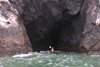
 another cave
Taken on 1997-05-11 .
Links to related images: Date. Proofs. Map. Story.
 jamie in a cave
Taken on 1997-05-11 .
Links to related images: Date. Proofs. Map. Story.
 fuzzy picture
Taken on 1997-05-11 .
Links to related images: Date. Proofs. Map. Story.
 Suiting up at Horseshoe cove
Taken on 1996-01-1 .
Links to related images: Date. Proofs. Map.
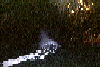
 Crossing horseshoe cove
Taken on 1996-01-1 .
Links to related images: Date. Proofs. Map.
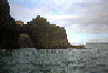
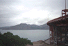
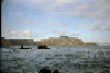
 The Golden Gate Bridge comes into view past the Boinita Lighthouse.
Taken on ~1994 .
Links to related images: Date. Proofs. Map.
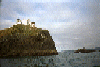
 Aproaching the Bonita Point Lighthouse.
Taken on ~1994 .
Links to related images: Date. Proofs. Map.
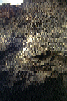
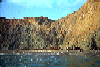
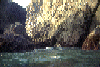
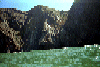
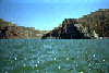
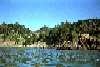
 Caves in the clifs south of Bird Rock.
Taken on ~1994 .
Links to related images: Date. Proofs. Map.
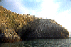
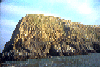
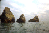
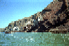
 Bird Rock near Rodeo Beach, viewed from the south.
Taken on ~1994 .
Links to related images: Date. Proofs. Map.
 Aproaching the Bonita Point Lighthouse.
Taken on ~1994 .
Links to related images: Date. Proofs. Map.
 Approaching Bird Rock near Rodeo Beach.
Taken on ~1994 .
Links to related images: Date. Proofs. Map.
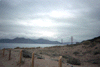
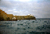
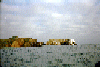
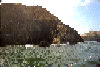
 Rodeo Beach, south end.
Taken on ~1994 .
Links to related images: Date. Proofs. Map.
 A small cave throuh Bird rock.
Taken on ~1994 .
Links to related images: Date. Proofs. Map.
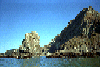
 Lighthouse through large Bird Rock Cave.
Taken on ~1994 .
Links to related images: Date. Proofs. Map.
 Large cave in Bird Rock.
Taken on ~1994 .
Links to related images: Date. Proofs. Map.
 Tip of bird rock viewed from south.
Taken on ~1994 .
Links to related images: Date. Proofs. Map.
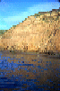 Reflections of cliff in water near Rodeo Beach.
Taken on ~1994 .
Links to related images: Date. Proofs. Map.
 Rodeo beach viewed from behind Bird Rock.
Taken on ~1994 .
Links to related images: Date. Proofs. Map.
 Small grotto behind Bird Rock.
Taken on ~1994 .
Links to related images: Date. Proofs. Map.
 Pelicans flying overhead.
Taken on ~1994 .
Links to related images: Date. Proofs. Map.
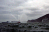
 A mist-breathing dragon: A blowhole in the cliff.
Taken on ~1994 .
Links to related images: Date. Proofs. Map.
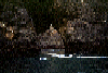
 Inside a dark cave near Rodeo Beach.
Taken on ~1994 .
Links to related images: Date. Proofs. Map.
 Mouth of a large cave near Rodeo Beach with nesting cormerants.
Taken on ~1994 .
Links to related images: Date. Proofs. Map.
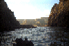
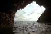
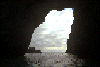
 Sunlight falling inside the large cave near Rodeo Beach.
Taken on ~1994 .
Links to related images: Date. Proofs. Map.
 looking out the large cave near Rodeo Beach.
Taken on ~1994 .
Links to related images: Date. Proofs. Map.
 Sunlight falling inside the large cave near Rodeo Beach.
Taken on ~1994 .
Links to related images: Date. Proofs. Map.
 Reflected light inside the big cave near Rodeo Beach.
Taken on ~1994 .
Links to related images: Date. Proofs. Map.
 Entrance to the big cave near Rodeo Beach.
Taken on ~1994 .
Links to related images: Date. Proofs. Map.
 Pelicans on rocks near Bonita Point:
Taken on ~1994 .
Links to related images: Date. Proofs. Map.
 Scrap iron is all that remains near Point Bonita of this wrecked ship.
Taken on ~1994 .
Links to related images: Date. Proofs. Map.
 Pelicans on rocks near Bonita Point:
Taken on ~1994 .
Links to related images: Date. Proofs. Map.
 Arches under the Bonita Lighthouse:
Taken on ~1994 .
Links to related images: Date. Proofs. Map.

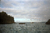
 Rounding Point Bonita to see inside The Bay.
Taken on ~1994 .
Links to related images: Date. Proofs. Map.
 Rocky shoreline north of Rodeo Beach
Taken on ~1994 .
Links to related images: Date. Proofs. Map. Story.
 Tennessee Cove
Taken on ~1994 .
Links to related images: Date. Proofs. Map. Story.
 Looking ahead past Rodeo Beach
Taken on ~1994 .
Links to related images: Date. Proofs. Map. Story.
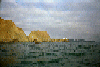
 White rocks south of Muir Beach
Taken on ~1994 .
Links to related images: Date. Proofs. Map. Story.
 Could this be Pirates Cove?
Taken on ~1994 .
Links to related images: Date. Proofs. Map. Story.
 Nearshore rock south of Muir Beach
Taken on ~1994 .
Links to related images: Date. Proofs. Map. Story.
 Looking back at Muir Beach
Taken on ~1994 .
Links to related images: Date. Proofs. Map. Story.
 Houses on the hill north of Muir Beach
Taken on ~1994 .
Links to related images: Date. Proofs. Map. Story.
 I went on a trip initiated by Jamie Morgan to try (unsucessfully) to
catch an e
I went on a trip initiated by Jamie Morgan to try (unsucessfully) to
catch an e
Taken on ~1994 .
Links to related images: Date. Proofs. Map.
All text and images Copyright © by Mike Higgins / contact