The following images were all taken near the same location, ~40.0775451660156/124.087829589844:
Click on the small images to see the full-sized ones.
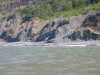
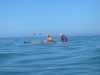
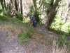
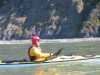 Fred Cooper heading home from Big Flat
Taken on 2005-09-5 .
Links to related images: Date. Proofs. Map. Story.
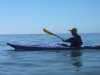
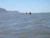
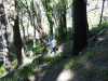
 Dörte Mann and Dave Littlejohn heading home from Big Flat
Taken on 2005-09-5 .
Links to related images: Date. Proofs. Map. Story.
 Waterfall creek onto the beach on the Lost Coast Trail
Taken on 2005-09-5 .
Links to related images: Date. Proofs. Map. Story.
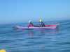
 We paddle past Kate DesLauriers and Antrea Wolf on the Lost Coast Trail
Taken on 2005-09-5 .
Links to related images: Date. Proofs. Story.
 Dave Littlejohn and Dörte Mann approaching Delgada Point
Taken on 2005-09-5 .
Links to related images: Date. Proofs. Map. Story.
 We pass the Lost Coast Trail put-in near Shelter Cove
Taken on 2005-09-5 .
Links to related images: Date. Proofs. Map. Story.
 Fred Cooper and Lucy O'Brien out of her boat for a break at Delgada Point
Taken on 2005-09-5 .
Links to related images: Date. Proofs. Map. Story.
 The first rock of rocky Delgada Point
Taken on 2005-09-5 .
Links to related images: Date. Proofs. Map. Story.
 The Cape Mendocino Lighthouse on the end of Point Delgada
Taken on 2005-09-5 .
Links to related images: Date. Proofs. Map. Story.
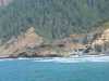
 Cheated Death Again! Everyone safely landed for fish and chips at the Shelter Cove Deli
Taken on 2005-09-5 .
Links to related images: Date. Proofs. Map. Story.
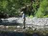
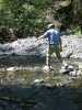
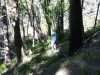
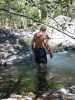
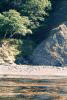
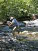 Fred Cooper crosses Big Flat Creek without getting wet
Taken on 2005-09-4 .
Links to related images: Date. Proofs. Map. Story.
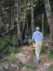
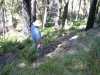
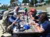
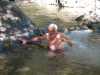
 Fred Cooper, Don Fleming and I go for a walk up Big Flat Creek
Taken on 2005-09-4 .
Links to related images: Date. Proofs. Map. Story.
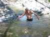
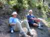
 Fred Cooper, Don Fleming and I go skinny dipping in Big Flat Creek
Taken on 2005-09-4 .
Links to related images: Date. Proofs. Map. Story.
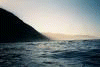
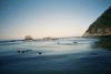
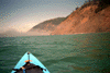
 The morning light makes it difficult to photograph the shore!
Taken on 2000-08-16 .
Links to related images: Date. Proofs. Map. Story.
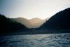
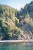
 Inviting tree lined valley behind beach
Taken on 2000-08-16 .
Links to related images: Date. Proofs. Map. Story.
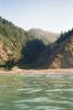
 Tree topped cliffs
Taken on 2000-08-16 .
Links to related images: Date. Proofs. Map. Story.
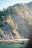
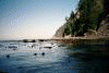
 Calm water and kelp in front of Lost Coast forest
Taken on 2000-08-16 .
Links to related images: Date. Proofs. Map. Story.
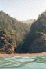
 The water mysteriously calms down inshore from the underwater Delgada Canyon.
Taken on 2000-08-16 .
Links to related images: Date. Proofs. Map. Story.
 Glimse of a waterfall on the cliff
Taken on 2000-08-16 .
Links to related images: Date. Proofs. Map. Story.
 The water mysteriously calms down inshore from the underwater Delgada Canyon.
Taken on 2000-08-16 .
Links to related images: Date. Proofs. Map. Story.


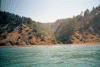
 The shore is calm behind the canyon, then gets rough again at the next point.
Taken on 2000-08-16 .
Links to related images: Date. Proofs. Map. Story.
 Inviting tree lined valley behind beach
Taken on 2000-08-16 .
Links to related images: Date. Proofs. Map. Story.
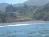
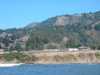
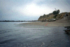
 The start of civilization again, houses behind the beach
Taken on 2000-08-16 .
Links to related images: Date. Proofs. Map. Story.
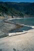
 A safe landing at the end of the expedition in the shelter of Shelter Cove.
Taken on 2000-08-16 .
Links to related images: Date. Proofs. Map. Story.
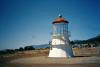
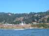
 In down-town Shelter Cove I find the new home of the Mendocino Point Lighthouse
Taken on 2000-08-16 .
Links to related images: Date. Proofs. Map. Story.
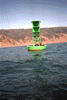 E over buoy
Taken on 1997-07-4 .
Links to related images: Date. Proofs. Map.
 v S over buoy
Taken on 1997-07-4 .
Links to related images: Date. Proofs. Map.
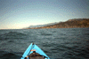 view back Shel Cove
Taken on 1997-07-4 .
Links to related images: Date. Proofs. Map.
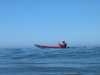
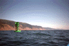
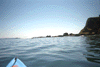
 far from shore
Taken on 1997-07-4 .
Links to related images: Date. Proofs. Map.
 Shelter breakwater
Taken on 1997-07-4 .
Links to related images: Date. Proofs. Map.
 Shelter Boat Ramp
Taken on 1997-07-4 .
Links to related images: Date. Proofs. Map.
 tents near beach
Taken on 1997-07-4 .
Links to related images: Date. Proofs. Map.
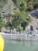
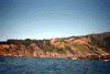
 rock close to shore
Taken on 1997-07-4 .
Links to related images: Date. Proofs. Map.
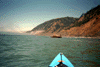
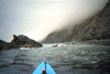
 The fog clearing on the way to Shelter Cove
Taken on 1997-07-4 .
Links to related images: Date. Proofs. Map.
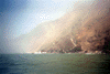
 Chasing fog bank N
Taken on 1997-07-4 .
Links to related images: Date. Proofs. Map.
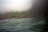
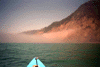
 foggy sunlight
Taken on 1997-07-4 .
Links to related images: Date. Proofs. Map.
 Dead Bird
Taken on 1997-07-4 .
Links to related images: Date. Proofs. Map.
All text and images Copyright © 1997 by Mike Higgins / contact