![]()
![]()
![]()
![]()
![]()
![]()
To my great and pleasant surprise the swells at sea calmed down to 3 feet this morning. I decided to run out to a local beach and take advantage of it before the big swells from the next storm came in. I went to Russian Gulch Beach with the plan of going as far as Goat Rock if the weather held out. The sky was full of high wispy clouds that combined into a more solid layer as I started out.
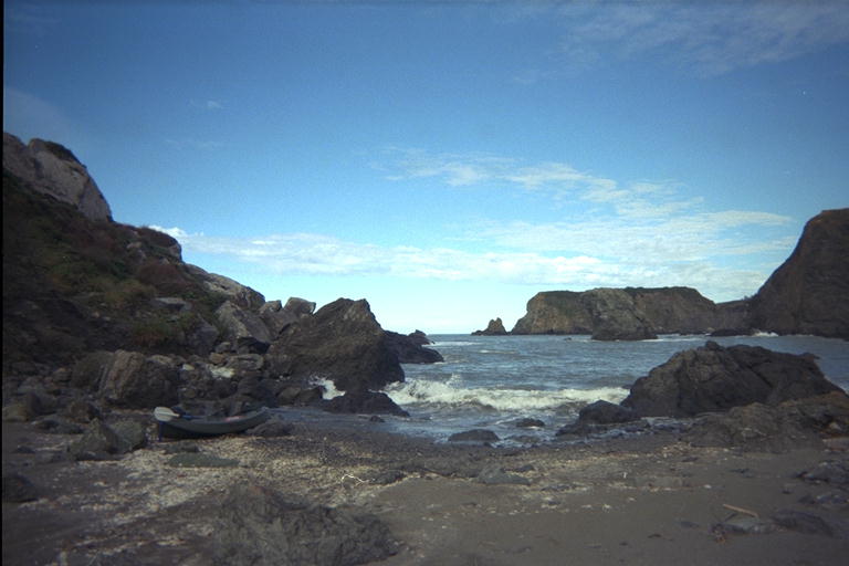
I slid my kayak down the slippery muddy trail from the parking lot. This years storms have knocked a tree down across the trail, but the kayak slid under it and I stepped around the base. I expect the trail will just swerve a few meters around this obstacle, so there is no reason for me to come back and do any trail maintenance here. The creek was full from the recent rains and I drifted half way down the wash where I normally carry the kayak. I towed it through the shallow running water the rest of the way to the sand dune and slid it over the sand to the sea without having to carry it at all this trip! The waves were as low as promised, and I made it out to sea with no problems.
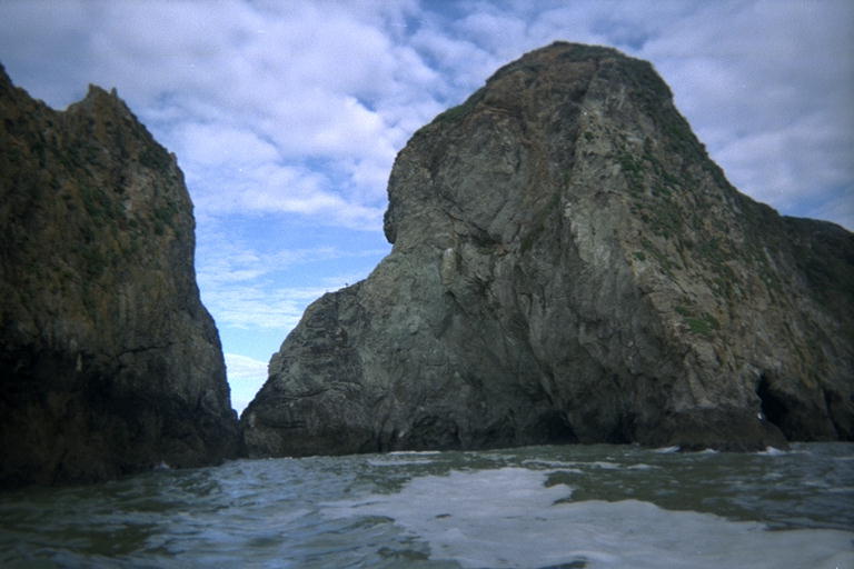
I've decided that there is no way to really predict what the waves will do. (I suppose this is an important lesson to learn well if you spend time in the ocean). Even though the swells were only 3 feet tall (smooth as glass), the waves rose up and broke viciously onto some of the points and discouraged me from getting too close. There is a little cave/arch that I have been through before, but even with the mild waves today I couldn't consider it this time. I suppose that the depth of the tide and the angle that the waves strike the shore enters into the formula for this. I found the crack behind a rock where I got in trouble once before and it was too rough to consider. I found a pair of cracks that I have safely been through several times. These two cracks meet at a small beach in the inside corner of a big rock, but the tide was so high there was no beach. Without the beach, the crack on the south side looked so wide I paddled in anyway and looked around the corner. I probably could have paddle all the way through, but there will be other times.
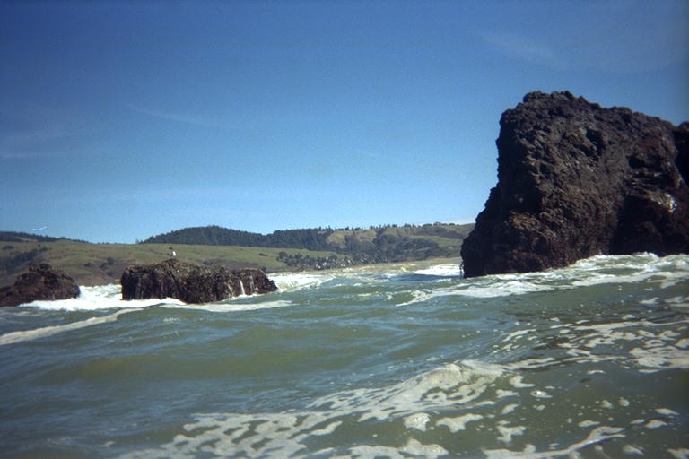
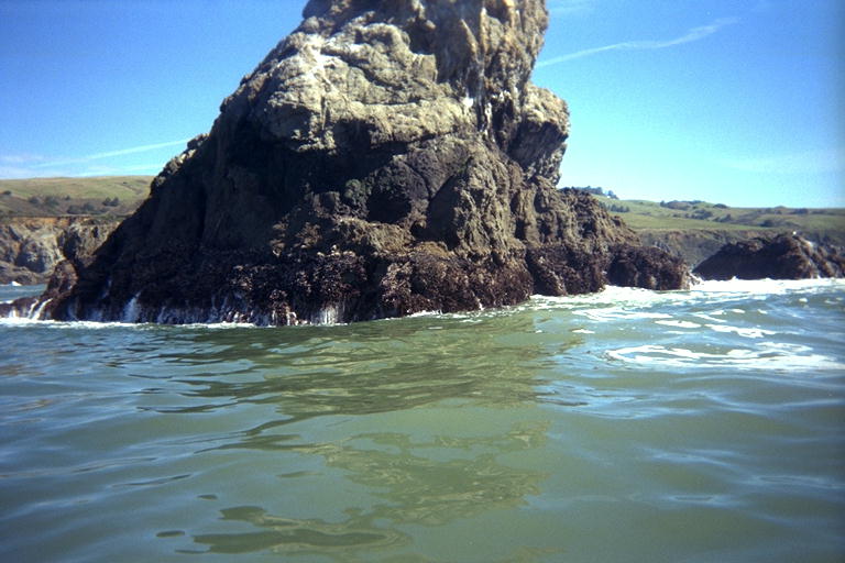
One of the little coves along here has a rock in it that looks like a big bear sitting in the water and staring out to sea. The south side of this cove has a point that is a group of rocks separated by a short spit of sand from the shore. I landed here and slid the kayak across the spit instead of going around to the next cove. That cove was sheltered on it's southern edge by a group of separate off-shore rocks. The waves were breaking violently around the outer few of these rocks, and I would have to go way out and around them to avoid this. Instead I watched the inner-most rock and the water between it and the cliff. When a really big wave came, it wrapped around the rock and created two breakers that smashed into each other. I figured if the worst happened and I got knocked out of the kayak by this "haystack", at least the breakers wouldn't push me anywhere afterwards. But I timed it very well and zoomed through that spot without any trouble.
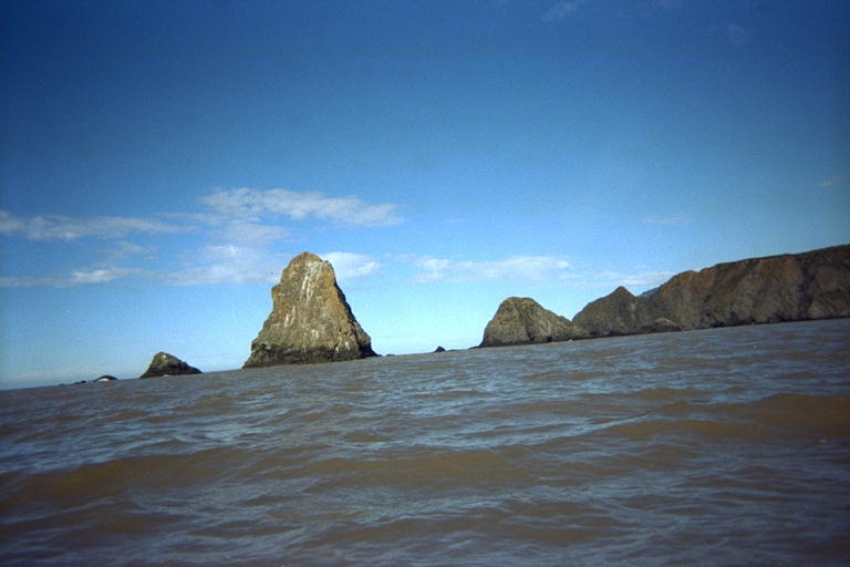
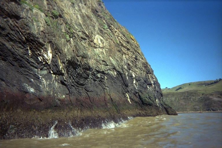
When I turned left around that point, I found myself in the thick of the rock garden just north of the mouth of the Russian River. The river was dumping large amounts of muddy water into the ocean, and all the water I had been in so far had been a little muddy. But here was the straight stuff which was a much more opaque brown. I also discovered that I had turned straight into the face of the river current. The river was coming out at an angle and running along the shore, then fanning out to sea between all the rocks in my rock garden. As I paddled through here I could feel the vector field of the current flow changing direction from place to place under me. I went around the big rock that has a bunch of caves through it, and managed to resist trying to go through these very small caves. Then I went around the biggest rock off shore from the mouth of the river, the one that has a little tetrahedral framed device mounted on it. My dad says that this used to be the attachment point for a cable to load "dog-hole-schooners" right here on the mouth of the Russian River. But it looks too new to me to be part of one of those. I discovered that the strongest part of the river current seemed to be on the north side of this rock, and had to work hard to paddle around the shoreward side of the rock. Then I let the current sweep me out to sea while I paddled farther south.
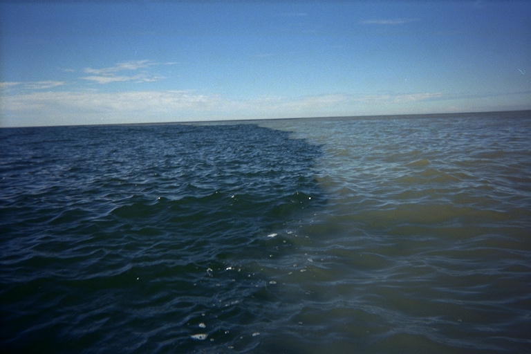
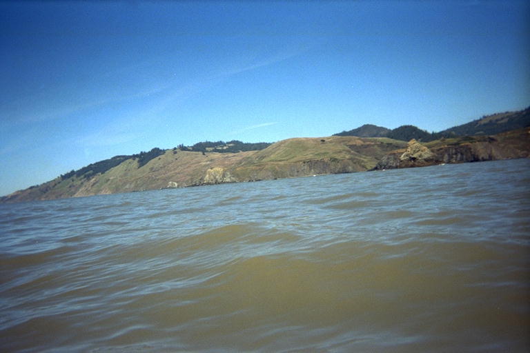
Driving by this morning I had seen that the brown stain from the river curved out from Goat Rock and left everything south of that a dark green color. Some of the rocks I passed had a trail of dark green behind them where their turbulence pulled cleaner water up from below. From the tops of the highest swells, I could see the horizon was made of darker green water. Just after I passed Goat Rock heading south, I came to the border of the dirty brown water. The edge between the two colors was amazingly sharp! Even though the surface of the ocean was choppy, the two colors of water did not mix at the boundary. It looked as if the cleaner water came up over the top edge of the muddy water and went down under it as well. Perhaps there was only a 20 or 30 cm layer of brown water. The edge of the muddy water had a cloud-like shape, as dark and solid looking as a swarm of jelly fish or collections of fresh-water algae threads. But if I stuck my paddle in the boundary and stirred it up, the two colors would mix and fade into each other.
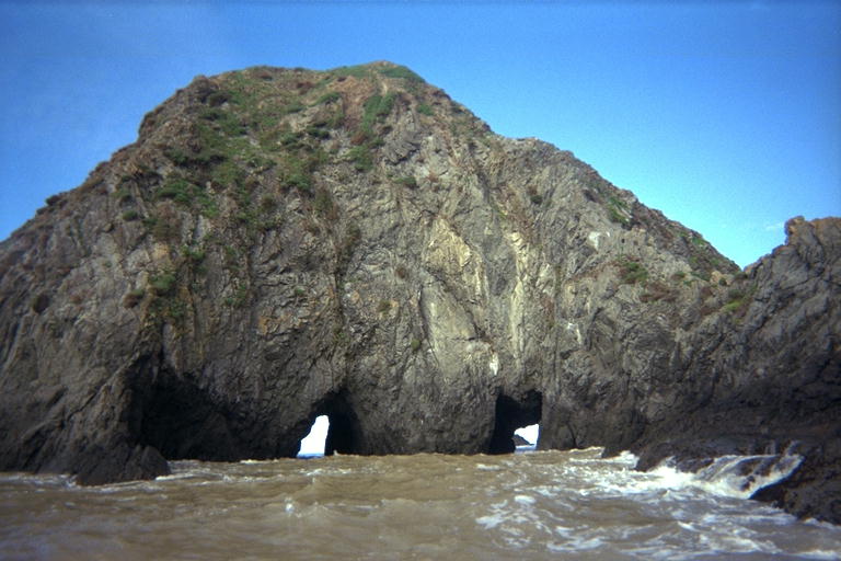
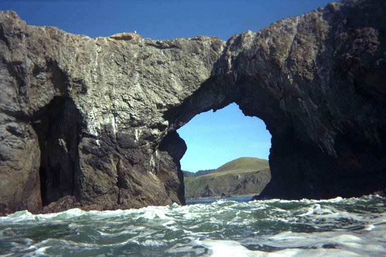
Of course, there's no way that I can get within several kilometers of the arched rock at Goat Rock Beach without paddling through it. It was rougher inside than I expected from 3 foot swells, but I took my time and enjoyed it. There was no real danger of being dumped over by the waves, but probably a lot of danger of me falling out while twisting around to take some pictures. I just went through it once, east to west, and then turned north back towards Russian Gulch.
I followed the edge of the muddy water for a while, then turned into it to go visit the farthest out group of rocks in this neighborhood, about a kilometer from shore. I'm not sure if I have ever visited them before, since they are too far from anything else around here that I want to see. Then I turned and headed back towards the rock garden to go north along the shore. But the current from the river was so strong, even diluted out into a big fan of muddy water this far from shore, that it pushed me back out to sea. Instead of approaching some interesting rocks to paddle behind, my path was bent until I was just crabbing along parallel to shore. I was never in any danger of being washed out to sea, it was just easier to let the current keep me off-shore than to fight my way closer. I made good time and managed to get back close to shore as I passed the last big rock before Russian Gulch Beach.
Approaching Russian Gulch from out to sea like this, it was easy to see how I had missed it in the dusk late one evening last year. The beach faces farther north than I though, so I was approaching it practically on edge. The whole beach was hidden behind a rock that blended into the rocks on the extreme other end of the beach. And this time, since my morning clouds had burned away, it was a bright sunny day around noon. There is another, smaller, inaccessible beach just north of Russian Gulch beach. This gives the illusion that you are looking at a small cove with one inaccessible beach on it. I was also surprised to notice, from the vantage point of 1 kilometer away, how short the section of shore between Russian Gulch and the Russian River really is. When you are traveling in and out of every fractal nook and cranny, it is a much longer stretch of shoreline. Then on the trip back going in straight lines the beach came by long before I expected it and I missed it on that evening trip. This trip I had time to study the shore, construct and discard several hypotheses about which point was the one I wanted. I recognized the rock in front of my favorite abalone diving spot, that's WAY too far north. I recognized the point that my brother Paul and I failed to find any abalone behind, and that is just north of the beach. But just south of this, I recognized a dike that extents between the cliff and a rocky point that I know is one cove too far south! I reasoned that Russian Gulch must be between these two points, and sure enough that is where I found it.
I approached the beach with some trepidation. After all the rough waves around rocks, I feared that the swells had gotten worse than when I left. But either they had not, or I timed my approach well and missed the biggest waves. By bracing my paddle behind me, I managed to just keep the kayak from falling over the edge of a breaking wave. But I was far enough over the edge to be pulled along by the wave and was given a safe and smooth ride way up onto the sandy beach.