The following images were all taken near the same location, ~37.9702606201172/122.790725708008:
Click on the small images to see the full-sized ones.


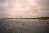
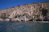
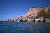
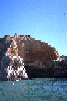
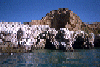
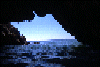
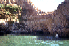
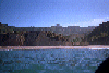
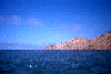
 Arches in Point Resistance
Taken on 2008-10-18 .
Links to related images: Date. Proofs. Map. Story.
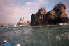
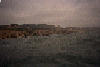
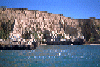
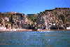
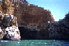
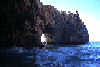
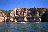
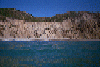
 Looking north out of Point Resistance
Taken on 2008-10-18 .
Links to related images: Date. Proofs. Map. Story.
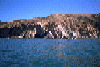
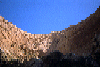
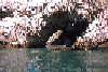
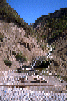
 Hikers looking down from Arched Rock
Taken on 2008-10-18 .
Links to related images: Date. Proofs. Map. Story.

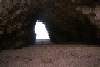
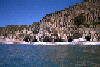
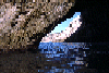
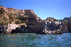
 Small arch in the Sculptured Coast
Taken on 2008-10-18 .
Links to related images: Date. Proofs. Map. Story.
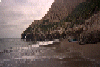
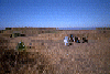
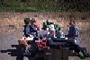
 A picnic lunch on the beach at Miller Point.
Taken on 1998-06-21 .
Links to related images: Date. Proofs. Map. Story.
 We go for a walk from Miller Point towards Alamere Falls.
Taken on 1998-06-21 .
Links to related images: Date. Proofs. Map. Story.

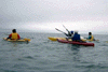
 Great lengths to avoid getting their feet wet aroud a point.
Taken on 1998-06-21 .
Links to related images: Date. Proofs. Map. Story.
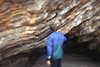
 Beautiful arch near Alamere Falls.
Taken on 1998-06-21 .
Links to related images: Date. Proofs. Map. Story.
 We go for a walk from Miller Point towards Alamere Falls.
Taken on 1998-06-21 .
Links to related images: Date. Proofs. Map. Story.
 Landed near Resistance Point
Taken on 1998-06-21 .
Links to related images: Date. Proofs. Map. Story.
 Altamere Falls, and a group of friends hiking up the beach to see the
falls, the
Altamere Falls, and a group of friends hiking up the beach to see the
falls, the
Taken on 1998-06-21 .
Links to related images: Date. Proofs. Map. Story.
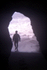 Paul MacIntire entering the Secret Cave
Taken on 1998-03-8 .
Links to related images: Date. Proofs. Map. Story.
 Roger Lamb invenstigating the geology of Miller Point
Taken on 1998-03-8 .
Links to related images: Date. Proofs. Map. Story.
 Flowers on the cliff at Miller Point
Taken on 1998-03-8 .
Links to related images: Date. Proofs. Map. Story.
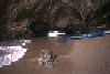
 Kip and I landed in the Sculptured Beach area
Taken on 1998-03-8 .
Links to related images: Date. Proofs. Map. Story.
 Joan leading kayakers away from nesting birds on Point Resistance
Taken on 1998-03-8 .
Links to related images: Date. Proofs. Map. Story.
 The creek at the south end of Limantour Beach
Taken on 1996-06-17 .
Links to related images: Date. Proofs. Map. Story.
 Through the cave south of Resistance Point
Taken on 1996-06-17 .
Links to related images: Date. Proofs. Map. Story.
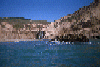
 Landing behind Resistance Point
Taken on 1996-06-17 .
Links to related images: Date. Proofs. Map. Story.
 Wildcat Beach after a sucessful launch
Taken on 1996-06-17 .
Links to related images: Date. Proofs. Map. Story.
 Dead bird on WIldcat Beach
Taken on 1996-06-17 .
Links to related images: Date. Proofs. Map. Story.
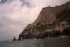
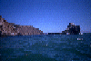
 Steep cliffs near Wildcat Beach
Taken on 1996-06-16 .
Links to related images: Date. Proofs. Map. Story.
 Approaching Wildcat Beach
Taken on 1996-06-16 .
Links to related images: Date. Proofs. Map. Story.
 Offshore rocks at Miller Point
Taken on 1996-06-16 .
Links to related images: Date. Proofs. Map. Story.
 The creek that carved Arched Rock?
Taken on 1996-06-16 .
Links to related images: Date. Proofs. Map. Story.
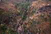
 The view south from on top of Arched Rock
Taken on 1996-06-16 .
Links to related images: Date. Proofs. Map. Story.
 The view north from on top of Arched Rock
Taken on 1996-06-16 .
Links to related images: Date. Proofs. Map. Story.
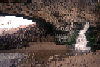 Water flowing through Arched Rock
Taken on 1996-06-16 .
Links to related images: Date. Proofs. Map. Story.
 The beach just north of Arched Rock
Taken on 1996-06-16 .
Links to related images: Date. Proofs. Map. Story.
 The Sculptured Coast near the Secret Cave
Taken on 1996-06-16 .
Links to related images: Date. Proofs. Map. Story.
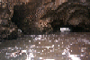
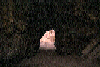
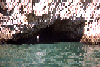
 looking up from inside the Secret Cave
Taken on 1996-06-16 .
Links to related images: Date. Proofs. Map. Story.
 Looking back at the Sculptured Coast
Taken on 1996-06-16 .
Links to related images: Date. Proofs. Map. Story.
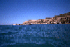
 Limantour Beach
Taken on 1996-06-16 .
Links to related images: Date. Proofs. Map. Story.
 Looking out of the Secret Cave
Taken on 1996-06-16 .
Links to related images: Date. Proofs. Map. Story.
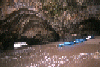
 Looking into the Secret Cave
Taken on 1996-06-16 .
Links to related images: Date. Proofs. Map. Story.
 Landed on a remote section of the Sculptured Coast
Taken on 1996-06-16 .
Links to related images: Date. Proofs. Map. Story.

 The Scupltured Cliffs near Limantour Beach
Taken on 1995-08-28 .
Links to related images: Date. Proofs. Map. Story.


 The Scupltured Cliffs south of Miller Point
Taken on 1995-08-28 .
Links to related images: Date. Proofs. Map. Story.
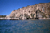
 Rocks off Point Resistance
Taken on 1995-08-28 .
Links to related images: Date. Proofs. Map. Story.
 Just south of Point Resistance
Taken on 1995-08-28 .
Links to related images: Date. Proofs. Map. Story.

 Miller Point
Taken on 1995-08-28 .
Links to related images: Date. Proofs. Map. Story.
 Rocks off Miller Point
Taken on 1995-08-28 .
Links to related images: Date. Proofs. Map. Story.
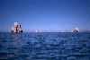
 Rocks off Double Point, you can see Point Reyes in the distance
Taken on 1995-08-28 .
Links to related images: Date. Proofs. Map. Story.
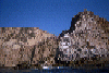
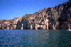 The Sculptured Coast
Taken on 1995-08-28 .
Links to related images: Date. Proofs. Map. Story.
 Approaching Double Point
Taken on 1995-08-28 .
Links to related images: Date. Proofs. Map. Story.
 Up at the cathedral of Resistance Point from inside
Taken on 1995-08-28 .
Links to related images: Date. Proofs. Map. Story.
 Looking into the center of Resistance Point
Taken on 1995-08-28 .
Links to related images: Date. Proofs. Map. Story.
 This is one arch I didn't go through, if you look carfully you
will see a gro
This is one arch I didn't go through, if you look carfully you
will see a gro
Taken on 1995-08-28 .
Links to related images: Date. Proofs. Map. Story.
 Looking into the center of Resistance Point
Taken on 1995-08-28 .
Links to related images: Date. Proofs. Map. Story.
 Up at the cathedral of Resistance Point from inside
Taken on 1995-08-28 .
Links to related images: Date. Proofs. Map. Story.
 Looking out between the south and north wing of Resistance Point
Taken on 1995-08-28 .
Links to related images: Date. Proofs. Map. Story.
 Looking out the big arch in the north wing of Resistance Point
Taken on 1995-08-28 .
Links to related images: Date. Proofs. Map. Story.
 Looking out to sea from the inside of Resistance Point
Taken on 1995-08-28 .
Links to related images: Date. Proofs. Map. Story.
 A second large arch in the south wing of Resistance Point
Taken on 1995-08-28 .
Links to related images: Date. Proofs. Map. Story.
 Looking into one of the bigger arches that leads into Resistance Point
Taken on 1995-08-28 .
Links to related images: Date. Proofs. Map. Story.
 Looking back through a small cave at Resistance Point
Taken on 1995-08-28 .
Links to related images: Date. Proofs. Map. Story.
 A small cave that goes through Resistance Point
Taken on 1995-08-28 .
Links to related images: Date. Proofs. Map. Story.

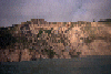
 Caves and arches just south of Resistance Point
Taken on 1995-08-28 .
Links to related images: Date. Proofs. Map. Story.
 Approaching Resistance Point from the south
Taken on 1995-08-28 .
Links to related images: Date. Proofs. Map. Story.
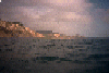
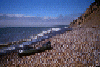
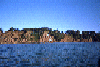
 Wildcat Beach in Point Reyes National Seashore
Taken on 1995-08-28 .
Links to related images: Date. Proofs. Map. Story.
 Marty et all setting up camp at Wildcat Beach Campground
Taken on 1995-08-28 .
Links to related images: Date. Proofs. Map. Story.
 The shrine on the gravel beach north of Bolinas
Taken on 1995-08-27 .
Links to related images: Date. Proofs. Map. Story.
 The gravel beach north of Bolinas
Taken on 1995-08-27 .
Links to related images: Date. Proofs. Map. Story.
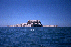
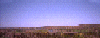
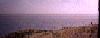
 Southern end of Point Reyes National Seashore
Taken on 1995-08-27 .
Links to related images: Date. Proofs. Map. Story.
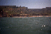
 Buildings above the bluff just south of Point Reyes National Seashore
Taken on 1995-08-27 .
Links to related images: Date. Proofs. Map. Story.
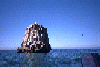
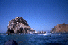
 Stormy Stack, off Double Point, Point Reyes National Seashore
Taken on 1995-08-27 .
Links to related images: Date. Proofs. Map. Story.
 Double Point, Point Reyes National Seashore
Taken on 1995-08-27 .
Links to related images: Date. Proofs. Map. Story.
 Rock off Double Point, Point Reyes National Seashore
Taken on 1995-08-27 .
Links to related images: Date. Proofs. Map. Story.
 Stormy Stack off Double Point ahead of me.
Taken on 1995-08-27 .
Links to related images: Date. Proofs. Map. Story.
 Altamere Falls, and a group of friends hiking up the beach to see the
falls, the
Altamere Falls, and a group of friends hiking up the beach to see the
falls, the
Taken on 1995-08-27 .
Links to related images: Date. Proofs. Map. Story.
 of the salt marsh behind the beach.
Taken on ~1994 .
Links to related images: Date. Proofs. Map.
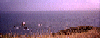
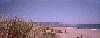 The trail starts out along the sandy beach.
Taken on ~1994 .
Links to related images: Date. Proofs. Map.
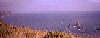
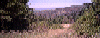 Then you follow the Coast Trail.
Taken on ~1994 .
Links to related images: Date. Proofs. Map.
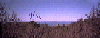
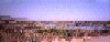
 Views back to Point Reyes.
Taken on ~1994 .
Links to related images: Date. Proofs. Map.
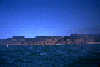
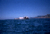
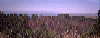
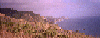
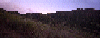 The last glimer of sunlight on the ridge above Wildcat.
Taken on ~1994 .
Links to related images: Date. Proofs. Map.
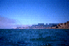
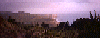
 Wildcat camp viewed from above as the sunlight fades.
Taken on ~1994 .
Links to related images: Date. Proofs. Map.
 Closer to Double Point, the lakes above Wildcat Camp can be seen.
Taken on ~1994 .
Links to related images: Date. Proofs. Map.
 These three pictures form a panoramic view from Double Point on the left
past t
These three pictures form a panoramic view from Double Point on the left
past t
Taken on ~1994 .
Links to related images: Date. Proofs. Map.
 of the salt marsh behind the beach.
Taken on ~1994 .
Links to related images: Date. Proofs. Map.
 These three pictures form a panoramic view from Double Point on the left
past t
These three pictures form a panoramic view from Double Point on the left
past t
Taken on ~1994 .
Links to related images: Date. Proofs. Map.
 A view forward to Double Point past Wildcat Camp.
Taken on ~1994 .
Links to related images: Date. Proofs. Map.
All text and images Copyright © by Mike Higgins / contact