The following images were all taken near the same location, ~40.0103912353516/124.034957885742:
Click on the small images to see the full-sized ones.
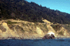
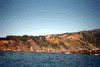
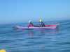 Dave Littlejohn and D—rte Mann approaching Delgada Point
Taken on 2005-09-5 .
Links to related images: Date. Proofs. Map. Story.
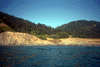
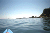
 We pass the Lost Coast Trail put-in near Shelter Cove
Taken on 2005-09-5 .
Links to related images: Date. Proofs. Map. Story.
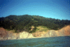
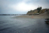
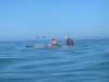 Fred Cooper and Lucy O'Brien out of her boat for a break at Delgada Point
Taken on 2005-09-5 .
Links to related images: Date. Proofs. Map. Story.
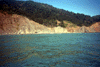
 The first rock of rocky Delgada Point
Taken on 2005-09-5 .
Links to related images: Date. Proofs. Map. Story.
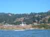
 The Cape Mendocino Lighthouse on the end of Point Delgada
Taken on 2005-09-5 .
Links to related images: Date. Proofs. Map. Story.
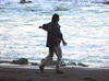
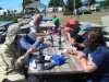 Cheated Death Again! Everyone safely landed for fish and chips at the Shelter Cove Deli
Taken on 2005-09-5 .
Links to related images: Date. Proofs. Map. Story.

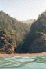
 The shore is calm behind the canyon, then gets rough again at the next point.
Taken on 2000-08-16 .
Links to related images: Date. Proofs. Map. Story.
 Inviting tree lined valley behind beach
Taken on 2000-08-16 .
Links to related images: Date. Proofs. Map. Story.
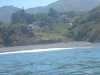
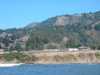
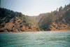
 The start of civilization again, houses behind the beach
Taken on 2000-08-16 .
Links to related images: Date. Proofs. Map. Story.
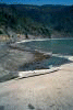
 A safe landing at the end of the expedition in the shelter of Shelter Cove.
Taken on 2000-08-16 .
Links to related images: Date. Proofs. Map. Story.
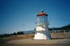
 In down-town Shelter Cove I find the new home of the Mendocino Point Lighthouse
Taken on 2000-08-16 .
Links to related images: Date. Proofs. Map. Story.
 On Saturday we paddled north past the Needle Rock Visitors Center but
made our
On Saturday we paddled north past the Needle Rock Visitors Center but
made our
Taken on 1998-10-12 .
Links to related images: Date. Proofs. Map. Story.
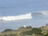 12 foot swell from the Gulf of Alaska broke far from shore.
Taken on 1997-10-5 .
Links to related images: Date. Proofs. Map. Story.
 I found a message in a bottle!
Taken on 1997-10-5 .
Links to related images: Date. Proofs. Map. Story.
 Several creeks flowed into the beach and disapeared into the sand. As the
water
Several creeks flowed into the beach and disapeared into the sand. As the
water
Taken on 1997-10-5 .
Links to related images: Date. Proofs. Map. Story.

 We went for a walk from one campground to another at low tide around sunset.
Taken on 1997-10-5 .
Links to related images: Date. Proofs. Map. Story.
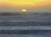
 Sami did a little dance to try and make a pelikin fly in front of the sunset
to
Sami did a little dance to try and make a pelikin fly in front of the sunset
to
Taken on 1997-10-5 .
Links to related images: Date. Proofs. Map. Story.
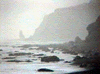
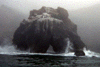
 Needle Rock viewed through several of its arches.
Taken on 1997-10-5 .
Links to related images: Date. Proofs. Map. Story.
 This tall thin rock was near our destination, the access to the next campground
Taken on 1997-10-5 .
Links to related images: Date. Proofs. Map. Story.
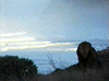
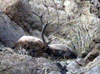 Everywhere we went we saw huge Roosevelt's elk, including these large intimidat
Taken on 1997-10-5 .
Links to related images: Date. Proofs. Map. Story.
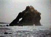 Needle Rock viewed through several of its arches.
Taken on 1997-10-5 .
Links to related images: Date. Proofs. Map. Story.
 This tall thin rock was near our destination, the access to the next campground
Taken on 1997-10-5 .
Links to related images: Date. Proofs. Map. Story.
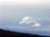 12 foot swell from the Gulf of Alaska broke far from shore.
Taken on 1997-10-5 .
Links to related images: Date. Proofs. Map. Story.
 View N of Needle
Taken on 1997-10-3 .
Links to related images: Date. Proofs. Map.
 Needle R Visitor Cntr
Taken on 1997-07-4 .
Links to related images: Date. Proofs. Map.
 cambround beach?
Taken on 1997-07-4 .
Links to related images: Date. Proofs. Map.
 campground cliff?
Taken on 1997-07-4 .
Links to related images: Date. Proofs. Map.
 campground beach?
Taken on 1997-07-4 .
Links to related images: Date. Proofs. Map.
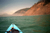
 cliffs
Taken on 1997-07-4 .
Links to related images: Date. Proofs. Map.
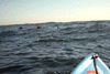 Dolphins!
Taken on 1997-07-4 .
Links to related images: Date. Proofs. Map.
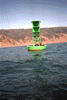 E over buoy
Taken on 1997-07-4 .
Links to related images: Date. Proofs. Map.
 v S over buoy
Taken on 1997-07-4 .
Links to related images: Date. Proofs. Map.
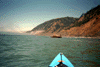
 view back Shel Cove
Taken on 1997-07-4 .
Links to related images: Date. Proofs. Map.
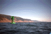
 far from shore
Taken on 1997-07-4 .
Links to related images: Date. Proofs. Map.
 Shelter breakwater
Taken on 1997-07-4 .
Links to related images: Date. Proofs. Map.
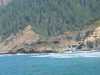
 Shelter Boat Ramp
Taken on 1997-07-4 .
Links to related images: Date. Proofs. Map.
 tents near beach
Taken on 1997-07-4 .
Links to related images: Date. Proofs. Map.
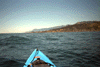
 rock close to shore
Taken on 1997-07-4 .
Links to related images: Date. Proofs. Map.
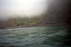
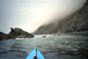
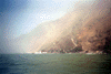
 The fog clearing on the way to Shelter Cove
Taken on 1997-07-4 .
Links to related images: Date. Proofs. Map.
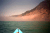 Chasing fog bank N
Taken on 1997-07-4 .
Links to related images: Date. Proofs. Map.
 foggy sunlight
Taken on 1997-07-4 .
Links to related images: Date. Proofs. Map.
 Dead Bird
Taken on 1997-07-4 .
Links to related images: Date. Proofs. Map.
 Needle Rock
Taken on 1997-07-4 .
Links to related images: Date. Proofs. Map.
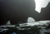 small arches
Taken on 1997-07-4 .
Links to related images: Date. Proofs. Map.
All text and images Copyright © 1997 by Mike Higgins / contact