The following images were all taken near the same location, ~40.3710060119629/124.378799438477:
Click on the small images to see the full-sized ones.
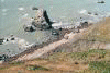
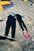
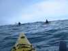 Everyone ready to paddle after launching from the Mattole River Beach
Taken on 2005-09-3 .
Links to related images: Date. Proofs. Map. Story.
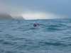
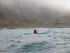
 Dörte Mann paddling south to Punta Gorda
Taken on 2005-09-3 .
Links to related images: Date. Proofs. Map. Story.
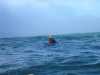
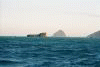
 Dave Littlejohn paddling south to Punta Gorda
Taken on 2005-09-3 .
Links to related images: Date. Proofs. Map. Story.
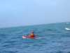 Don Fleming paddling south to Punta Gorda
Taken on 2005-09-3 .
Links to related images: Date. Proofs. Map. Story.
 Lucy O'Brien paddling south to Punta Gorda
Taken on 2005-09-3 .
Links to related images: Date. Proofs. Map. Story.
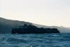
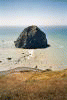
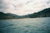
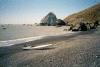
 Passing Steamboat Rock the next morning.
Taken on 2000-08-15 .
Links to related images: Date. Proofs. Map. Story.
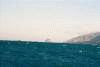
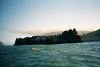
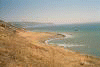
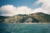
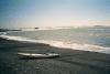
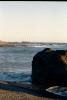
 The view back to Mendocino Point and ahead to Punta Gorda.
Taken on 2000-08-15 .
Links to related images: Date. Proofs. Map. Story.
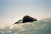
 On a walk around the point I see Seamboat rock, California sea lions and the li
Taken on 2000-08-14 .
Links to related images: Date. Proofs. Map. Story.
 Looking up at the lighthouse from the beach
Taken on 2000-08-14 .
Links to related images: Date. Proofs. Map. Story.
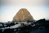 Sugarloaf Island viewed from shore by morning light.
Taken on 2000-08-14 .
Links to related images: Date. Proofs. Map. Story.
 The view from the lighthouse the next morning, the brown line along shore is 10
Taken on 2000-08-14 .
Links to related images: Date. Proofs. Map. Story.
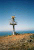
 I climbed to see the lighthouse, but only find the old foundation. What happene
Taken on 2000-08-14 .
Links to related images: Date. Proofs. Map. Story.
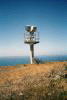
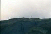
 A new rotating flasher replaced the old lighthouse.
Taken on 2000-08-14 .
Links to related images: Date. Proofs. Map. Story.
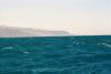
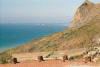
 A view of the angry sea ahead to Punta Gorda. I spent a day here waiting for th
Taken on 2000-08-14 .
Links to related images: Date. Proofs. Map. Story.
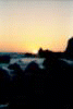 Out of focus sunset
Taken on 2000-08-14 .
Links to related images: Date. Proofs. Map. Story.
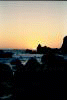
 Sunset next to Sugarloaf Island.
Taken on 2000-08-14 .
Links to related images: Date. Proofs. Map. Story.
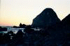
 Sunset next to Sugarloaf Island
Taken on 2000-08-14 .
Links to related images: Date. Proofs. Map. Story.
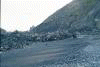
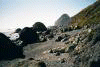
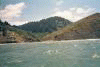 The shoreline starts to get interesting again
Taken on 2000-08-13 .
Links to related images: Date. Proofs. Map. Story.
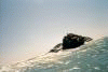
 Wind and rough seas prevented taking many good pictures.
Taken on 2000-08-13 .
Links to related images: Date. Proofs. Map. Story.
 Until I landed below the point for the evening.
Taken on 2000-08-13 .
Links to related images: Date. Proofs. Map. Story.
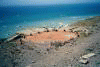
 And set up my campsite.
Taken on 2000-08-13 .
Links to related images: Date. Proofs. Map. Story.
 On a walk around the point I see Seamboat rock, California sea lions and the li
Taken on 2000-08-13 .
Links to related images: Date. Proofs. Map. Story.
 And set up my campsite.
Taken on 2000-08-13 .
Links to related images: Date. Proofs. Map. Story.
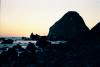
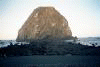 Sugarloaf Island viewed from shore by evening light.
Taken on 2000-08-13 .
Links to related images: Date. Proofs. Map. Story.
All text and images Copyright © 2000 by Mike Higgins / contact