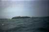
The following images were all taken near the same location, ~38.7863998413086/123.575996398926:
Click on the small images to see the full-sized ones.


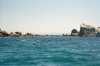
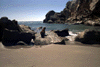
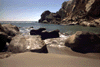
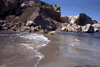
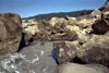
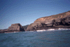
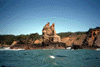
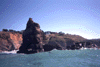
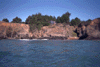
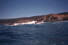
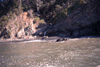
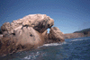
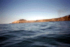
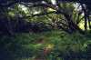
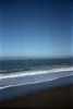
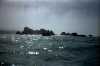
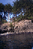
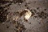
 Rock gardens near Iverson Point, a little too rough, the tide a little too low
Taken on 2009-05-31 .
Links to related images: Date. Proofs. Map. Story.
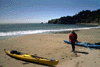
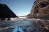
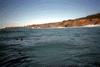
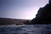
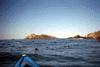
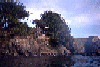
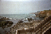
 The intrepid kayaker at Sunders Landing
Taken on 2006-10-14 .
Links to related images: Date. Proofs. Map.
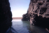
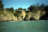
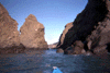
 Peaking into a notch near Saunders Landing
Taken on 2006-10-14 .
Links to related images: Date. Proofs. Map.
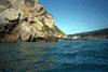
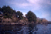
 Near the entrance of Saunders Landing
Taken on 2006-10-14 .
Links to related images: Date. Proofs. Map.
 Looking in the side entrance of Saunders Landing
Taken on 2006-10-14 .
Links to related images: Date. Proofs. Map.
 Looking out the side entrance of Saunders Landing
Taken on 2006-10-14 .
Links to related images: Date. Proofs. Map.


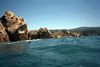
 Fun rock garden south of Saunders Landing
Taken on 2006-10-14 .
Links to related images: Date. Proofs. Map.
 Gordon Schanck joins me inside rock garden south of Saunders Landing
Taken on 2006-10-14 .
Links to related images: Date. Proofs. Map.

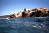
 Fun rock garden south of Saunders Landing
Taken on 2006-10-14 .
Links to related images: Date. Proofs. Map.

 The short cut into Iverson Landing
Taken on 2006-10-14 .
Links to related images: Date. Proofs. Map.
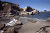
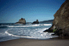
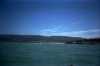
 Iverson Landing is a protected cove with a sandy beach
Taken on 2006-10-14 .
Links to related images: Date. Proofs. Map.

 Gordon Schanck on the Iverson Landing beach
Taken on 2006-10-14 .
Links to related images: Date. Proofs. Map.
 Looking south from the end of the Iverson Landing beach
Taken on 2006-10-14 .
Links to related images: Date. Proofs. Map.

 The rock that protects the south end of the Iverson Landing beach
Taken on 2006-10-14 .
Links to related images: Date. Proofs. Map.
 Our kayaks viewed from the south end of the Iverson Landing beach
Taken on 2006-10-14 .
Links to related images: Date. Proofs. Map.
 Heading north out of Iverson Landing
Taken on 2006-10-14 .
Links to related images: Date. Proofs. Map.

 Gordon Schanck coming out behind a sea palm covered rock
Taken on 2006-10-14 .
Links to related images: Date. Proofs. Map.

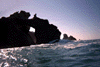
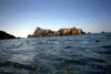
 Cave/arch near Saunders Landing
Taken on 2000-07-22 .
Links to related images: Date. Proofs. Map.

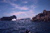
 Kayaker in front of cliffs near Saunders Landing
Taken on 2000-07-22 .
Links to related images: Date. Proofs. Map.

 Kayakers rock gardening near Iversen Landing
Taken on 2000-07-22 .
Links to related images: Date. Proofs. Map.
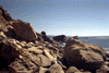
 Rough point near Iversen Landing
Taken on 2000-07-22 .
Links to related images: Date. Proofs. Map.
 Kayakers crossing open ocean near Iversen Landing
Taken on 2000-07-22 .
Links to related images: Date. Proofs. Map.
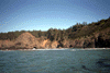
 Steep cliffs near Iversen Landing
Taken on 2000-07-22 .
Links to related images: Date. Proofs. Map.
 Kayakers exiting a cave south of Iversen Landing
Taken on 2000-07-22 .
Links to related images: Date. Proofs. Map.
 Calm water and rocks south of Iversen Landing
Taken on 2000-07-22 .
Links to related images: Date. Proofs. Map.


 Kayaker entering a cave south of Iversen Landing
Taken on 2000-07-22 .
Links to related images: Date. Proofs. Map.


 Shallow water between rocks south of Iversen Landing
Taken on 2000-07-22 .
Links to related images: Date. Proofs. Map.
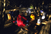
 Stoped for lunch at Steens Landing
Taken on 2000-07-22 .
Links to related images: Date. Proofs. Map.
 The spit connecting the Fish Rocks togetner
Taken on 2000-07-22 .
Links to related images: Date. Proofs. Map.


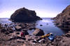
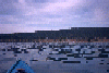
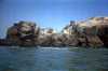
 California Sea lions around the Fish Rock islands
Taken on 2000-07-22 .
Links to related images: Date. Proofs. Map.
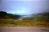
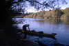 Ken and I paddled up the Gualala River to the campground.
Taken on 1998-09-17 .
Links to related images: Date. Proofs. Map. Story.
 With Ken Kelton, I stopped at beautiful Bourns Landing for lunch.
Taken on 1998-09-17 .
Links to related images: Date. Proofs. Map. Story.
 That evening we camped at the Anchor Bay Campground.
Taken on 1998-09-17 .
Links to related images: Date. Proofs. Map. Story.

 with Ken Kelton, we stopped at Steens Landing for lunch.
Taken on 1998-09-17 .
Links to related images: Date. Proofs. Map. Story.
 Looking south from Steens Landing
Taken on 1998-09-17 .
Links to related images: Date. Proofs. Map. Story.
 Ken, his boat and the stone wall at Steens Landing
Taken on 1998-09-17 .
Links to related images: Date. Proofs. Map. Story.
 The next day I landed to take pictures of the sea lions while Ken surfed across
Taken on 1998-09-17 .
Links to related images: Date. Proofs. Map. Story.
 Ken surfing the sand between the Fish Rock Islands
Taken on 1998-09-17 .
Links to related images: Date. Proofs. Map. Story.
 Close up of east Fish Rock
Taken on 1998-09-17 .
Links to related images: Date. Proofs. Map. Story.
 Ken approaching the spit between the Fish Rocks
Taken on 1998-09-17 .
Links to related images: Date. Proofs. Map. Story.
 Close up of east Fish Rock
Taken on 1998-09-17 .
Links to related images: Date. Proofs. Map. Story.
 California sea lion sleeping right above my kayak on east Fish Rock!
Taken on 1998-09-17 .
Links to related images: Date. Proofs. Map. Story.
 Landed in beautiful Iverson landing
Taken on 1997-07-27 .
Links to related images: Date. Proofs. Map. Story.
 Entering Iverson Landing from the outside
Taken on 1997-07-27 .
Links to related images: Date. Proofs. Map. Story.
 The exit point of a little cave through a point
Taken on 1997-07-27 .
Links to related images: Date. Proofs. Map. Story.
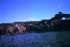
 Houses above the cliffs near Point Arena
Taken on 1997-07-27 .
Links to related images: Date. Proofs. Map. Story.
 View out a little cove near Point Arena
Taken on 1997-07-27 .
Links to related images: Date. Proofs. Map. Story.
 Small cave that goes all the way through the point
Taken on 1997-07-27 .
Links to related images: Date. Proofs. Map. Story.
 View out crack in little cove near Point Arena
Taken on 1997-07-27 .
Links to related images: Date. Proofs. Map. Story.
 Houses above the cliffs near Point Arena
Taken on 1997-07-27 .
Links to related images: Date. Proofs. Map. Story.
 View across beautiful rock garden near Point Arena
Taken on 1997-07-27 .
Links to related images: Date. Proofs. Map. Story.
 View across small cove near Point Arena
Taken on 1997-07-27 .
Links to related images: Date. Proofs. Map. Story.
 Paddling into rocky cove near Point Arena
Taken on 1997-07-27 .
Links to related images: Date. Proofs. Map. Story.
 Landed on small sandy cove near Point Arena
Taken on 1997-07-27 .
Links to related images: Date. Proofs. Map. Story.
 Small sandy cove near Point Arena
Taken on 1997-07-27 .
Links to related images: Date. Proofs. Map. Story.
 Crack in the cliffs near Point Arena
Taken on 1997-07-27 .
Links to related images: Date. Proofs. Map. Story.
 View out small cove near Iverson Landing
Taken on 1997-07-27 .
Links to related images: Date. Proofs. Map. Story.
 Small arch in wall of small cove
Taken on 1997-07-27 .
Links to related images: Date. Proofs. Map. Story.
 Landed on tiny cove near Iverson Landing
Taken on 1997-07-27 .
Links to related images: Date. Proofs. Map. Story.
 Crack in the cliffs near Point Arena
Taken on 1997-07-27 .
Links to related images: Date. Proofs. Map. Story.
 Notch in the cliffs near Point Arena
Taken on 1997-07-27 .
Links to related images: Date. Proofs. Map. Story.
 Caves in the cliffs near Point Arena
Taken on 1997-07-27 .
Links to related images: Date. Proofs. Map. Story.
 Cave near the mouth of the Gualala River.
Taken on 1997-02-22 .
Links to related images: Date. Proofs. Map. Story.
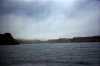
 Gualala Beach viewed from offshore.
Taken on 1997-02-22 .
Links to related images: Date. Proofs. Map. Story.
 North end of Gualala Beach and start of bluffs.
Taken on 1997-02-22 .
Links to related images: Date. Proofs. Map. Story.
 The crack I paddled out later behind Robinson Point.
Taken on 1997-02-22 .
Links to related images: Date. Proofs. Map. Story.
 Sitting in crack behind Robinson Point waiting for a window to paddle out.
Taken on 1997-02-22 .
Links to related images: Date. Proofs. Map. Story.
 Looking north and south from the beach behind Robinson Point.
Taken on 1997-02-22 .
Links to related images: Date. Proofs. Map. Story.
 Totoro Rock at Gualala near Robinson Point.
Taken on 1997-02-22 .
Links to related images: Date. Proofs. Map. Story.
 Houses above cliff near Gualala.
Taken on 1997-02-22 .
Links to related images: Date. Proofs. Map. Story.
 Approaching Bourns Landing.
Taken on 1997-02-22 .
Links to related images: Date. Proofs. Map. Story.
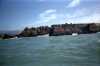
 Bourns Landing
Taken on 1997-02-22 .
Links to related images: Date. Proofs. Map. Story.
 Rough waves around Bourns Point
Taken on 1997-02-22 .
Links to related images: Date. Proofs. Map. Story.
 View north to Cooks Beach.
Taken on 1997-02-22 .
Links to related images: Date. Proofs. Map. Story.
 Green mossy rock near Cooks Beach.
Taken on 1997-02-22 .
Links to related images: Date. Proofs. Map. Story.
 Secluded beach Near Cooks Beach.
Taken on 1997-02-22 .
Links to related images: Date. Proofs. Map. Story.
 Cooks Beach
Taken on 1997-02-22 .
Links to related images: Date. Proofs. Map. Story.
 Houses on shore near Cooks Beach
Taken on 1997-02-22 .
Links to related images: Date. Proofs. Map. Story.
 Cracks in cliff near Collins Landing.
Taken on 1997-02-22 .
Links to related images: Date. Proofs. Map. Story.
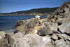
 Rough shore near Anchor Bay
Taken on 1997-02-22 .
Links to related images: Date. Proofs. Map. Story.
 Houses near Anchor Bay
Taken on 1997-02-22 .
Links to related images: Date. Proofs. Map. Story.
 Shore near Anchor Bay
Taken on 1997-02-22 .
Links to related images: Date. Proofs. Map. Story.
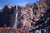
 Waterfall near Anchor Bay
Taken on 1997-02-22 .
Links to related images: Date. Proofs. Map. Story.
 Fish Rocks viewed through nearshore rocks.
Taken on 1997-02-22 .
Links to related images: Date. Proofs. Map. Story.
 Fish Rock Beach, Anchor Bay Campground.
Taken on 1997-02-22 .
Links to related images: Date. Proofs. Map. Story.
 East Fish Rock
Taken on 1997-02-22 .
Links to related images: Date. Proofs. Map. Story.
 Sea lions on the shore of Fish Rock.
Taken on 1997-02-22 .
Links to related images: Date. Proofs. Map. Story.

 Outer tip of Havens Neck.
Taken on 1997-02-22 .
Links to related images: Date. Proofs. Map. Story.
 Wild water behind Fish Rock.
Taken on 1997-02-22 .
Links to related images: Date. Proofs. Map. Story.
 Small Rock Near Fish Rocks.
Taken on 1997-02-22 .
Links to related images: Date. Proofs. Map. Story.
 View North past Havens Neck.
Taken on 1997-02-22 .
Links to related images: Date. Proofs. Map. Story.
 Beach on north side of Havens Neck.
Taken on 1997-02-22 .
Links to related images: Date. Proofs. Map. Story.
 View in down north side of Havens Neck.
Taken on 1997-02-22 .
Links to related images: Date. Proofs. Map. Story.

 Outer end of Havens Neck.
Taken on 1997-02-22 .
Links to related images: Date. Proofs. Map. Story.
 Outside shape of west Fish Rock.
Taken on 1997-02-22 .
Links to related images: Date. Proofs. Map. Story.
 Shore on south side of Havens Neck.
Taken on 1997-02-22 .
Links to related images: Date. Proofs. Map. Story.
 Havens Neck viewed from a distance.
Taken on 1997-02-22 .
Links to related images: Date. Proofs. Map. Story.
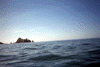
 West Fish Rock Island.
Taken on 1997-02-22 .
Links to related images: Date. Proofs. Map. Story.
 Calm water behind rocks near Fish Rocks.
Taken on 1997-02-22 .
Links to related images: Date. Proofs. Map. Story.
 Fish rocks viewed from close to shore.
Taken on 1997-02-22 .
Links to related images: Date. Proofs. Map. Story.
 Anchor Bay Campground at Fish Rock Beach.
Taken on 1997-02-22 .
Links to related images: Date. Proofs. Map. Story.
 Fish Rock Islands
Taken on 1997-02-22 .
Links to related images: Date. Proofs. Map. Story.
 The mysterious wave approaching shore
Taken on 1996-03-30 .
Links to related images: Date. Proofs. Map. Story.
 Walk On Beach viewd from above on the trail
Taken on 1996-03-30 .
Links to related images: Date. Proofs. Map. Story.
 The stairs leading down to Walk On Beach
Taken on 1996-03-30 .
Links to related images: Date. Proofs. Map. Story.
 Walk On Beach viewed from offshore
Taken on 1996-03-30 .
Links to related images: Date. Proofs. Map. Story.
 Sea Ranch Stengel Beach in bad light
Taken on 1996-01-11 .
Links to related images: Date. Proofs. Map. Story.

 Waterfall at Sea Ranch at Stengel Beach
Taken on 1996-01-11 .
Links to related images: Date. Proofs. Map. Story.
 Wave breaking between rocks near Stengel Beach
Taken on 1996-01-11 .
Links to related images: Date. Proofs. Map. Story.

 Here is the mysterious deck, but the light was poor on this
winter morning, and
Here is the mysterious deck, but the light was poor on this
winter morning, and
Taken on 1996-01-11 .
Links to related images: Date. Proofs. Map. Story.

 I did go back in March of 1996 and took the following pictures. They
still do
I did go back in March of 1996 and took the following pictures. They
still do
Taken on 1996-01-11 .
Links to related images: Date. Proofs. Map. Story.


 Coves and rocks in the cliff between Stengel and Shell Beaches:
Taken on 1996-01-11 .
Links to related images: Date. Proofs. Map. Story.
 Coves and rocks in the cliff between Stengel and Shell Beaches:
Taken on 1996-01-11 .
Links to related images: Date. Proofs. Map. Story.
 Shoreline on Sea Ranch
Taken on 1995-08-26 .
Links to related images: Date. Proofs. Map. Story.
 Gualala River mouth viewed from Highway One
Taken on 1995-03-29 .
Links to related images: Date. Proofs. Map. Story.
 The green picnic spot at Gualala Park
Taken on 1995-03-29 .
Links to related images: Date. Proofs. Map. Story.
 Looking up the Gualala River
Taken on 1995-03-29 .
Links to related images: Date. Proofs. Map. Story.
 Gualala Beach viewed from offshore
Taken on 1995-03-29 .
Links to related images: Date. Proofs. Map. Story.

 Waves breaking on Gualala Beach, osprey diving
Taken on 1995-03-29 .
Links to related images: Date. Proofs. Map. Story.
 The shore of the Gualala River
Taken on 1995-03-29 .
Links to related images: Date. Proofs. Map. Story.
 Gualala Beach from a distance offshore
Taken on 1995-03-29 .
Links to related images: Date. Proofs. Map. Story.
 The rugged shoreline south of Gualala Beach
Taken on 1995-03-29 .
Links to related images: Date. Proofs. Map. Story.
 Gualala Point Island up close
Taken on 1995-03-29 .
Links to related images: Date. Proofs. Map. Story.
 Big crack in Gualala Point Island
Taken on 1995-03-29 .
Links to related images: Date. Proofs. Map. Story.
 East end of Gualala Point Island
Taken on 1995-03-29 .
Links to related images: Date. Proofs. Map. Story.
 Rough waves on Gualala Point Island
Taken on 1995-03-29 .
Links to related images: Date. Proofs. Map. Story.
 West end of Gualala Point Island
Taken on 1995-03-29 .
Links to related images: Date. Proofs. Map. Story.
 Jagged rocks on Gualala Point Island
Taken on 1995-03-29 .
Links to related images: Date. Proofs. Map. Story.
 Approaching Gualala Point Island
Taken on 1995-03-29 .
Links to related images: Date. Proofs. Map. Story.
 Vertical layers in Gualala Point Island
Taken on 1995-03-29 .
Links to related images: Date. Proofs. Map. Story.
 Gualala Point Island up close
Taken on 1995-03-29 .
Links to related images: Date. Proofs. Map. Story.
 Stengel Beach with the waterfall, which does
not have a permanent stream and on
Stengel Beach with the waterfall, which does
not have a permanent stream and on
Taken on 1995-02-28 .
Links to related images: Date. Proofs. Map. Story.
 Coves and rocks in the cliff between Stengel and Shell Beaches:
Taken on ~1994 .
Links to related images: Date. Proofs. Map.


 Sea Ranch Shell Beach
Taken on ~1994 .
Links to related images: Date. Proofs. Map.
 Shoreline on Sea Ranch
Taken on ~1994 .
Links to related images: Date. Proofs. Map.
 Sea Ranch Shell Beach
Taken on ~1994 .
Links to related images: Date. Proofs. Map.
 Shoreline on Sea Ranch
Taken on ~1994 .
Links to related images: Date. Proofs. Map.
 Stengel Beach with the waterfall, which does
not have a permanent stream and on
Stengel Beach with the waterfall, which does
not have a permanent stream and on
Taken on ~1994 .
Links to related images: Date. Proofs. Map.
All text and images Copyright © by Mike Higgins / contact