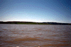
The following images were all taken near the same location, ~37.9281196594238/122.43025970459:
Click on the small images to see the full-sized ones.


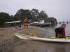
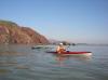
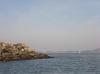
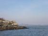
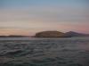
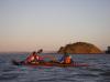
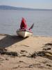
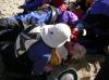
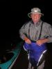
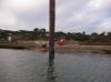
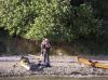
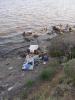
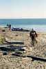
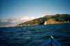
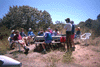
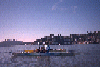
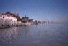
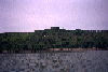
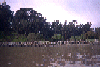
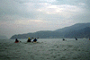
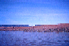
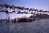
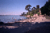
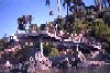
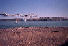
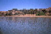
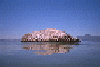
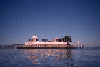
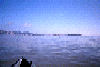
 Launching for the Sojourn at McNears Beach
Taken on 2012-09-30 .
Links to related images: Date. Proofs. Map.
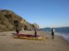
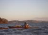
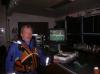
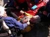
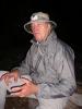
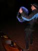
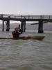
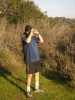
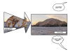
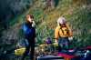
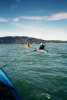
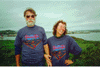
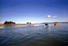
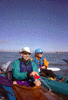
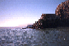
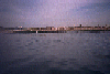
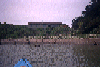
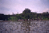
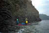
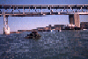
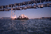
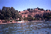
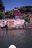
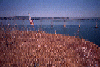
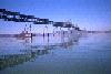
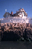
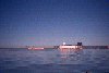
 Herb Howe and Andre Wolf laaunching for the Sojourn at McNears Beach
Taken on 2012-09-30 .
Links to related images: Date. Proofs. Map.


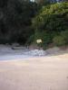
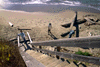
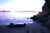
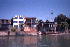
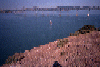
 A proposed handycapped access to the water at McNears Beach
Taken on 2011-10-19 .
Links to related images: Date. Map.

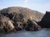
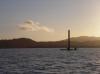
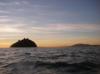
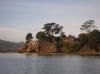
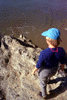
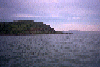
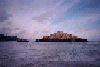
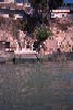
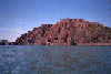
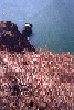
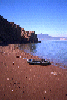
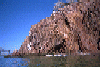
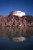
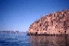
 I made a side trip to photograph the top of Rat Rock
Taken on 2011-10-19 .
Links to related images: Date. Map.


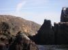
 A survey marker on the top of Rat Rock
Taken on 2011-10-19 .
Links to related images: Date. Map.


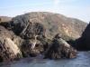
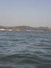
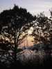
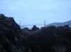
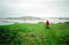
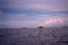
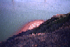
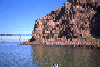
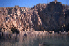
 Views from the top of Rat Rock
Taken on 2011-10-19 .
Links to related images: Date. Map.


 A buckeye tree grows on the top of Rat Rock
Taken on 2011-10-19 .
Links to related images: Date. Map.
 The well worn trail down off the top of Rat Rock
Taken on 2011-10-19 .
Links to related images: Date. Map.
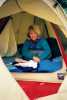
 Our tents drying in the morning at Paradise Park on Tiburon
Taken on 2011-10-18 .
Links to related images: Date. Proofs. Map.
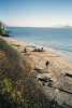
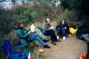
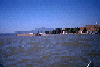
 We stopped for lunch on Jailhouse Beach (near San Quentin)
Taken on 2011-10-18 .
Links to related images: Date. Proofs. Map.
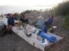
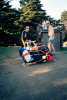
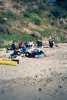
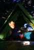
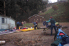
 Setting up camp at McNears Beach
Taken on 2011-10-18 .
Links to related images: Date. Proofs. Map.
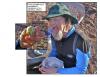
 Mike Edwards and Bo Barnes cooking dinner at McNears Beach
Taken on 2011-10-18 .
Links to related images: Date. Proofs. Map.
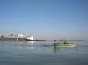
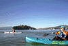
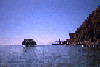
 A ferry runs Raccoon Strait past Kayak Kamp on Angel Island
Taken on 2011-10-17 .
Links to related images: Date. Proofs. Map.
 Looking down at Kayak Kamp on Angel Island
Taken on 2011-10-17 .
Links to related images: Date. Proofs. Map.
 Andrea Wolf on top of Angel Island
Taken on 2011-10-17 .
Links to related images: Date. Proofs. Map.
 Fran Sticha on top of Angel Island
Taken on 2011-10-17 .
Links to related images: Date. Proofs. Map.
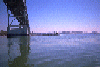
 The Bay Bridge and San Francisco from the top of Angel Island
Taken on 2011-10-17 .
Links to related images: Date. Proofs. Map.
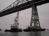
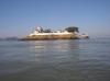
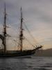
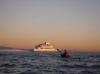
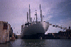
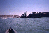
 We watched this ship being towed around The Bay
Taken on 2011-10-17 .
Links to related images: Date. Proofs. Map.
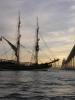
 Another ship rounding Angel Island
Taken on 2011-10-17 .
Links to related images: Date. Proofs. Map.

 Andrea Wolf and Fran Sticha coming back down Angel Island
Taken on 2011-10-17 .
Links to related images: Date. Proofs. Map.
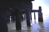
 Terns on an old pier post
Taken on 2011-10-17 .
Links to related images: Date. Proofs. Map.
 Dinner at Paradise Park on Tiburon
Taken on 2011-10-17 .
Links to related images: Date. Proofs. Map.
 Mike Edwards taking pictures from Kayak Kamp Beach on Angel Island
Taken on 2011-10-16 .
Links to related images: Date. Proofs. Map.
 Ken Mannsheardt on Kayak Kamp Beach on Angel Island
Taken on 2011-10-16 .
Links to related images: Date. Proofs. Map.
 Andrea Wolf and Herb Howe in Kayak Kamp on Angel Island
Taken on 2011-10-16 .
Links to related images: Date. Proofs. Map.
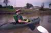
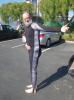 The intrepid kayaker showing off his new custom dive skin
Taken on 2011-09-29 .
Links to related images: Date. Proofs. Map.

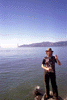
 Taking a break on Red Rock
Taken on 2011-03-19 .
Links to related images: Date. Proofs. Map. Story.

 Passing between the Brother Islands
Taken on 2011-03-19 .
Links to related images: Date. Proofs. Map. Story.

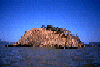
 Rounding Rat Rock
Taken on 2011-03-19 .
Links to related images: Date. Proofs. Map. Story.
 Doug Huft going between the Marin Islands
Taken on 2011-03-19 .
Links to related images: Date. Proofs. Map. Story.
 Dennis Holton going between the Marin Islands
Taken on 2011-03-19 .
Links to related images: Date. Proofs. Map. Story.
 Island 15, Angel Island
Taken on 2011-03-19 .
Links to related images: Date. Proofs. Map. Story.
 From the train we saw Lone Tree Point
Taken on 2010-10-9 .
Links to related images: Date. Proofs. Map.
 Bo Barnes washing dishes at the San Pablo Sportsmans Club
Taken on 2010-10-7 .
Links to related images: Date. Proofs. Map.
 Fran Sticha packing up to join us at the San Pablo Sportsmans Club
Taken on 2010-10-7 .
Links to related images: Date. Proofs. Map.
 Packing up on the beach at the San Pablo Sportsmans Club
Taken on 2010-10-7 .
Links to related images: Date. Proofs. Map.
 The Kayak Queen in her throne waiting for the rest of us to finish packintg
Taken on 2010-10-7 .
Links to related images: Date. Proofs. Map.

 The intrepid kayaker reading a book waiting for everyone else to finish packing
Taken on 2010-10-7 .
Links to related images: Date. Proofs. Map.


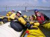
 Some of us paddle up the San Pablo Creek
Taken on 2010-10-7 .
Links to related images: Date. Proofs. Map.
 Salt Grass at Point Pinole
Taken on 2010-10-7 .
Links to related images: Date. Proofs. Map.
 Our tents set up at the Point San Pablo Yacht Club
Taken on 2010-10-6 .
Links to related images: Date. Proofs. Map.
 Packing up to leave the Point San Pablo Yacht Club
Taken on 2010-10-6 .
Links to related images: Date. Proofs. Map.

 Steve Shepard moving his sailboat to shore
Taken on 2010-10-6 .
Links to related images: Date. Proofs. Map.


 Penny Wells found this whirlpool where the tide flowed backwards up into a storm drain
Taken on 2010-10-6 .
Links to related images: Date. Proofs. Map.


 This car-carier arrived in the night and was still offloading new cars
Taken on 2010-10-6 .
Links to related images: Date. Proofs. Map.
 The Red Oak Victory ship in the morning
Taken on 2010-10-6 .
Links to related images: Date. Proofs. Map.

 This car-carier arrived in the night and was still offloading new cars
Taken on 2010-10-6 .
Links to related images: Date. Proofs. Map.
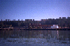
 Ferry Point in Richmond
Taken on 2010-10-6 .
Links to related images: Date. Proofs. Map.

 Approaching Red Rock Island
Taken on 2010-10-6 .
Links to related images: Date. Proofs. Map.

 Sojourners lunching on Red Rock Island
Taken on 2010-10-6 .
Links to related images: Date. Proofs. Map.
 Dinner at the San Pablo Sportsmans Club
Taken on 2010-10-6 .
Links to related images: Date. Proofs. Map.
 Breakfast in the morning on Angel Island
Taken on 2010-10-5 .
Links to related images: Date. Proofs. Map.

 Paul Nixon heading away from Angel Island
Taken on 2010-10-5 .
Links to related images: Date. Proofs.
 Bo Barnes heading away from Angel Island
Taken on 2010-10-5 .
Links to related images: Date.

 Bo Barnes and Paul Nixon landed on the Brooks Island spit
Taken on 2010-10-5 .
Links to related images: Date. Proofs. Map.
 The intrepid kayaker on the Brooks Island spit
Taken on 2010-10-5 .
Links to related images: Date. Proofs. Map.
 Iceplant on the Brooks Island spit
Taken on 2010-10-5 .
Links to related images: Date. Proofs. Map.
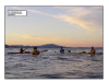
 Three Sojourners warming up before a swim on the Brooks Island spit
Taken on 2010-10-5 .
Links to related images: Date. Proofs. Map.


 Bo Barnes and Paul Nixon going for a swim on the Brooks Island spit
Taken on 2010-10-5 .
Links to related images: Date. Proofs. Map.
 Hong Chin joins us Paddling towards the Red Oak Victory
Taken on 2010-10-5 .
Links to related images: Date. Proofs. Map.


 The propellor and rudder of the Red Oak Victory
Taken on 2010-10-5 .
Links to related images: Date. Proofs. Map.
 We meet more Sojourners at the Point San Pablo Yacht Club
Taken on 2010-10-5 .
Links to related images: Date. Proofs. Map.
 Bo Barnes and Paul Nixon land at the Point San Pablo Yacht Club
Taken on 2010-10-5 .
Links to related images: Date. Proofs. Map.
 Kayaks stacked up at the Point San Pablo Yacht Club
Taken on 2010-10-5 .
Links to related images: Date. Proofs. Map.
 Penny Wells talking up the locals at the Point San Pablo Yacht Club
Taken on 2010-10-5 .
Links to related images: Date. Proofs. Map.
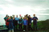
 Sojourners at the Point San Pablo Yacht Club
Taken on 2010-10-5 .
Links to related images: Date. Proofs. Map.
 Steve Shepard arrived at the Point San Pablo Yacht Club by salboat
Taken on 2010-10-5 .
Links to related images: Date. Proofs. Map.


 Bo Barnes reveling in the calm weather on The Bay
Taken on 2010-10-4 .
Links to related images: Date. Map.
 Bo Barnes setting up camp on Angel Island
Taken on 2010-10-4 .
Links to related images: Date. Proofs. Map.
 Bo Barnes filling Paul's cup on Angel Island
Taken on 2010-10-4 .
Links to related images: Date. Proofs. Map.
 Paul Nixon getting ready for a swim on Angel Island
Taken on 2010-10-4 .
Links to related images: Date. Proofs. Map.


 Bo Barnes joins Paul Nixon for a swim on Angel Island
Taken on 2010-10-4 .
Links to related images: Date. Proofs. Map.


 More Sojourners arrive on Angel Island by sailboat
Taken on 2010-10-4 .
Links to related images: Date. Proofs. Map.
 Paul Nixon attempts to warm up after a cold swim in The Bay
Taken on 2010-10-4 .
Links to related images: Date. Proofs. Map.
 Bo Barnes at night on Angel Island
Taken on 2010-10-4 .
Links to related images: Date. Proofs. Map.
 Danny Forer and I were the only ones to show up for Dannys Saturday paddle to Red Rock
Taken on 2009-09-12 .
Links to related images: Date. Proofs. Map. Story.
 Half way up the poison oak free scramble to the top of Red Rock
Taken on 2009-09-12 .
Links to related images: Date. Proofs. Map. Story.


 Danny Forer took the Poison Oak route
Taken on 2009-09-12 .
Links to related images: Date. Proofs. Map. Story.
 The Chevron Pier and Richmond from the top of Red Rock
Taken on 2009-09-12 .
Links to related images: Date. Proofs. Map. Story.
 The Richmond/San Rafael Bridge from the top of Red Rock
Taken on 2009-09-12 .
Links to related images: Date. Proofs. Map. Story.
 A row of decorative flowers on the top of Red Rock
Taken on 2009-09-12 .
Links to related images: Date. Proofs. Map. Story.

 Eco Terrorist Trash and a view of Toilet Bowl Beach from the top of Red Rock
Taken on 2009-09-12 .
Links to related images: Date. Proofs. Map. Story.


 Danny and I clean up the trash left by Earth First Eco Terrorists
Taken on 2009-09-12 .
Links to related images: Date. Proofs. Map. Story.
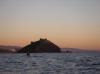
 View of Angel Island from the top of Red Rock
Taken on 2009-09-12 .
Links to related images: Date. Proofs. Map. Story.
 View of the Richmond San Rafael Bridge and Marin from the top of Red Rock
Taken on 2009-09-12 .
Links to related images: Date. Proofs. Map. Story.
 View of the Richmond San Rafael Bridge from the top of Red Rock
Taken on 2009-09-12 .
Links to related images: Date. Proofs. Map. Story.
 The Intrepid Kayaker (and Danny Forers thumb) on top of Red Rock Island
Taken on 2009-09-12 .
Links to related images: Date. Proofs. Map. Story.

 The Intrepid Kayaker hauling off the trash left by Earth First Eco Terrorists on Red Rock Island
Taken on 2009-09-12 .
Links to related images: Date. Proofs. Map. Story.
 Danny Forers kaysk loaded down with trash left by Earth First Eco Terrorists on Red Rock Island
Taken on 2009-09-12 .
Links to related images: Date. Proofs. Map. Story.
 Marjorie Little at the Obama fundraising paddle
Taken on 2008-10-12 .
Links to related images: Date. Proofs. Map. Story.
 BASKers getting ready to launch at the Obama fundraising paddle
Taken on 2008-10-12 .
Links to related images: Date. Proofs. Map. Story.

 Supertankers pass in front of us, ferries behind us
Taken on 2008-10-12 .
Links to related images: Date. Proofs. Map. Story.
 Safely landed on Red Rock for lunch
Taken on 2008-10-12 .
Links to related images: Date. Proofs. Map. Story.


 Another ferry and sail boat on the way back to Ferry Point
Taken on 2008-10-12 .
Links to related images: Date. Proofs. Map. Story.

 The sun rising over my campsite on Toilet Bowl Beach
Taken on 2008-10-10 .
Links to related images: Date. Proofs. Map.
 Thurseve Paddlers getting ready at Jailhouse Beach
Taken on 2008-10-9 .
Links to related images: Date. Proofs. Map. Story.

 Keltic Kim joins the Thurseve Paddlers crossing The Bay
Taken on 2008-10-9 .
Links to related images: Date. Proofs. Map. Story.
 Thurseve Paddlers around the campfire on Toilet Bowl Beach
Taken on 2008-10-9 .
Links to related images: Date. Proofs. Map. Story.
 Keltic Kim enjoys her first Thurseve Paddle
Taken on 2008-10-9 .
Links to related images: Date. Proofs. Map. Story.
 Thurseve Paddlers around the campfire on Toilet Bowl Beach
Taken on 2008-10-9 .
Links to related images: Date. Proofs. Map. Story.
 Keltic Kim by campfire light on Toilet Bowl Beach
Taken on 2008-10-9 .
Links to related images: Date. Proofs. Map. Story.
 The mayor and Keltic Kim on Toilet Bowl Beach
Taken on 2008-10-9 .
Links to related images: Date. Proofs. Map. Story.

 John Boeschen putting out our campfire by dragging it into The Bay
Taken on 2008-10-9 .
Links to related images: Date. Proofs. Map. Story.
 Most of the Thurseve Paddlers paddle home for the evening, with running lights on
Taken on 2008-10-9 .
Links to related images: Date. Proofs. Map. Story.
 Thurseve Paddlers on Pallete Beach
Taken on 2008-09-25 .
Links to related images: Date. Proofs. Map. Story.
 My ninja camp on Toilet Bowl Beach
Taken on 2008-09-19 .
Links to related images: Date. Proofs. Map.
 Thurseve Paddlers at Dannys Secret Launch
Taken on 2008-09-18 .
Links to related images: Date. Proofs. Map. Story.

 South end of Red Rock Island at sunset
Taken on 2008-09-18 .
Links to related images: Date. Proofs. Map. Story.

 Landing on Toilet Bowl Beach
Taken on 2008-09-18 .
Links to related images: Date. Proofs. Map. Story.
 My ninja camp on Toilet Bowl Beach
Taken on 2008-09-18 .
Links to related images: Date. Proofs. Map. Story.


 Jonathan Purcell, John Boeschen and the Hobo play in the water swirling around West Sister Island
Taken on 2008-09-4 .
Links to related images: Date. Proofs. Map. Story.

 John Boeschen, Gordon Schanck and Jonathan Purcell paddling under the gun club pier
Taken on 2008-07-10 .
Links to related images: Date. Proofs. Map. Story.

 John Boeschen and Indiana resting from the wind and waves behind East Marin Island
Taken on 2008-07-10 .
Links to related images: Date. Proofs. Map. Story.
 John Boeschen Gordon Schanck and Indiana landing at Dynamite Beach
Taken on 2008-07-10 .
Links to related images: Date. Proofs. Map. Story.

 Jonathan Purcell landing and safely landed at Dynamite Beach
Taken on 2008-07-10 .
Links to related images: Date. Proofs. Map. Story.
 Indiana setting the table at Dynamite Beach
Taken on 2008-07-10 .
Links to related images: Date. Proofs. Map. Story.


 Duck hunting boat washed ashore at Dynamite Beach
Taken on 2008-07-10 .
Links to related images: Date. Proofs. Map. Story.
 Jonathan Purcell enjoying the evening at Dynamite Beach
Taken on 2008-07-10 .
Links to related images: Date. Proofs. Map. Story.
 Gordon Schanck enjoying the evening at Dynamite Beach
Taken on 2008-07-10 .
Links to related images: Date. Proofs. Map. Story.
 John Boeschen enjoying the evening at Dynamite Beach
Taken on 2008-07-10 .
Links to related images: Date. Proofs. Map. Story.
 Indiana and Gordon Schanck enjoying the evening at Dynamite Beach
Taken on 2008-07-10 .
Links to related images: Date. Proofs. Map. Story.
 The driftwood campfire at Dynamite Beach
Taken on 2008-07-10 .
Links to related images: Date. Proofs. Map. Story.


 My ninja camping bivy tent on Brooks Island
Taken on 2008-05-22 .
Links to related images: Date. Proofs. Map. Story.
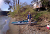
 I had to launch through the mud on Brooks Island at low tide
Taken on 2008-05-22 .
Links to related images: Date. Proofs. Map. Story.
 Small ships in the Richmond Reserve Shipyard
Taken on 2008-05-22 .
Links to related images: Date. Proofs. Map. Story.


 The Red Oak Victory ship at Richmond Reserve Shipyard
Taken on 2008-05-22 .
Links to related images: Date. Proofs. Map. Story.


 USS Horne, a Belknap-class destroyer at Richmond Reserve Shipyard
Taken on 2008-05-22 .
Links to related images: Date. Proofs. Map. Story.
 Sunrise in the middle of San Francisco Bay
Taken on 2008-04-4 .
Links to related images: Date. Proofs. Map.
 Stone sculpture at the entrance of the Lock Lomond Marina
Taken on 2008-04-4 .
Links to related images: Date. Proofs. Map.

 I ran into Thurseve Paddlers in the market formerly known as Brunos
Taken on 2008-04-3 .
Links to related images: Date. Proofs. Map. Story.
 My kayak ready for a Thurseve Paddle
Taken on 2008-04-3 .
Links to related images: Date. Proofs. Map. Story.

 The Thurseve Paddlers talking before a paddle
Taken on 2008-04-3 .
Links to related images: Date. Proofs. Map. Story.
 John Boeschen getting ready to launch
Taken on 2008-04-3 .
Links to related images: Date. Proofs. Map. Story.
 Eagret at the Lock Lomond Marina
Taken on 2008-04-3 .
Links to related images: Date. Proofs. Map. Story.
 Everyone else watching John Boeschen fall over
Taken on 2008-04-3 .
Links to related images: Date. Proofs. Map. Story.


 John Boeschen recovered from falling over in his kayak
Taken on 2008-04-3 .
Links to related images: Date. Proofs. Map. Story.


 Everyone else launches without falling over
Taken on 2008-04-3 .
Links to related images: Date. Proofs. Map. Story.
 John Boeschen passing the west Marin Island
Taken on 2008-04-3 .
Links to related images: Date. Proofs. Map. Story.
 Approaching Red Rock Island
Taken on 2008-04-3 .
Links to related images: Date. Proofs. Map. Story.
 Car-carrier ship rounding Red Rock Island
Taken on 2008-04-3 .
Links to related images: Date. Proofs. Map. Story.
 Red Rock Island in the morning
Taken on 2008-03-28 .
Links to related images: Date. Proofs. Map.

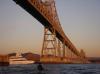
 Richmond San Rafael Bridge
Taken on 2008-03-28 .
Links to related images: Date. Proofs. Map.


 Approaching Jail House Beach in the morning
Taken on 2008-03-28 .
Links to related images: Date. Proofs. Map.
 John Boeschen on Jail House Beach
Taken on 2008-03-27 .
Links to related images: Date. Proofs. Map. Story.

 Thurseve Paddlers getting ready on Jail House Beach
Taken on 2008-03-27 .
Links to related images: Date. Proofs. Map. Story.
 Gordon Schanck on Jail House Beach
Taken on 2008-03-27 .
Links to related images: Date. Proofs. Map. Story.
 The intrepid kayaker on Jail House Beach
Taken on 2008-03-27 .
Links to related images: Date. Proofs. Map. Story.
 Dave Brown on Jail House Beach
Taken on 2008-03-27 .
Links to related images: Date. Proofs. Map. Story.
 Penny Wells on Jail House Beach
Taken on 2008-03-27 .
Links to related images: Date. Proofs. Map. Story.
 Thurseve Paddlers getting ready on Jail House Beach
Taken on 2008-03-27 .
Links to related images: Date. Proofs. Map. Story.
 Thurseve Paddlers launching from Jail House Beach, heading for Red Rock
Taken on 2008-03-27 .
Links to related images: Date. Proofs. Map. Story.

 Thurseve Paddlers heading for Red Rock
Taken on 2008-03-27 .
Links to related images: Date. Proofs. Map. Story.
 Penny Wells and Gordon Schanck heading for Red Rock
Taken on 2008-03-27 .
Links to related images: Date. Proofs. Map. Story.

 I wonder why they call this island Red Rock
Taken on 2008-03-27 .
Links to related images: Date. Proofs. Map. Story.
 Penny Wells approaching Red Rock
Taken on 2008-03-27 .
Links to related images: Date. Proofs. Map. Story.
 I wonder why they call this island Red Rock
Taken on 2008-03-27 .
Links to related images: Date. Proofs. Map. Story.

 Penny Wells rounding the south end of Red Rock
Taken on 2008-03-27 .
Links to related images: Date. Proofs. Map. Story.
 Gordon Schanck rounding the south end of Red Rock
Taken on 2008-03-27 .
Links to related images: Date. Proofs. Map. Story.
 I wonder why they call this island Red Rock
Taken on 2008-03-27 .
Links to related images: Date. Proofs. Map. Story.
 In the shadow of Red Rock Island
Taken on 2008-03-27 .
Links to related images: Date. Proofs. Map. Story.

 Thurseve Paddlers landing on Toilet Bowl Beach on Red Rock Island
Taken on 2008-03-27 .
Links to related images: Date. Proofs. Map. Story.
 John Boeschen on Toilet Bowl Beach
Taken on 2008-03-27 .
Links to related images: Date. Proofs. Map. Story.
 Thurseve Paddlers on Toilet Bowl Beach
Taken on 2008-03-27 .
Links to related images: Date. Proofs. Map. Story.
 Stone soup started with red stones from Red Rock Island
Taken on 2008-03-27 .
Links to related images: Date. Proofs. Map. Story.


 John Boeschen sitting next to brussels sprouts on Red Rock Island
Taken on 2008-03-27 .
Links to related images: Date. Proofs. Map. Story.
 John Boeschen and Penny Wells Red Rock Island
Taken on 2008-03-27 .
Links to related images: Date. Proofs. Map. Story.


 John Boeschen is willing to try one brussels sprout
Taken on 2008-03-27 .
Links to related images: Date. Proofs. Map. Story.
 Gordon Schanck enjoying a brussels sprout
Taken on 2008-03-27 .
Links to related images: Date. Proofs. Map. Story.
 Thurseve Paddlers landing on Toilet Bowl Beach on Red Rock Island
Taken on 2008-03-27 .
Links to related images: Date. Proofs. Map. Story.
 Dessert on Red Rock Island
Taken on 2008-03-27 .
Links to related images: Date. Proofs. Map. Story.


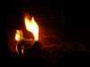
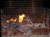
 Camp fire on Red Rock Island
Taken on 2008-03-27 .
Links to related images: Date. Proofs. Map. Story.
 John Boeschen packing up to leave Red Rock Island
Taken on 2008-03-27 .
Links to related images: Date. Proofs. Map. Story.
 Dave Brown packing up to leave Red Rock Island
Taken on 2008-03-27 .
Links to related images: Date. Proofs. Map. Story.
 John Boeschen packing up to leave Red Rock Island
Taken on 2008-03-27 .
Links to related images: Date. Proofs. Map. Story.
 Ninja Camping on Red Rock Island
Taken on 2008-03-27 .
Links to related images: Date. Proofs. Map. Story.
 The intrepid kayaker preparing brussel sprouts on Red Rock Island
Taken on 2008-03-27 .
Links to related images: Date. Proofs. Map. Story.
 Richard Pieper heading towards Brooks Island
Taken on 2008-03-9 .
Links to related images: Date. Map. Story.
 Pier reflecting in calm water at the end of the Brooks Island Breakwater
Taken on 2008-03-9 .
Links to related images: Date. Proofs. Map. Story.
 The end of the Brooks Island Breakwater
Taken on 2008-03-9 .
Links to related images: Date. Proofs. Map. Story.

 Approaching Red Rock Island
Taken on 2008-03-9 .
Links to related images: Date. Proofs. Map. Story.
 Short break on Red Rock Island
Taken on 2008-03-9 .
Links to related images: Date. Proofs. Map. Story.
 Richard Pieper and Paula Hubbard between the Brother Islands
Taken on 2008-03-9 .
Links to related images: Date. Proofs. Map. Story.
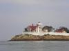
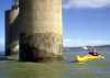
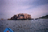
 Lighthouse on East Brother Island
Taken on 2008-03-9 .
Links to related images: Date. Proofs. Map. Story.
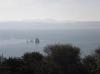
 West Brother Island
Taken on 2008-03-9 .
Links to related images: Date. Proofs. Map. Story.
 Dave Littlejohn at the West Sister Island
Taken on 2008-03-9 .
Links to related images: Date. Proofs. Map. Story.
 West Sister Island
Taken on 2008-03-9 .
Links to related images: Date. Proofs. Map. Story.
 Dave Littlejohn at Rat Rock
Taken on 2008-03-9 .
Links to related images: Date. Map. Story.
 Launching after a lunch break at China Camp State Park
Taken on 2008-03-9 .
Links to related images: Date. Map. Story.
 West Marin Island
Taken on 2008-03-9 .
Links to related images: Date. Proofs. Map. Story.

 East Marin Island
Taken on 2008-03-9 .
Links to related images: Date. Proofs. Map. Story.
 Stuarts Point on Angel Island
Taken on 2008-03-9 .
Links to related images: Date. Proofs. Map. Story.
 Dave Brown stopped for lunch on the Brooks Island Spit
Taken on 2008-03-8 .
Links to related images: Date. Proofs. Map. Story.

 My Coaster at a lunch stop on the Brooks Island Spit
Taken on 2008-03-8 .
Links to related images: Date. Proofs. Map. Story.


 The pilons of the South Hampton Shoal
Taken on 2008-03-8 .
Links to related images: Date. Map. Story.


 A super-tanker passing between Angel Island and Dave Brown
Taken on 2008-03-8 .
Links to related images: Date. Story.
 Ninja camping bivy tent on Pallett Beach
Taken on 2008-03-4 .
Links to related images: Date. Proofs. Map.
 Leaving Angel Island in the morning
Taken on 2008-03-4 .
Links to related images: Date. Proofs. Map.
 San Francisco and Alcatraz Island in the morning
Taken on 2008-03-4 .
Links to related images: Date. Proofs. Map.


 Approching Angel Island
Taken on 2008-03-3 .
Links to related images: Date. Proofs. Map. Story.
 Point Blunt in evening light
Taken on 2008-03-3 .
Links to related images: Date. Proofs. Map. Story.
 Landing on Pallett Beach
Taken on 2008-03-3 .
Links to related images: Date. Proofs. Map. Story.

 Margaritas before dinner on Pallett Beach
Taken on 2008-03-3 .
Links to related images: Date. Proofs. Map. Story.
 Thurseve Paddlers around the campfire on Pallett Beach
Taken on 2008-03-3 .
Links to related images: Date. Proofs. Map. Story.
 Irish Coffee on Pallett Beach
Taken on 2008-03-3 .
Links to related images: Date. Proofs. Map. Story.
 Thurseve Paddlers eating dinner on Pallett Beach
Taken on 2008-03-3 .
Links to related images: Date. Proofs. Map. Story.
 Thurseve Paddlers leaving Pallett Beach
Taken on 2008-03-3 .
Links to related images: Date. Proofs. Map. Story.
 The inrepid kayaker napping near Red Rock
Taken on 2008-02-18 .
Links to related images: Date. Proofs. Map. Story.

 Fred Cooper examining repairs to the Richmond Bridge
Taken on 2008-02-18 .
Links to related images: Date. Proofs. Map. Story.
 Passing The Brother Islands on the way north
Taken on 2008-02-18 .
Links to related images: Date. Proofs. Map. Story.

 Stopping for lunch at China Camp halfway through the Mini Gonzo paddle
Taken on 2008-02-18 .
Links to related images: Date. Map. Story.
 Gordon Schanck between The Brother Islands on the way south
Taken on 2008-02-18 .
Links to related images: Date. Proofs. Map. Story.
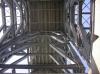
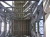
 Under a tower of the Richmond / San Rafael Bridge
Taken on 2008-02-18 .
Links to related images: Date. Proofs. Map. Story.
 Ferry boat passing the Brother Islands
Taken on 2008-02-16 .
Links to related images: Date. Proofs. Map. Story.

 Approaching the Brother Islands
Taken on 2008-02-16 .
Links to related images: Date. Proofs. Map. Story.
 Don Fleming and Paula leaving Red Rock
Taken on 2008-02-16 .
Links to related images: Date. Proofs. Map. Story.
 Paula Hubbard and Rich Pieper approaching Angel Island
Taken on 2008-02-16 .
Links to related images: Date. Proofs. Story.
 Kate DesLauriers sleeping in late on New Years Day
Taken on 2008-01-1 .
Links to related images: Date. Proofs. Map.
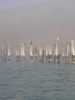
 Sailing ships fighting a mock battle in San Fancisco Bay
Taken on 2008-01-1 .
Links to related images: Date. Proofs. Map.

 Kate DesLauriers launched from Perls Beach
Taken on 2008-01-1 .
Links to related images: Date. Proofs. Map.
 D�rte Mann in front of the Golden Gate Bridge
Taken on 2008-01-1 .
Links to related images: Date. Proofs. Map.

 Chasing a great blue heron around Angel Island
Taken on 2008-01-1 .
Links to related images: Date. Proofs. Map.
 Landing on Perls Beach, Angel Island
Taken on 2007-12-31 .
Links to related images: Date. Proofs. Map. Story.
 The start of the climb from Perls Beach to ridge camp
Taken on 2007-12-31 .
Links to related images: Date. Proofs. Map. Story.

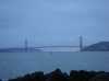
 View of the Golden Gate Bridge from Angel Island
Taken on 2007-12-31 .
Links to related images: Date. Proofs. Map. Story.

 Picnic table at Ridge Camp 5, Angel Island
Taken on 2007-12-31 .
Links to related images: Date. Proofs. Map. Story.
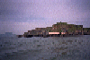
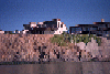
 East Brother Lighthouse in the morning
Taken on 2007-12-21 .
Links to related images: Date. Proofs. Map.
 Tide rip in front of West Brother Island
Taken on 2007-12-21 .
Links to related images: Date. Proofs. Map.
 Morning light on the East Marin Island
Taken on 2007-12-21 .
Links to related images: Date. Proofs. Map.
 My Coaster landed on the road at extreme high tide
Taken on 2007-12-21 .
Links to related images: Date. Proofs. Map.
 John Boeschen and Indiana leaving Bruno's
Taken on 2007-12-20 .
Links to related images: Date. Proofs. Map. Story.
 John Boeschen and Indiana crossing in front of Chard and Buckwheat Islands
Taken on 2007-12-20 .
Links to related images: Date. Proofs. Map. Story.
 John Boeschen in Heaven: Beer, chocolate and Footbal TV
Taken on 2007-12-20 .
Links to related images: Date. Proofs. Map. Story.
 Joe Petolino's Coaster on Angel Island
Taken on 2007-12-9 .
Links to related images: Date. Proofs. Map. Story.

 Fred Cooper being amorously attacked by the Women of BASK on his birthday
Taken on 2007-12-9 .
Links to related images: Date. Proofs. Map. Story.
 Fred Cooper being amorously attacked by the Men of BASK on his birthday
Taken on 2007-12-9 .
Links to related images: Date. Proofs. Map. Story.
 Fred Cooper celebrating his birthday on Angel Island
Taken on 2007-12-9 .
Links to related images: Date. Proofs. Map. Story.
 Patch of bunker oil spill on Red Rock Island
Taken on 2007-11-21 .
Links to related images: Date. Proofs. Map.
 Leaving Red Rock Island in the morning
Taken on 2007-11-21 .
Links to related images: Date. Proofs. Map.

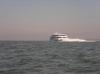
 The Hawaiian Chieftain motors by in the morning
Taken on 2007-11-21 .
Links to related images: Date. Proofs. Map.
 John Boeschen, Indiana and The Mayor launching from Jailhouse Beach
Taken on 2007-11-20 .
Links to related images: Date. Proofs. Map. Story.
 John Boeschen giving the ferry the right of way
Taken on 2007-11-20 .
Links to related images: Date. Proofs. Map. Story.
 Indiana giving the ferry the right of way
Taken on 2007-11-20 .
Links to related images: Date. Proofs. Map. Story.
 The Mayor giving the ferry the right of way
Taken on 2007-11-20 .
Links to related images: Date. Proofs. Map. Story.
 The Mayor approaching Red Rock Island at sunset
Taken on 2007-11-20 .
Links to related images: Date. Proofs. Story.
 John Boeschen, The Mayor and Indiana hanging out on Red Rock Island
Taken on 2007-11-20 .
Links to related images: Date. Proofs. Map. Story.

 Campfire on Red Rock Island
Taken on 2007-11-20 .
Links to related images: Date. Proofs. Map. Story.
 John Boeschen hanging out on Red Rock Island
Taken on 2007-11-20 .
Links to related images: Date. Proofs. Map. Story.

 John Boeschen,Indiana and The Mayor packing up to leave Red Rock Island
Taken on 2007-11-20 .
Links to related images: Date. Proofs. Map. Story.
 The lights of the kayaks drift off, leaving me behind
Taken on 2007-11-20 .
Links to related images: Date. Proofs. Map. Story.
 I pass the Marin Islands on my way back to Brunos
Taken on 2007-11-16 .
Links to related images: Date. Proofs. Map.
 Yellow booms to keep spilled bunker oil away from Marin County
Taken on 2007-11-16 .
Links to related images: Date. Proofs. Map.

 John Boeschen and Jonathan Purcel preparing to launch at Brunos
Taken on 2007-11-15 .
Links to related images: Date. Proofs. Map. Story.

 Sunset skies over San Francisco Bay
Taken on 2007-11-15 .
Links to related images: Date. Proofs. Map. Story.
 John Boeschen taking my picture taking his picture
Taken on 2007-05-24 .
Links to related images: Date. Proofs. Map. Story.
 A jet boat zooms around San Francisco Bay
Taken on 2007-05-24 .
Links to related images: Date. Proofs. Map. Story.
 Landing on Dynamite Beach
Taken on 2007-05-24 .
Links to related images: Date. Proofs. Map. Story.
 Flotsam picnic table on Dynamite Beach
Taken on 2007-05-24 .
Links to related images: Date. Proofs. Map. Story.
 Why they call it Dynamite Beach
Taken on 2007-05-24 .
Links to related images: Date. Proofs. Map. Story.
 Flotsam picnic table on Dynamite Beach
Taken on 2007-05-24 .
Links to related images: Date. Proofs. Map. Story.
 Don Fleming watching boat traffic on New Years Eve
Taken on 2006-12-31 .
Links to related images: Date. Proofs. Map.

 Sunset behind the Golden Gate Bridge
Taken on 2006-12-31 .
Links to related images: Date. Proofs. Map.
 Watching the presto logs burn down
Taken on 2006-12-31 .
Links to related images: Date. Proofs. Map.

 A mothballed ship is towed out the gate
Taken on 2006-12-31 .
Links to related images: Date. Proofs. Map.

 The old fog bell on Point Knox
Taken on 2006-12-31 .
Links to related images: Date. Proofs. Map.
 Belvedere viewed from Point Knox
Taken on 2006-12-31 .
Links to related images: Date. Proofs. Map.
 Camp Reynolds and the Quartermasters House viewed from Point Knox
Taken on 2006-12-31 .
Links to related images: Date. Proofs. Map.
 The clockwork hammer for the old fog bell on Point Knox
Taken on 2006-12-31 .
Links to related images: Date. Proofs. Map.
 Point Knox from the next point east
Taken on 2006-12-31 .
Links to related images: Date. Proofs. Map.

 Golden Gate Bridge viwed from near Point Knox
Taken on 2006-12-31 .
Links to related images: Date. Proofs. Map.
 Nice fender hanging in driftwood on Perls Beach
Taken on 2006-12-31 .
Links to related images: Date. Proofs. Map.
 The beautiful courtyard of Battery Wallace
Taken on 2006-12-31 .
Links to related images: Date. Proofs. Map.
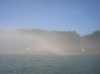
 Paking up in the fog on Perls Beach
Taken on 2006-12-31 .
Links to related images: Date. Proofs. Map.

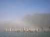 A fog bow over Camp Reynolds
Taken on 2006-12-31 .
Links to related images: Date. Proofs. Map.
 Kate DesLauriers safely accross to Belvedere in the fog
Taken on 2006-12-31 .
Links to related images: Date. Proofs. Map.
 Don Fleming safely accross to Belvedere in the fog
Taken on 2006-12-31 .
Links to related images: Date. Proofs. Map.


 I am featured in Old Man Boeschen's Comics
Taken on 2006-12-28 .
Links to related images: Date. Map. Story.
 I make my Thai Peanut Sauce Asparagus on a John Boeschen paddle
Taken on 2006-12-28 .
Links to related images: Date. Map. Story.
 Which apparently makes me disappear!
Taken on 2006-12-28 .
Links to related images: Date. Map. Story.

 Hijinks on a John Boeschen Thurseve Paddle.
Taken on 2006-12-28 .
Links to related images: Date. Proofs. Map. Story.
 Landed on Perls Beach
Taken on 2000-12-30 .
Links to related images: Date. Proofs. Map.
 Rolling gear up the hill to the Ridge Camps
Taken on 2000-12-30 .
Links to related images: Date. Proofs. Map.
 Maryly Snow at Ridge Camp on Angel Island
Taken on 2000-12-30 .
Links to related images: Date. Proofs. Map.
 The intrepid kayakers sleeping off New Years at Ridge Camp on Angel Island
Taken on 2000-12-30 .
Links to related images: Date. Proofs. Map.
 Maryly Snow in her new tent on Angel Island
Taken on 1999-12-31 .
Links to related images: Date. Proofs. Map. Story.
 The intrepid kayaker outside a tent on Angel Island
Taken on 1999-12-31 .
Links to related images: Date. Proofs. Map. Story.
 BASKers basking in Ridge Camp on Angel Island
Taken on 1999-12-31 .
Links to related images: Date. Proofs. Map. Story.
 Maryly Snow enjoying dinner in Ridge Camp on Angel Island
Taken on 1999-12-31 .
Links to related images: Date. Proofs. Map. Story.
 Lugging kayak gear up to Ridge Camp on Angel Island
Taken on 1999-12-31 .
Links to related images: Date. Proofs. Map. Story.
 Unused Kayak Camp on Angel Island
Taken on 1999-12-31 .
Links to related images: Date. Proofs. Map. Story.
 Photographer near Ridge Camp on Angel Island
Taken on 1999-12-31 .
Links to related images: Date. Proofs. Map. Story.
 Kayakers resting on Perls Beach on Angel Island
Taken on 1999-12-31 .
Links to related images: Date. Proofs. Map. Story.
 Photographing tourists at Dumphy Park on the way to Angel Island
Taken on 1999-12-31 .
Links to related images: Date. Proofs. Map. Story.

 Approaching Angel Island
Taken on 1999-12-31 .
Links to related images: Date. Proofs. Map. Story.
 Landed on Perls Beach on Angel Island
Taken on 1999-12-31 .
Links to related images: Date. Proofs. Map. Story.
 Maryly Snow with electric toothbrush on Angel Island
Taken on 1999-12-31 .
Links to related images: Date. Proofs. Map. Story.

 Maryly Snow ready to leave Angel Island
Taken on 1999-12-31 .
Links to related images: Date. Proofs. Map. Story.
 Heading back to Marin from Angel Island
Taken on 1999-12-31 .
Links to related images: Date. Proofs. Map. Story.
 Maryly Snow and Mike Higgins safely back from Angel Island
Taken on 1999-12-31 .
Links to related images: Date. Proofs. Map. Story.
 The 'Gonzo Bay Tour' went under the Richmond Bridge near here.
Taken on 1999-01-31 .
Links to related images: Date. Proofs. Map. Story.
 Launching from China Camp on a BASK trip.
Taken on 1999-01-31 .
Links to related images: Date. Map. Story.
 The 'Gonzo Bay Tour' went around Red Rock.
Taken on 1999-01-31 .
Links to related images: Date. Proofs. Map. Story.
 Next to the pier on east Marin Island.
Taken on 1998-10-6 .
Links to related images: Date. Proofs. Map. Story.
 Don Fleming poking the 'do not land here' sign on east Marin Island.
Taken on 1998-10-6 .
Links to related images: Date. Proofs. Map. Story.
 In January of 1998, Fred McCollum retired as the resident naturalist on Brooks
Taken on 1998-01-17 .
Links to related images: Date. Proofs. Map. Story.
 In January of 1998, Fred McCollum retired as the resident naturalist on Brooks
Taken on 1998-01-17 .
Links to related images: Date. Proofs. Map. Story.
 In January of 1998, Fred McCollum retired as the resident naturalist on Brooks
Taken on 1998-01-17 .
Links to related images: Date. Proofs. Map. Story.


 Pictures from the 1998/1999 Angel Island New Years Eve Campout.
Taken on 1998-01-1 .
Links to related images: Date. Proofs. Map. Story.
 Launching from China Camp on a BASK trip.
Taken on 1997-12-12 .
Links to related images: Date. Proofs. Map. Story.
 Mount Tam looking like a Japanese ink-on-rice-paper painting with the
Marin Isl
Mount Tam looking like a Japanese ink-on-rice-paper painting with the
Marin Isl
Taken on 1997-12-12 .
Links to related images: Date. Proofs. Map. Story.
 Pablo Point
Taken on 1997-10-3 .
Links to related images: Date. Proofs. Map.
 Dump pyramid
Taken on 1997-10-3 .
Links to related images: Date. Proofs. Map.
 Duck blind
Taken on 1997-10-3 .
Links to related images: Date. Proofs. Map.


 Paddling close to Angel Island
Taken on 1997-10-3 .
Links to related images: Date. Proofs. Map.
 nappers distant
Taken on 1997-07-13 .
Links to related images: Date. Proofs. Map. Story.
 more nappers
Taken on 1997-07-13 .
Links to related images: Date. Proofs. Map. Story.
 BASKers basking on the cystern on East Brother Island
Taken on 1997-07-13 .
Links to related images: Date. Proofs. Map. Story.
 Me, dog and Don Flemming on East Brother Island
Taken on 1997-07-13 .
Links to related images: Date. Proofs. Map. Story.
 boat landing
Taken on 1997-07-13 .
Links to related images: Date. Proofs. Map. Story.
 marin b/lighthouse
Taken on 1997-07-13 .
Links to related images: Date. Proofs. Map. Story.
 diablo b/lignthouse
Taken on 1997-07-13 .
Links to related images: Date. Proofs. Map. Story.
 down at cystern
Taken on 1997-07-13 .
Links to related images: Date. Proofs. Map. Story.
 down at E Brother
Taken on 1997-07-13 .
Links to related images: Date. Proofs. Map. Story.
 landing at Brother
Taken on 1997-07-13 .
Links to related images: Date. Proofs. Map. Story.
 Lecture on Brooks
Taken on 1997-06-22 .
Links to related images: Date. Proofs. Map. Story.
 Richmond f/peak
Taken on 1997-06-22 .
Links to related images: Date. Proofs. Map. Story.
 Quary from peak
Taken on 1997-06-22 .
Links to related images: Date. Proofs. Map. Story.
 Brooks S point
Taken on 1997-06-22 .
Links to related images: Date. Proofs. Map. Story.
 Launch@ Keller
Taken on 1997-06-22 .
Links to related images: Date. Proofs. Map. Story.
 Pilons on way out
Taken on 1997-06-22 .
Links to related images: Date. Proofs. Map. Story.
 Canadian G.
Taken on 1997-03-5 .
Links to related images: Date. Proofs. Map. Story.

 Pictures from the 1997/1998 Angel Island New Years Eve Campout.
Taken on 1997-01-1 .
Links to related images: Date. Proofs. Map.
 The intrepid kayaker on Angel Island New Years 1998
Taken on 1997-01-1 .
Links to related images: Date. Proofs. Map.

 Pictures from the 1997/1998 Angel Island New Years Eve Campout.
Taken on 1997-01-1 .
Links to related images: Date. Proofs. Map.
 The 'Gonzo Bay Tour' went under the Richmond Bridge near here.
Taken on 1996-11-24 .
Links to related images: Date. Proofs. Map. Story.
 Paddling close to Angel Island
Taken on 1996-11-24 .
Links to related images: Date. Proofs. Map. Story.
 Perls Beach on Angel Island
Taken on 1996-11-24 .
Links to related images: Date. Proofs. Map. Story.
 Pictures from several tidal rip paddles to Yellow Bluff.
Taken on 1996-11-24 .
Links to related images: Date. Proofs. Map. Story.
 Pictures from several tidal rip paddles to Yellow Bluff.
Taken on 1996-11-24 .
Links to related images: Date. Proofs. Map. Story.


 The old pumphouse, pier, and Richmond Bridge maintinence building:
Taken on 1996-08-28 .
Links to related images: Date. Proofs. Map. Story.
 Brooks Island viewed from the south
Taken on 1996-04-14 .
Links to related images: Date. Proofs. Map. Story.
 Brooks Island spt with white birds
Taken on 1996-04-14 .
Links to related images: Date. Proofs. Map. Story.
 East shore of Brooks Island
Taken on 1996-04-14 .
Links to related images: Date. Proofs. Map. Story.
 Rock of south end of Brooks Island
Taken on 1996-04-14 .
Links to related images: Date. Proofs. Map. Story.
 South tip of Brooks Island
Taken on 1996-04-14 .
Links to related images: Date. Proofs. Map. Story.
 I paddled around Brooks Island in April of 1996.
Taken on 1996-04-14 .
Links to related images: Date. Proofs. Map. Story.
 Richmond Harbor
Taken on 1996-04-14 .
Links to related images: Date. Proofs. Map. Story.
 Navy boat in Richmond Harbor
Taken on 1996-04-14 .
Links to related images: Date. Proofs. Map. Story.
 New pier house for sale on Richmond Waterfront
Taken on 1996-04-14 .
Links to related images: Date. Proofs. Map. Story.
 New pier house on Richmond Waterfront
Taken on 1996-04-14 .
Links to related images: Date. Proofs. Map. Story.
 Houses and yachts in Richmond Harbor
Taken on 1996-04-14 .
Links to related images: Date. Proofs. Map. Story.
 Under an old burnt out pier in Richmond Harbor
Taken on 1996-04-14 .
Links to related images: Date. Proofs. Map. Story.
 Abandoned concrete building on Richmond Point
Taken on 1996-04-14 .
Links to related images: Date. Proofs. Map. Story.
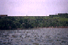
 The salt marshes of China Camp State Beach
Taken on 1996-03-11 .
Links to related images: Date. Proofs. Map. Story.
 Is this the natual shoreline of San Pablo Bay at China Camp?
Taken on 1996-03-11 .
Links to related images: Date. Proofs. Map. Story.
 Another park south of China Camp
Taken on 1996-03-11 .
Links to related images: Date. Proofs. Map. Story.
 The rock quarry south of China Camp State Park
Taken on 1996-03-11 .
Links to related images: Date. Proofs. Map. Story.
 Another park south of China Camp
Taken on 1996-03-11 .
Links to related images: Date. Proofs. Map. Story.
 China Camp and Rat Rock from a distance
Taken on 1996-03-11 .
Links to related images: Date. Proofs. Map. Story.
 The pier at China Camp State Beach
Taken on 1996-03-11 .
Links to related images: Date. Proofs. Map. Story.

 The Sister Islands
Taken on 1996-03-11 .
Links to related images: Date. Proofs. Map. Story.
 The intrepid kayaker in his Scupper Pro kayak in Gallinas Creek
Taken on 1996-03-9 .
Links to related images: Date. Proofs. Map. Story.
 Paul paddling up Gallinas Creek
Taken on 1996-03-9 .
Links to related images: Date. Proofs. Map. Story.
 Paul in my Frenzy kayak in Gallinas Creek
Taken on 1996-03-9 .
Links to related images: Date. Proofs. Map. Story.
 Crossing Raccoon Strait
Taken on 1996-01-1 .
Links to related images: Date. Proofs. Map.
 Rounding a corner of Angel Island
Taken on 1996-01-1 .
Links to related images: Date. Proofs. Map.
 X2 in crack at Angel Island new years
Taken on 1996-01-1 .
Links to related images: Date. Proofs. Map.
 First view of Rat Rock
Taken on 1995-11-11 .
Links to related images: Date. Map. Story.
 Approaching Rat Rock
Taken on 1995-11-11 .
Links to related images: Date. Map. Story.
 Trees on Rat Rock
Taken on 1995-11-11 .
Links to related images: Date. Map. Story.
 Small arch on Rat Rock
Taken on 1995-11-11 .
Links to related images: Date. Map. Story.

 The marshy coastline of China Camp State Park
Taken on 1995-11-11 .
Links to related images: Date. Map. Story.
 Castro Rocks in front of the Richmond Bridge
Taken on 1995-10-14 .
Links to related images: Date. Proofs. Map. Story.
 Keller Beach on a sunny day on the bay
Taken on 1995-10-14 .
Links to related images: Date. Proofs. Map. Story.
 Keller Beach viewed from offshore
Taken on 1995-10-14 .
Links to related images: Date. Proofs. Map. Story.
 Kayak on Keller Beach late in the evening
Taken on 1995-10-14 .
Links to related images: Date. Proofs. Map. Story.
 Old personal boat ramp on Point Richmond
Taken on 1995-10-14 .
Links to related images: Date. Proofs. Map. Story.
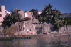
 Flowering bushes on Point Richmond
Taken on 1995-10-14 .
Links to related images: Date. Proofs. Map. Story.
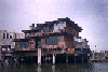
 Incredible deck over water at Point Richmond
Taken on 1995-10-14 .
Links to related images: Date. Proofs. Map. Story.
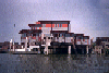
 Boathouse with red flowers on roof at Point Richmond
Taken on 1995-10-14 .
Links to related images: Date. Proofs. Map. Story.

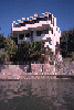
 Modern house above bluff at Point Richmond
Taken on 1995-10-14 .
Links to related images: Date. Proofs. Map. Story.

 Nice houses above water at Point Richmond
Taken on 1995-10-14 .
Links to related images: Date. Proofs. Map. Story.
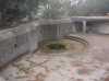
 Stone terraces down to water at Point Richmond
Taken on 1995-10-14 .
Links to related images: Date. Proofs. Map. Story.
 Modern house above the water at Point Richmond
Taken on 1995-10-14 .
Links to related images: Date. Proofs. Map. Story.
 Nice houses above water at Point Richmond
Taken on 1995-10-14 .
Links to related images: Date. Proofs. Map. Story.
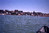 Point Richmond houses from farther ofshore
Taken on 1995-10-14 .
Links to related images: Date. Proofs. Map. Story.
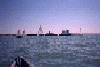 Sail boats going around supertanker
Taken on 1995-10-14 .
Links to related images: Date. Proofs. Map. Story.
 Sailboat between me and Red Rock Island
Taken on 1995-10-14 .
Links to related images: Date. Proofs. Map. Story.
 Tugboat pushing supertanker sideways
Taken on 1995-10-14 .
Links to related images: Date. Proofs. Map. Story.
 Tugboat pushing barge quickly past me
Taken on 1995-10-14 .
Links to related images: Date. Proofs. Map. Story.
 Funky beach houses at Point Richmond
Taken on 1995-10-14 .
Links to related images: Date. Proofs. Map. Story.
 Desiner house above rocky Point Richmond shoreline
Taken on 1995-10-14 .
Links to related images: Date. Proofs. Map. Story.
 Evening light on Point Richmond shorefront houses
Taken on 1995-10-14 .
Links to related images: Date. Proofs. Map. Story.
 Approaching Red Rock Island
Taken on 1995-10-14 .
Links to related images: Date. Proofs. Map. Story.
 The view from the beach on Red Rock Island
Taken on 1995-10-14 .
Links to related images: Date. Proofs. Map. Story.
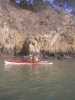
 The view from inside the cave on the east side of Red Rock Island
Taken on 1995-10-14 .
Links to related images: Date. Proofs. Map. Story.
 The San Rafael Bridge viewed from the flag at the top of Red Rock Island
Taken on 1995-10-14 .
Links to related images: Date. Proofs. Map. Story.
 Sailboat under the San Rafael Bridge from the top of Red Rock Island
Taken on 1995-10-14 .
Links to related images: Date. Proofs. Map. Story.
 The south end of Red Rock Island viewed from the top
Taken on 1995-10-14 .
Links to related images: Date. Proofs. Map. Story.
 The beach on the north end of Red Rock Island viewed from the top
Taken on 1995-10-14 .
Links to related images: Date. Proofs. Map. Story.
 Yerba Buena, San Francisco, Angel Island and Tiburon from the top of Red Rock Is
Taken on 1995-10-14 .
Links to related images: Date. Proofs. Map. Story.
 Mount Tam viewed from the top of Red Rock Island
Taken on 1995-10-14 .
Links to related images: Date. Proofs. Map. Story.
 Richmond viewed from the top of Red Rock Island
Taken on 1995-10-14 .
Links to related images: Date. Proofs. Map. Story.
 The east side of Red Rock Island viewed from the top
Taken on 1995-10-14 .
Links to related images: Date. Proofs. Map. Story.
 Richmond Bridge viewed through rocks on the shore of Red Rock Island
Taken on 1995-10-14 .
Links to related images: Date. Proofs. Map. Story.
 Looking through the small arch on the north end of Red Rock Island
Taken on 1995-10-14 .
Links to related images: Date. Proofs. Map. Story.
 The junk piled on the north end of Red Rock Island
Taken on 1995-10-14 .
Links to related images: Date. Proofs. Map. Story.
 Launching from Point Molate Park
Taken on 1995-10-2 .
Links to related images: Date. Proofs. Map. Story.
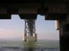
 Going under the Richmond - San Rafael Bridge
Taken on 1995-10-2 .
Links to related images: Date. Proofs. Map. Story.
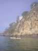
 Landed on the red sand beach on Red Rock Island
Taken on 1995-10-2 .
Links to related images: Date. Proofs. Map. Story.


 Circumnavigating Red Rock Island
Taken on 1995-10-2 .
Links to related images: Date. Proofs. Map. Story.
 Leaving Red Rock Island
Taken on 1995-10-2 .
Links to related images: Date. Proofs. Map. Story.
 Red Rock Island and the bridge
Taken on 1995-10-2 .
Links to related images: Date. Proofs. Map. Story.
 West and East Brother Islands
Taken on 1995-10-2 .
Links to related images: Date. Proofs. Map. Story.
 West Brother Island
Taken on 1995-10-2 .
Links to related images: Date. Proofs. Map. Story.
 East Brother Island
Taken on 1995-10-2 .
Links to related images: Date. Proofs. Map. Story.
 West Brother Island
Taken on 1995-10-2 .
Links to related images: Date. Proofs. Map. Story.


 East Brother Island
Taken on 1995-10-2 .
Links to related images: Date. Proofs. Map. Story.
 West and East Brother Islands
Taken on 1995-10-2 .
Links to related images: Date. Proofs. Map. Story.
 Molasses tank on the Richmond shoreline
Taken on 1995-10-2 .
Links to related images: Date. Proofs. Map. Story.
 Pocket Beach on the Richmond shoreline
Taken on 1995-10-2 .
Links to related images: Date. Proofs. Map. Story.
 Brick castle on the Richmond shoreline
Taken on 1995-10-2 .
Links to related images: Date. Proofs. Map. Story.
 Richmond - San Rafael Bridge viewed past the Richmond Shoreline
Taken on 1995-10-2 .
Links to related images: Date. Proofs. Map. Story.
 San Quentin to the Richmond Bridge:
Taken on 1995-08-24 .
Links to related images: Date. Proofs. Map. Story.

 The Marin Islands themselves:
Taken on 1995-08-24 .
Links to related images: Date. Proofs. Map. Story.

 Mansions on the Marin shore of the bay:
Taken on 1995-08-24 .
Links to related images: Date. Proofs. Map. Story.
 The Marin Islands viewed from just under the Richmond Bridge:
Taken on 1995-08-24 .
Links to related images: Date. Proofs. Map. Story.
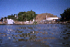 The old pumphouse, pier, and Richmond Bridge maintinence building:
Taken on 1995-08-24 .
Links to related images: Date. Proofs. Map. Story.

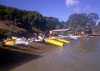
 The 1999 'Gonzo Bay Tour' stopped at China Beach for lunch.
Taken on ~1994 .
Links to related images: Date. Map.
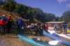
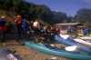 Launching from China Camp on a BASK trip.
Taken on ~1994 .
Links to related images: Date. Map.
 The Marin Islands themselves:
Taken on ~1994 .
Links to related images: Date. Proofs. Map.
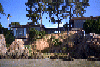 Mansions on the Marin shore of the bay:
Taken on ~1994 .
Links to related images: Date. Proofs. Map.
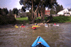
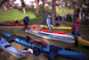 The 'Gonzo Bay Tour' went under the Richmond Bridge near here.
Taken on ~1994 .
Links to related images: Date. Proofs. Map.

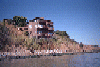
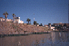
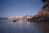 The old pumphouse, pier, and Richmond Bridge maintinence building:
Taken on ~1994 .
Links to related images: Date. Proofs. Map.
All text and images Copyright © by Mike Higgins / contact